We write about hiking a lot. Hiking in all seasons, hiking in many different states, day hiking and weekend backpacking, hiking with kids, hiking and photography, etc, here are all our hiking posts.
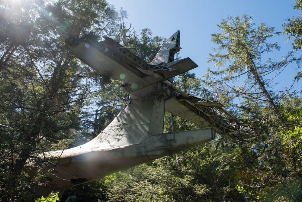
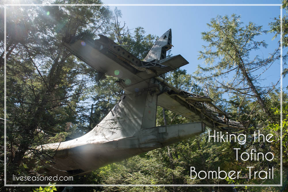
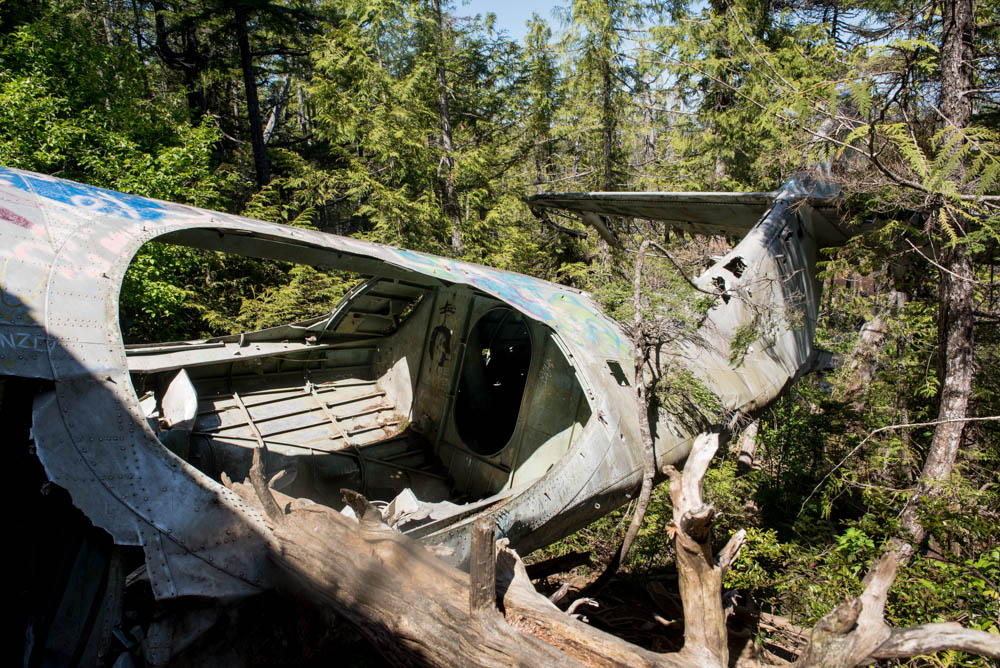
This past weekend, I went on a rad little hike. This time it wasn’t the scenery that made it extra special, it was the destination, an old bomber plane crash site. The plane was a Royal Canadian Air Force Canso 11007 that crashed shortly after takeoff on February 12, 1945. Apparently the engine malfunctioned causing the plane to crash into the trees just south of Radar hill, about a dozen kilometers south of Tofino, BC. There were 12 people onboard, they all survived the crash and were rescued 11 hours after going down. I’m betting most people will read this article for the pertinent information since the trail is ‘unofficial’ so I’m going to get right to it.
Parking:
Park in the Radar Hill lot on the west side of the Pacific Rim Highway. Make sure you buy and display a parking pass at the kiosk or you will get a ticket. We’ve seen it happen.
There is a large sign for Radar Hill so you shouldn’t miss it, but if you’re coming from Tofino and you see the airport, you’ve gone too far. If you’re coming from Ucluelet and you see an enormous sign saying you’re leaving the Canadian Parks land then turn around, you passed it.
Finding the Trail + Hiking:
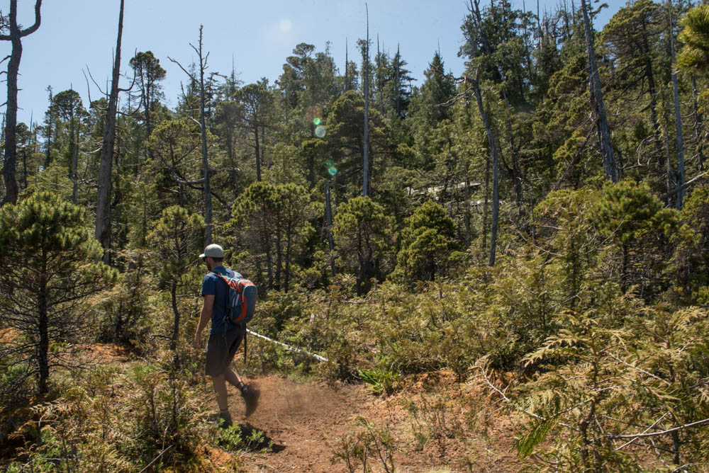
Leave the parking lot and head south on Pacific Rim Highway. No need to cross the road as the trail is also on the west side of the highway. Walk about 500 meters. At one point the west side of the road will have a low cement barrier wall on a sharp curve, keep going. Look for an old service road, it will be obvious as there is a utility pole at the entrance and a metal fence on either side of the service road. There will also be multiple no parking / tow away signs on the highway, this is a great indication that people have parked here in the past for the trail. Head up the road.
You’ll walk up this road for a good 15-20 minutes and it will end at an abandoned building, there is no way to mess this part up. The trail is to the left of the building, but head around to the right of the building (the left side was overgrown when I was there) and around the back and continue walking straight, you’ll see the trail heading down the hill.
At the beginning of the trail there are very few markers because it’s quite obvious. After five or so minutes you’ll start to see strings and signs denoting the path. Look for these and also pink and orange ribbons tied to trees, this is the way. It is boggy and quite muddy, so look up for the ribbon, but then plan your best route to get to it, don’t just step into a sinking mud patch. I say this only because I did that once.
After about thirty minutes of meandering, you’ll see the glimpses of shiny metal up in the trees to your right. Do not rush this part, it’s very muddy here, take your time and follow the ribbons instead of trying to cut across and hurry up to the plane.
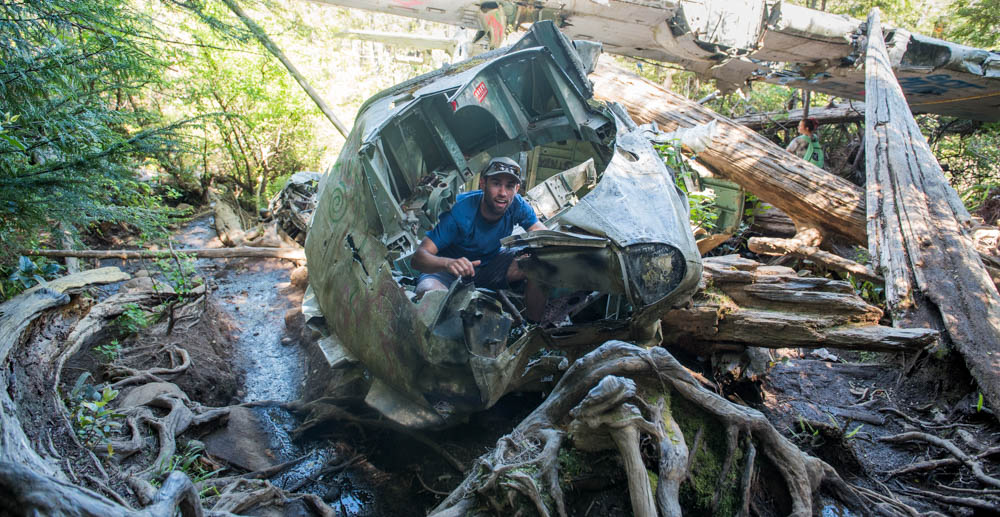
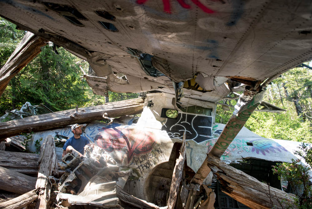
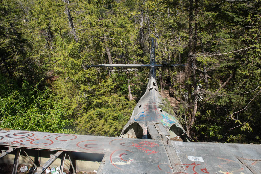
Climb around, marvel at the bent metal, enormous engines, and what the experience must have been like. Don’t cut yourself on the rusty stuff and have fun!
Wear + Pack:
- It’s always good to have the 10 essentials.
- Wear boots! This trail is muddy as all hell and I hiked it after three days of no rain. It’s hilariously muddy actually.
- Camera. Who knows when you’ll hike to a plane crash site again, snap a few pics.