
If you want to read about more of our hiking and camping adventures, you can find them here. And if you want more Colorado hikes, they’re here.
Last weekend I went on my first big hike in years, and it felt amazing. Click on to read about my little day hike across the continental divide from one Colorado ski-town to another.
In the scheme of things, this might not be considered an epic day hike (wait until you hear about Sarah’s marathon-length day hike), but it was just the sort of challenge that I needed to test my trip-planning abilities.
A Little Background
Last fall I learned that you could hike from Nederland to Fraser (near Winter Park), Colorado, and that it’s about a 12 hour hike. I knew that the hike was supposed to start at the Hessie Trailhead in Ned and end at the Devil’s Thumb Trailhead in Fraser.
It was the bare minimum of information, but the idea of hiking from one town that I knew to another across the continental divide sounded so intriguing, especially since this is normally a 90 minute drive!
The only problem was that I had no other information, and at the time I was having the hardest time figuring out exactly what trails to take… looking back, I can’t believe that it was so hard to piece together. I was asking around to see if anyone else had done the hike (NO). I was searching the internet for “Nederland to Winter Park” trails, and all results would send me down the rabbit hole of 30 mile mountain biking adventures.
Colorado Trail Explorer
I wanted to do the hike, but it seemed just out of reach. Honestly, it seemed absurd that I couldn’t figure out how to hike from one trailhead to another… and maybe it was slightly absurd that I didn’t pick up a paper map during my research (sorry, Frank!).
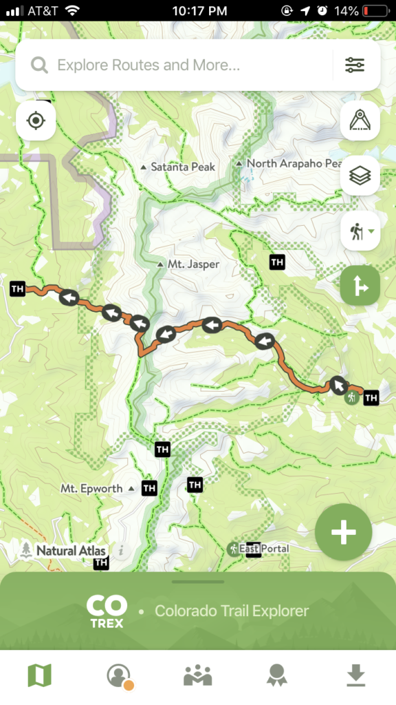
I finally had a breakthrough when the state of Colorado released the Colorado Trail Explorer App. If you’re going to do any hiking in Colorado, get the app. It’s free and provides the most comprehensive data on all of Colorado trails (from those in national parks to those in city parks).
You can download maps to use while offline. You can save routes for easy access while you’re hiking. When you highlight a trail segment or route, you’ll get a variety of useful information including elevation changes and tree cover.
Plan a Hike!
So, with the CO TREX app on my phone, suddenly the route from Nederland to Fraser was as clear as day.
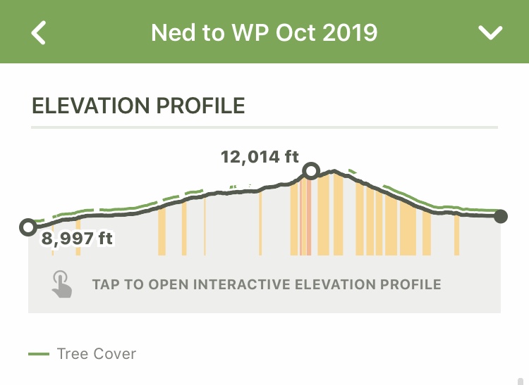
We started at the Hessie Trailhead in Ned, hiked the Devil’s Thumb Trail to the High Lonesome Trail and then finished on the Devil’s Thumb Park Trail. All in all it was about a 12 mile hike one way with an elevation gain of 3,444 ft.
I mapped out the route on CO TREX and saved it as a “custom route”. I also downloaded the map segments that we would need so that we could access them offline during our hike (the custom route will show up on your offline map as long as you have it selected).
So, with our route mapped, it was time to pack our bags! My packing list is below.
Hessie Trailhead
This is the point in the post where we have to devote a little bit of time to the infamous Hessie Trailhead. To say this is a busy location doesn’t even begin to describe it. And locals all know how frustrating it can be to plan a great hike only to be disappointed when there’s no parking at the trailhead.
At Hessie there is no way to accommodate all of the vehicles. There is limited parallel parking along the road, but be aware of the parking signs. Vehicles outside of the designated parking area may be ticketed or towed.
Knowing that the trailhead is busy, we made it a point to arrive first thing on a Saturday morning. We parked at 7 am. At that point, there were already cars parked in about 1/4 of the spaces, and the rest were starting to fill up.
BUT don’t fear – if you can’t get a spot, you can drive back into Nederland, park (no overnight parking in the shuttle lot), and take the free shuttle to the trailhead. The shuttle runs during the summer and into October.
Packing List
This is what I put in my pack for a one-day 12 mile hike in early October:
- 1.5 liters of water
- 1.5 liters of Gatorade
- 3 Epic bars (my favorites are the lamb, bacon, and bison bars)
- 2 Justin’s Peanut Butter + Honey Packs
- mozzarella cheese sticks + salami
- small first aid kit
- emergency sleeping bag
- wool hat
- a buff for sun/wind protection on my neck
- puffer jacket
- gloves
- wool base layers (I had on a couple of thin layers because I like the flexibility of taking one off if it gets too hot)
- back-up paper map of the Indian Peaks and Gold Hill area
At the end of the day, I drank a lot of my liquids, ate a little bit of my food, and never needed any of the emergency supplies, which is the sign of a great hike!
I also haven’t mentioned it yet, but I did the hike with a friend. While friends don’t fit in our packs, I do think of them as a hiking essential. In case anything were to go wrong or something were to happy to your supplies, it’s so reassuring to be out on the trail with a companion.
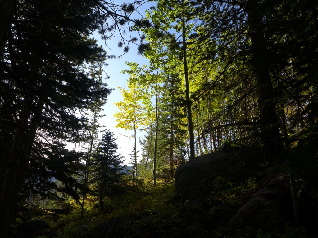
The Hike
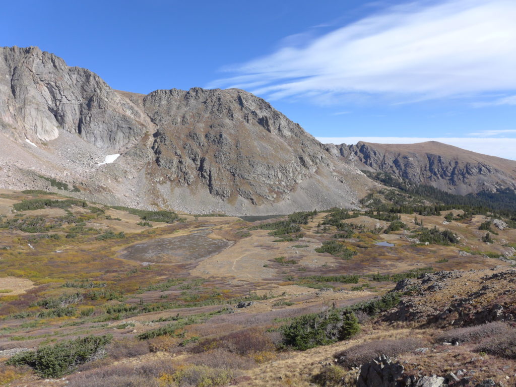
All in all, this hike is not technically difficult. The trails were very well maintained, and there was nothing tricky to navigate around or through.
It was relatively easy to stay on the trail without a risk of getting lost. There are a few trails that branch off of Devil’s Thumb as you’re hiking up from Hessie, so it’s important to pay attention to the signs.
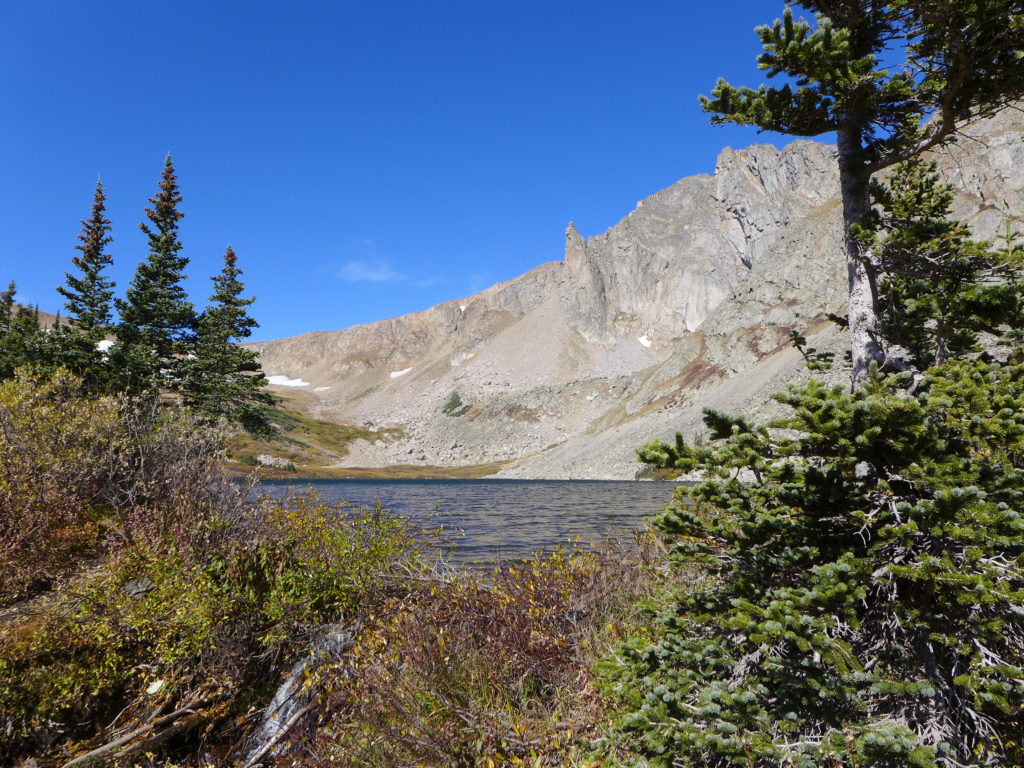
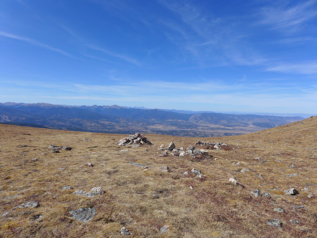
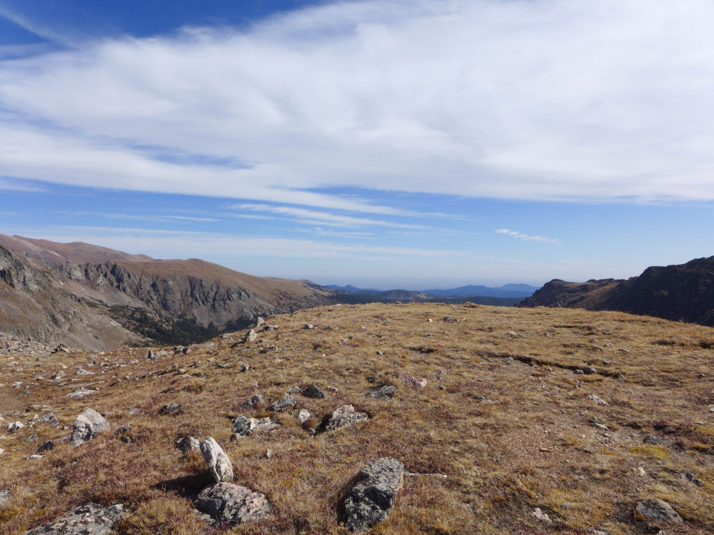
The only time we had a moment of confusion was at the very top of the mountain where there typically isn’t much traffic, and so the trail’s path isn’t as noticeable, but there are a few cairns. It seems that people will hike to the top from either side, but there aren’t that many people that actually go over the top and down the other side. And speaking of other hikers, we saw a few throughout the day, but none of them were doing the Hessie to Devil’s Thumb expedition.
The day was chilly, particularly when the wind would pick up, but again, it wasn’t anything out of the ordinary, and dressing in layers made it easy to stay comfortable.
As you can see from the elevation profile above, on the western side of the trail, the descent happens over a much shorter distance than the climb. It required taking big steps down, which can be hard on your knees, but if there’s an option, I’d rather do that than have be scrambling up the boulders for the climb up.
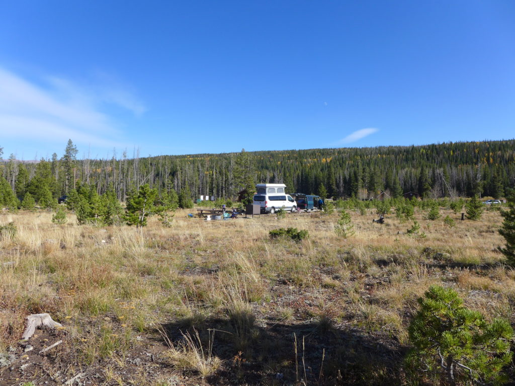
Camping
To extend our weekend adventure, on the Fraser side we camped at the St. Louis Creek campground for one night. It’s a first-come-first-served campground in a national forest. There are only 16 sites, so I’m sure that it fills up during the summer, but during this cold weekend in early October, the campground was about half full.
Ack! I’m just so happy that this little adventure came together!
With the snow starting to fall and winter temperatures just around the corner, I don’t think I’ll have an opportunity for another full-day hike this year, but I’m already planning and scheming for next year!