Interested in more hiking posts? You can find more of our Colorado hikes here.
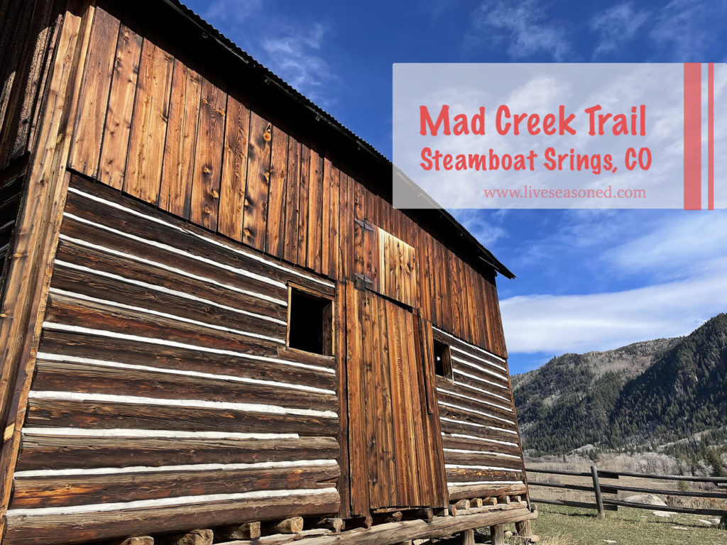
Come along on this short, fun, and extremely kid-friendly hike!
Continue reading
Come along on this short, fun, and extremely kid-friendly hike!
Continue reading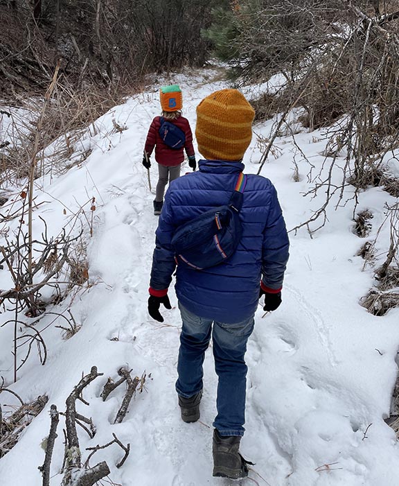
Hiking is definitely one of our favorite outdoor activities, and I happen to have two kids that are always up for a hike. We love our weekday hikes the best. The trails are relatively empty and we feel carefree to move along the trail at whatever pace feels good, even coming to a complete stop when we find spy a treasure worth investigating.
Continue reading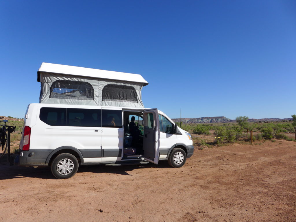
Have you camped on Bureau of Land Management (BLM) land? If you’re from the east coast (like us), you may have no clue what I’m talking about. If you’re from the west, this plethora of camping awesomeness may be nothing new to you. Continue reading
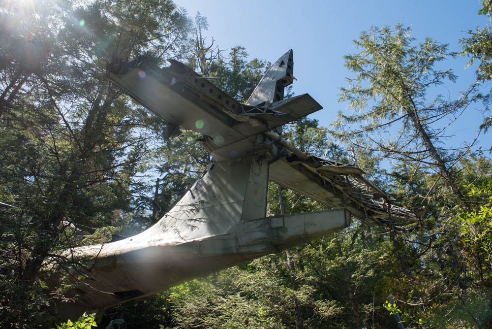
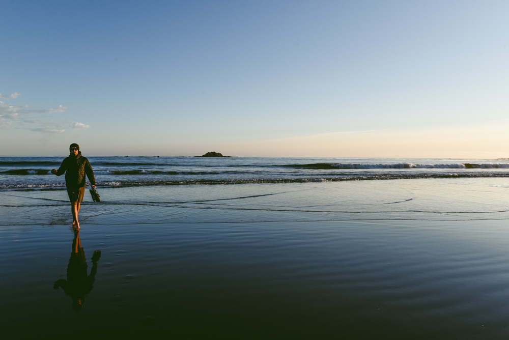
This past weekend, I went on a rad little hike. This time it wasn’t the scenery that made it extra special, it was the destination, an old bomber plane crash site. The plane was a Royal Canadian Air Force Canso 11007 that crashed shortly after takeoff on February 12, 1945. Apparently the engine malfunctioned causing the plane to crash into the trees just south of Radar hill, about a dozen kilometers south of Tofino, BC. There were 12 people onboard, they all survived the crash and were rescued 11 hours after going down. I’m betting most people will read this article for the pertinent information since the trail is ‘unofficial’ so I’m going to get right to it. Continue reading
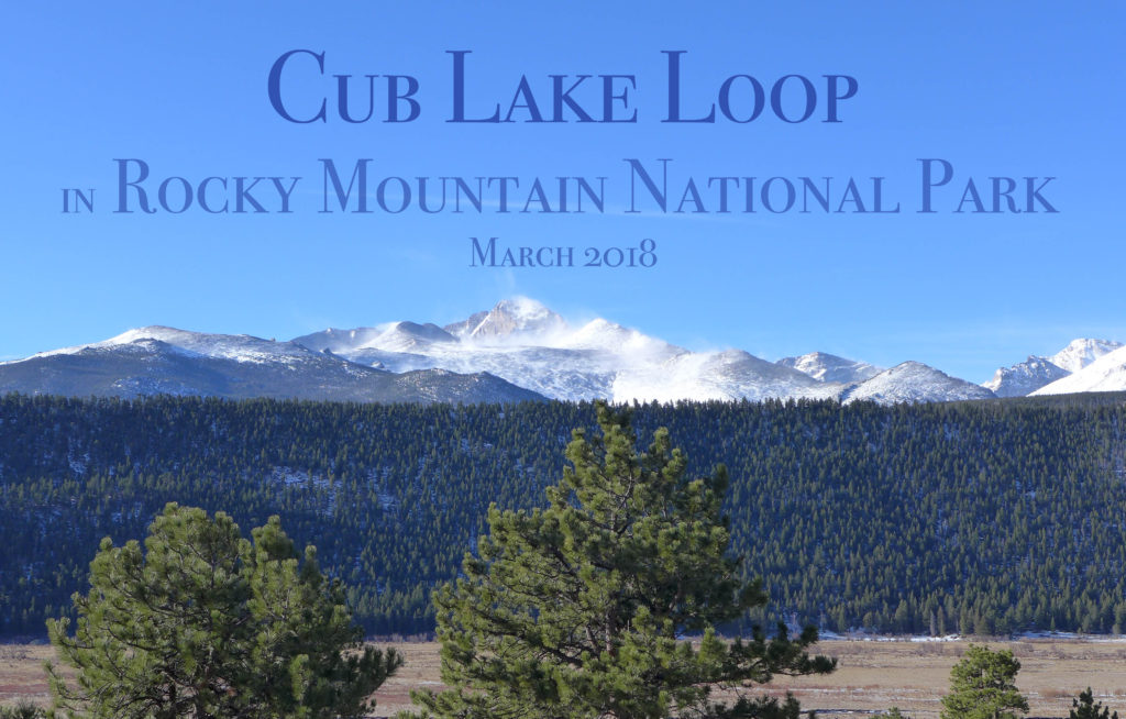
If you’ve been following along on Instagram, we spent a quick 36 hours in Rocky Mountain National Park last weekend. On Saturday we took an ambitious hike – click through to see more photos and details.
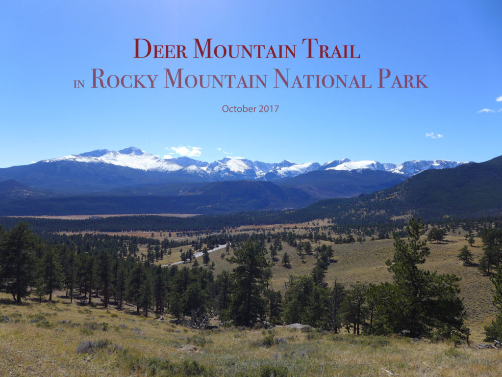
Today we’re sharing some photographs and info about our hike to the top of Deer Mountain in Rocky Mountain National Park. If you want even more info when planning a visit, leave us a comment, check out this post about winter camping in the park, or pick up this hiking guide (it’s super detailed and our favorite).
If you’ve been following the blog or our Instgram feed for any length of time, then you know that we love a good hike. Just put us outside with a good pair of boots, a snack, and a hat, and we are ready to go!
Some of my most memorable hikes have happened in the fall. Of course, the brisk weather and colorful foliage make for beautiful memories. But there’s also something about the shorter days anticipation of a long, cold winter indoors that makes the need to get outside even more urgent at this time of year.
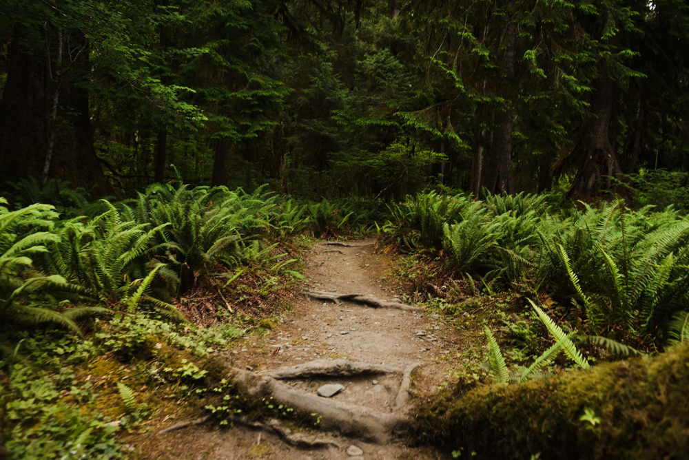
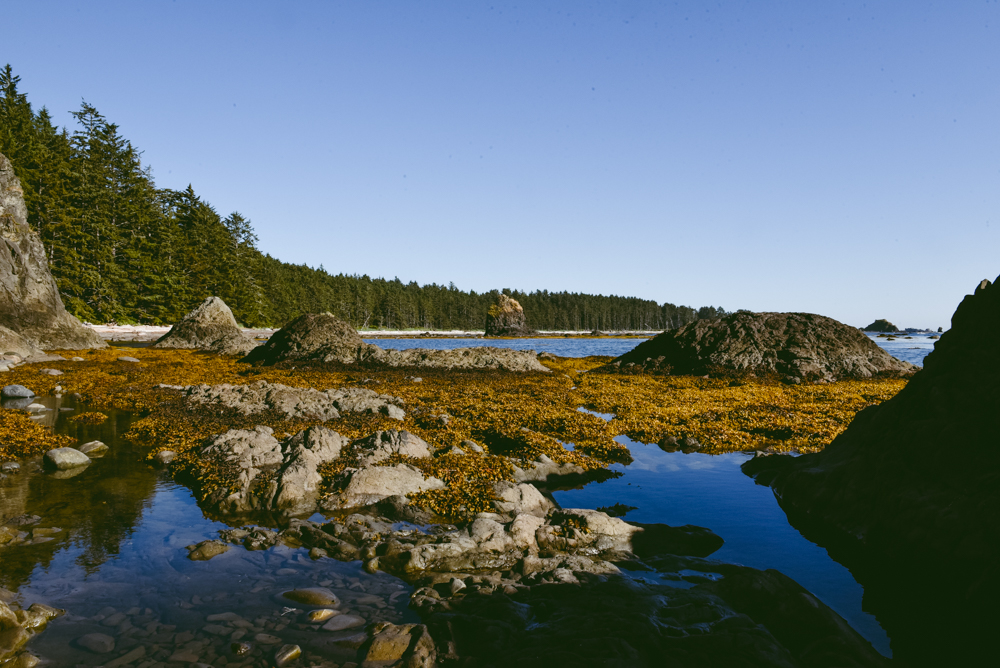
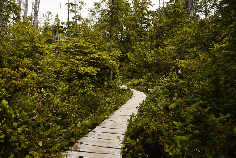
Hey there! In July, I hiked the Ozette Loop in Olympic National Park in Washington. Although I completed the loop as an overnight backpacking trip, the Ozette Loop would also make a nice day hike. The nine-ish mile loop starts in a coastal forest environment, forks right and winds its way across boardwalks until it dips slightly to the coast. Walking along the beach is the more challenging section, but only because you’re trudging through sand. Eventually, you reach Sand Point, a gorgeous outcropping with a large rock that you can climb atop of. It’s the perfect spot to watch the sunset and the ease of the return trip makes it possible to hike back during twilight and even as darkness falls if you’re not keen on camping. Over the course of the loop, the elevation change is less than 500 feet and beside the beach, most of the trail is on a wooden boardwalk. It’s nearly impossible to get lost and while you should always take a map, you shouldn’t need to consult it even once.
I found the Ozette Loop to be equal parts easy and exciting. As I mentioned, there’s not much elevation change and much of the trail takes place on a wooden boardwalk through coastal forests. While hiking on a boardwalk can be a bit boring, it gives your brain a chance to focus on your surroundings instead of your next steps. Walking amongst giant hemlock and cedar trees and seeing beautiful ferns and moss dripping with moisture had me thinking about ancient reptiles, sea creatures, and dinosaurs (turns out the first dino bone discovered in Washington happened just a couple years ago).
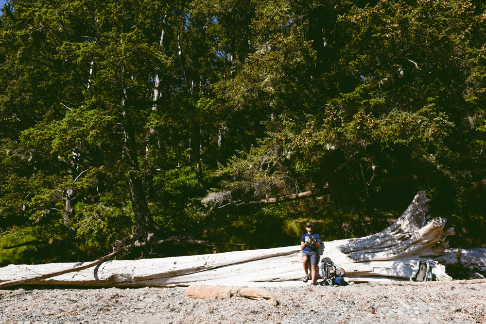
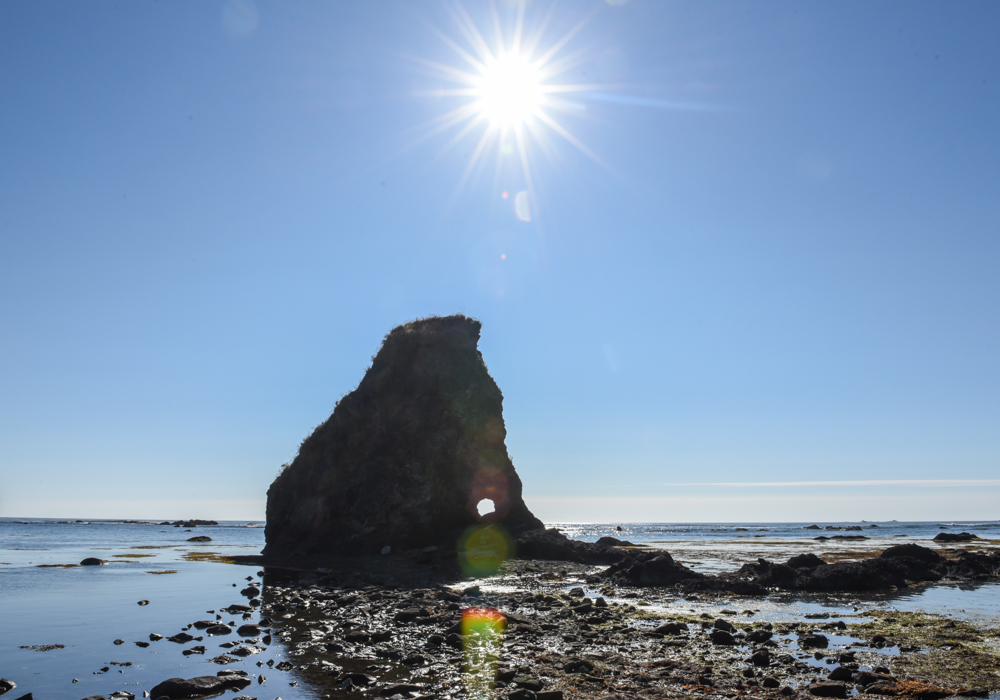
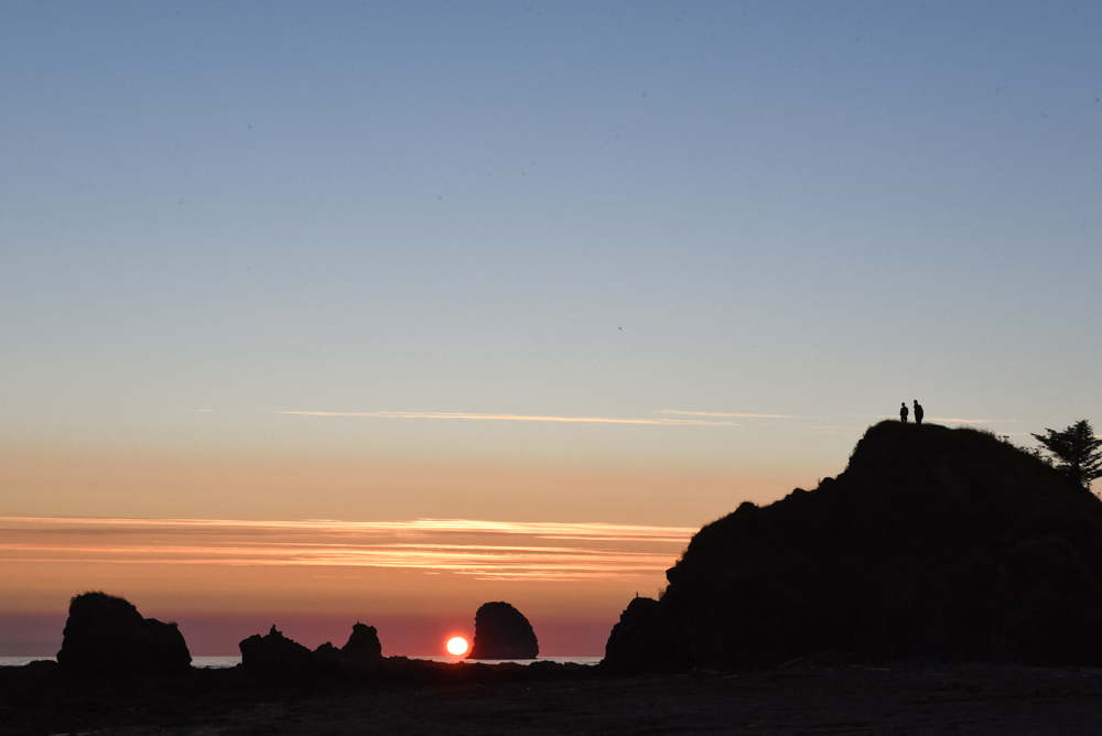
After about three miles, you’ll shuffle down a short and steep section (there’s a rope to aid in your decent) that spits you out on the sand. At this point, my hiking partner and I took off our shoes and shirts, found an enormous downed tree and had a quick snack and snooze. Then it was time to march on along the beach. Looking out towards the sea stacks we thought about the expanse of the Pacific. Was the trash on the beach from Japan? Some of it seemed so.
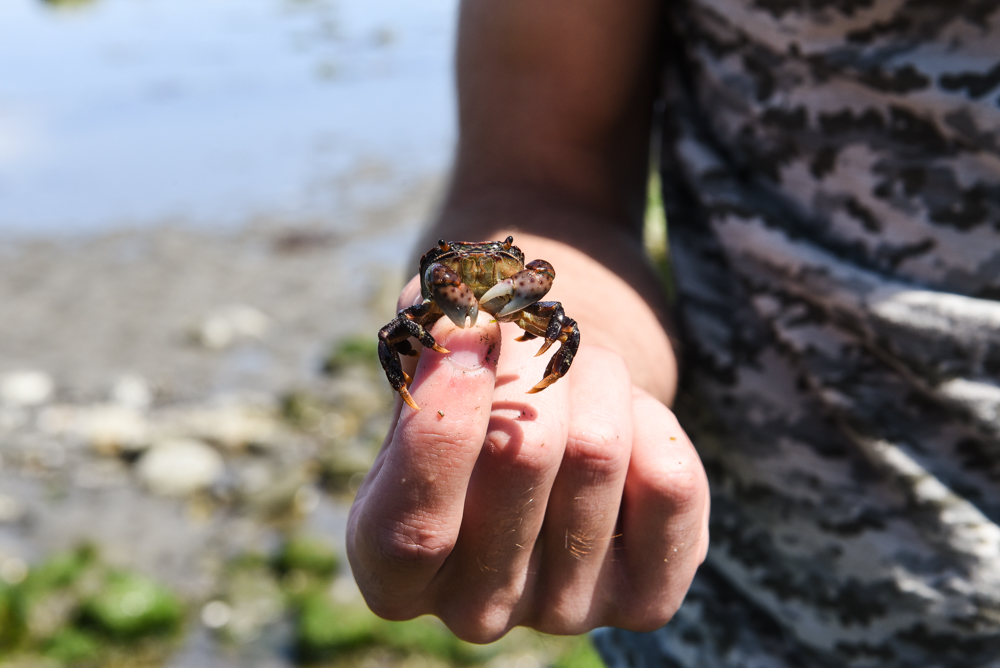
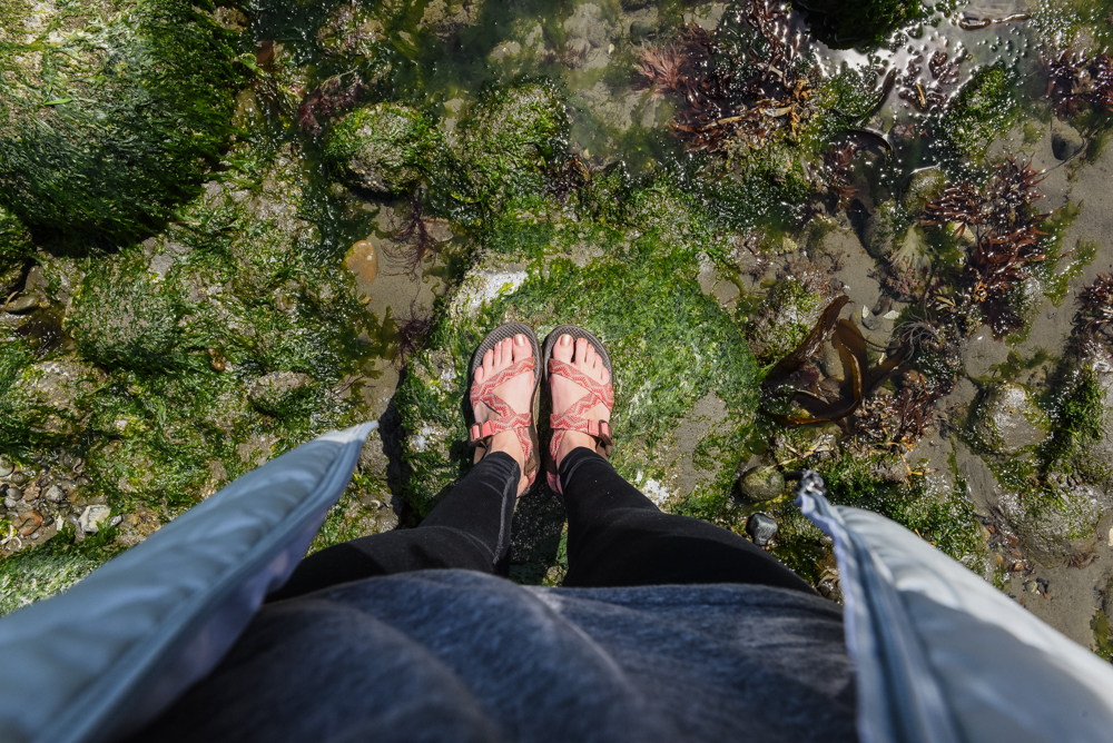
I opted to hike the two beautiful miles along the beach in Chacos. I tried bare feet for a few moments, but the sand was a bit too coarse for comfort. There was also a fair amount of sharp debris, kelp piles, driftwood and rocks covered in barnacles underfoot. Depending on the changing tide, there will be a few impassable headlands. You’ll have to scramble up over a big boulder or two (apparently there are ropes to assist, but we didn’t see or use them) or hike into the woods to navigate around them. These areas are evident and I found them to be easy enough to manage with an overnight pack. I thought that navigating around the series of downed trees was more exhausting, mostly because I’m short and those tree trunks are huuuge.
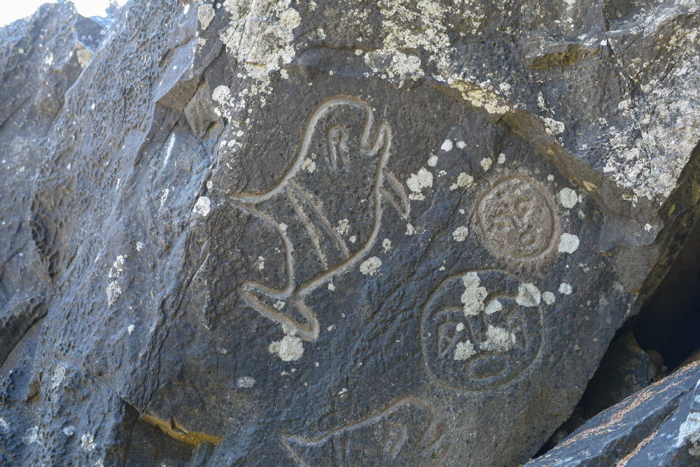
As you make your way around the headlands, be on the lookout for the Wedding Rocks petroglyphs. I’m sure I would have missed them if my friend hadn’t pointed them out to me. They are so amazing we thought that they might be fake, but a quick google search proved us wrong. I had seen petroglyphs in Mesa Verde, Colorado, but these were radically different not only in style (obviously) but also in size and definition. Thinking back, I wish I would have prepared myself for that moment because I would have stayed and enjoyed them longer instead of thinking I was being duped. I had expected to see small paintings, not large rock carvings. The petroglyphs were carved by the ancestors of the Makah tribe using tools made of rock and bone.
Soon enough you’ll reach Sand Point and a whole host of campsites. We wandered around for a good bit trying to find a site that was semi-secluded, which proved to be tough since we rolled in late on a Friday evening. Although we could see other tents from our site, once the sun went down I truly forgot that anyone else was around. There was also the option to camp on the beach, but we liked the sheltered feel of the forest. If you do camp on the beach, know where the high tide line falls or you’ll wake up soaking wet. The next morning, bask in the sun and eat your breakfast on the beach before hiking the 4ish miles back to the trailhead.
If I’m day hiking, sometimes I like to be extravagant. Wine with dinner while watching a sunset, anyone?
We started later in the day after we ate lunch so we packed snacks, dinner, and breakfast for our overnighter. And wine. And weed. Relax, it’s legal in Washington.
Hello from Virginia! I’m popping in to share a hike that we took a few weeks ago in mid/late July.
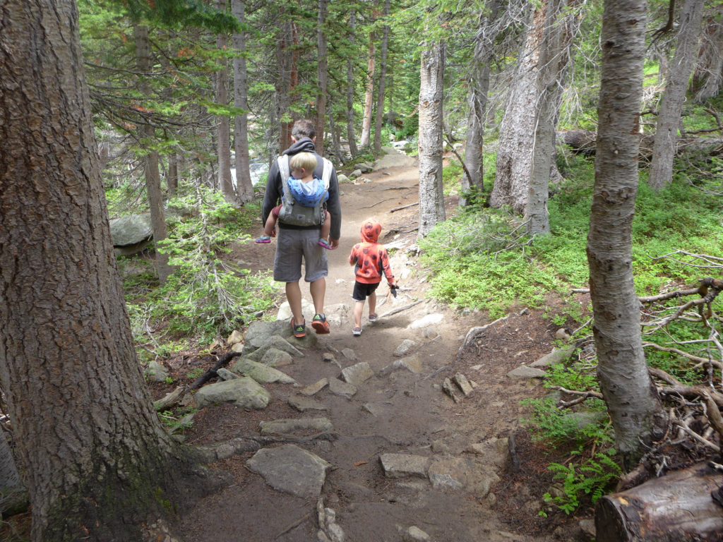
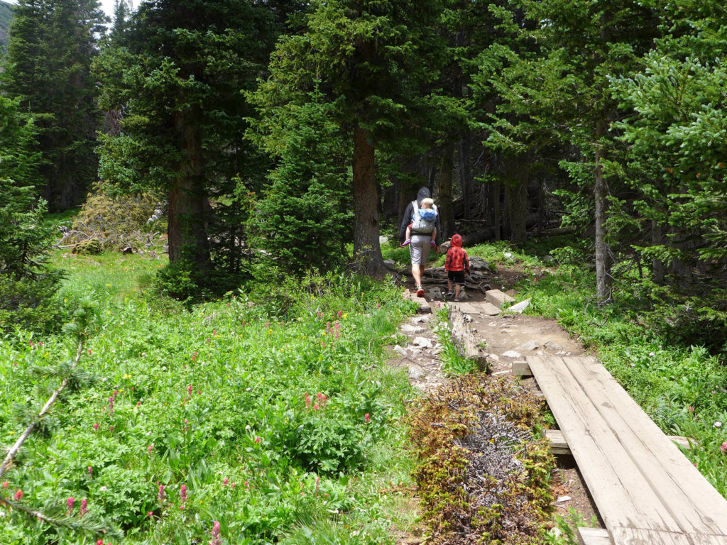
We hiked this same trail (and more) two times last October when there was snow on the ground and ice on the trails. You can read more about those hikes in that post, and I’m going to repost some of the general information about the Brainard Lake Recreation Area the Mitchell Lake Trailhead below.
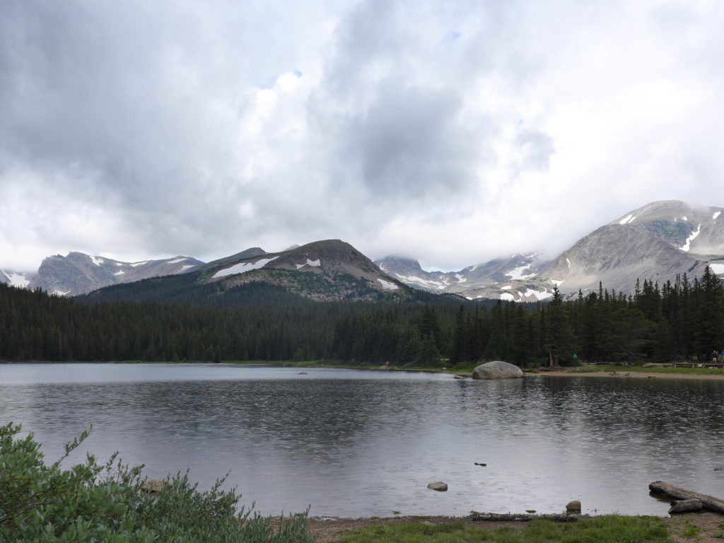
The trail starts within the Brainard Lake Recreation Area, but quickly leaves that area and continues on into the Indian Peaks Wilderness Area.
Brainard Lake Recreation Area is open to vehicles from June – October, but the exact opening and closing dates vary each year based on the weather. The entrance fee is on a sliding scale from $1 if you’re walking to $10/car, BUT you can access this area for free with a Nation Parks annual pass. When the area is closed during the winter, you can still park at a lot near the entrance and then enter the area by foot/ski/bike.
During the summer months, you can drive into the area and park at a number of lots. There’s a day-use lot near the main lake that often has spaces, and then there are two smaller lots near the Long Lake and Mitchell Lake trailheads, but in our experience, both of these fill up fairly early and remain packed throughout the day.
If possible, park at the Mitchell Lakes Trailhead and you’ll be able to quickly access the trail, if the lot is full, you’ll have to park in one of the other lots and walk over to the trailhead.
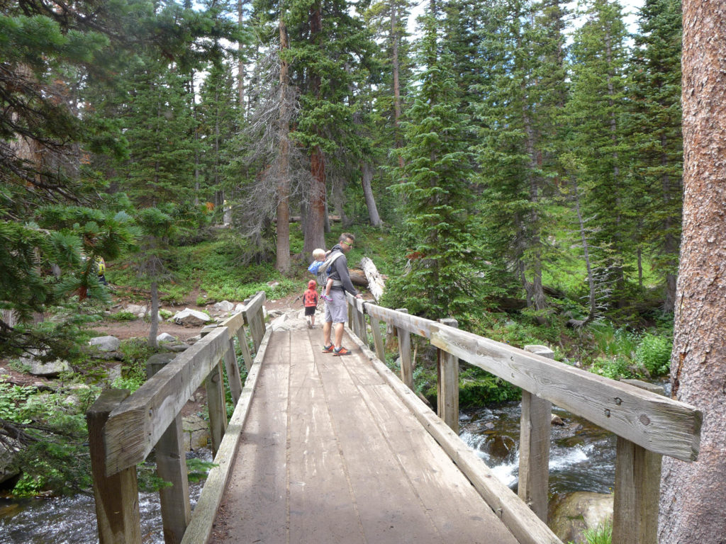
On this particular day, the Long Lake and Mitchell Lake parking areas were full, BUT we brought bikes! It was an easy ride from the day-use lot over to the Mitchell lot, and then we locked the bikes up by the ranger shed at the start of the trail.
The hike to Mitchell Lake is just under a mile, and it’s another 1.6 miles to reach Blue Lake. These are both out-and-back destinations, making the round-trip hike to Mitchell approximately 1.8 miles and the hike to Blue Lake five miles. The altitude at the trailhead is approximately 10,500 ft, with a gradual climb of just 200 ft to Mitchell Lake and then reaching a final altitude of 11,300 ft at Blue Lake.
On this particular hike, we only made it to Mitchell lake, but last fall, we made it all the way to Blue Lake (on our second try!).
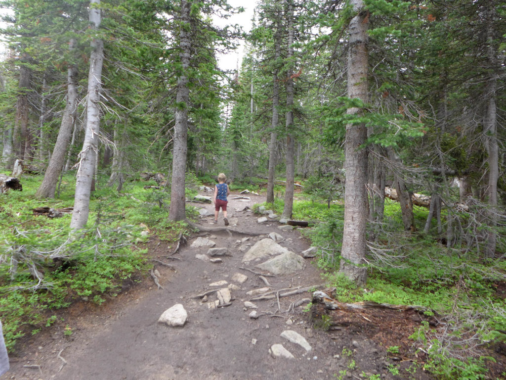
This is a popular, well-worn trail that is easily visible when there isn’t much snow on the ground, and was relatively well marked with flashes on the trees..
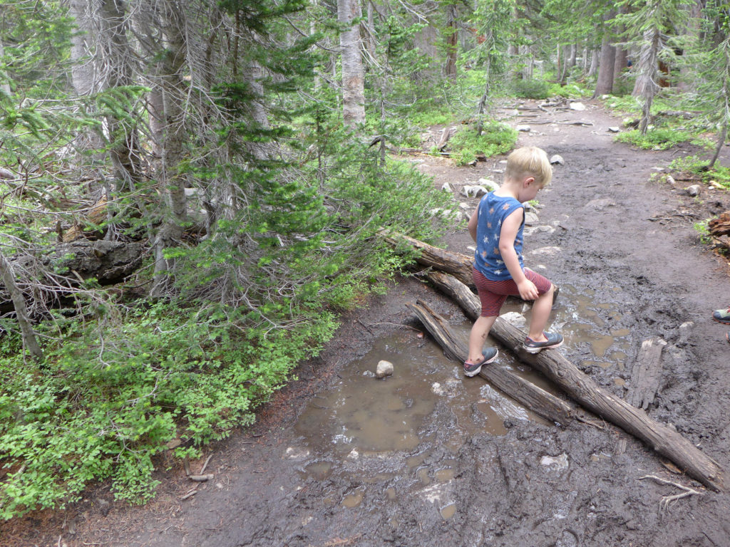
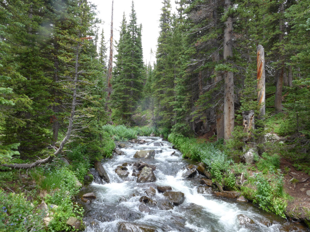
Near the base of the trail, hiking is relatively easy with that slow, gradual climb to Mitchell Lake. There is one large stream-crossing over a short wooden bridge, and then another crossing over a wider stream with fallen logs used as the bridge. In other segments, planks are used to keep hikers out of boggy areas.
If you go beyond Mitchell Lake, there are some steep areas where climbing the rocks is similar to climbing a steep set of stairs, with an increase in the portion of steep climbs as you approach Blue Lake.
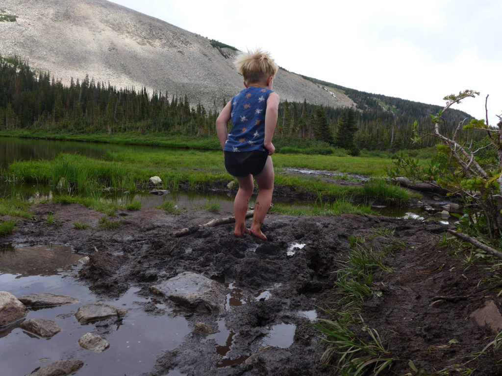
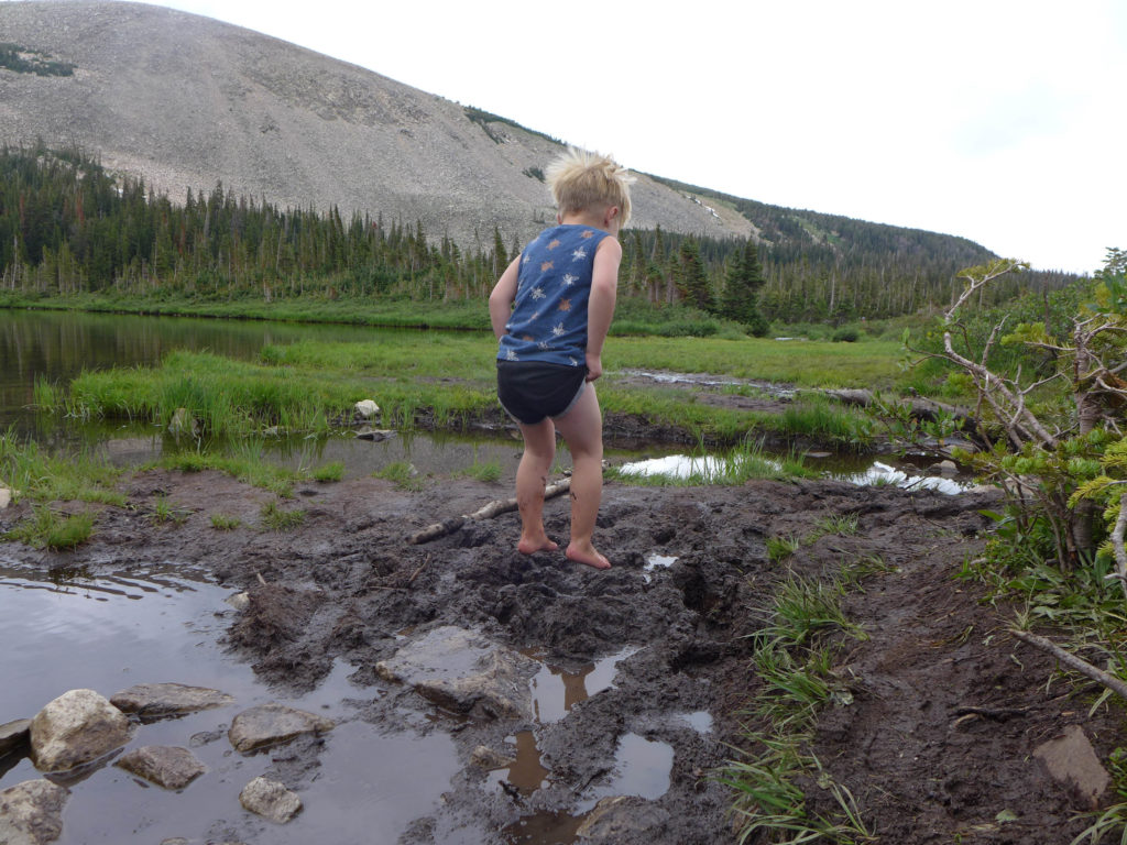
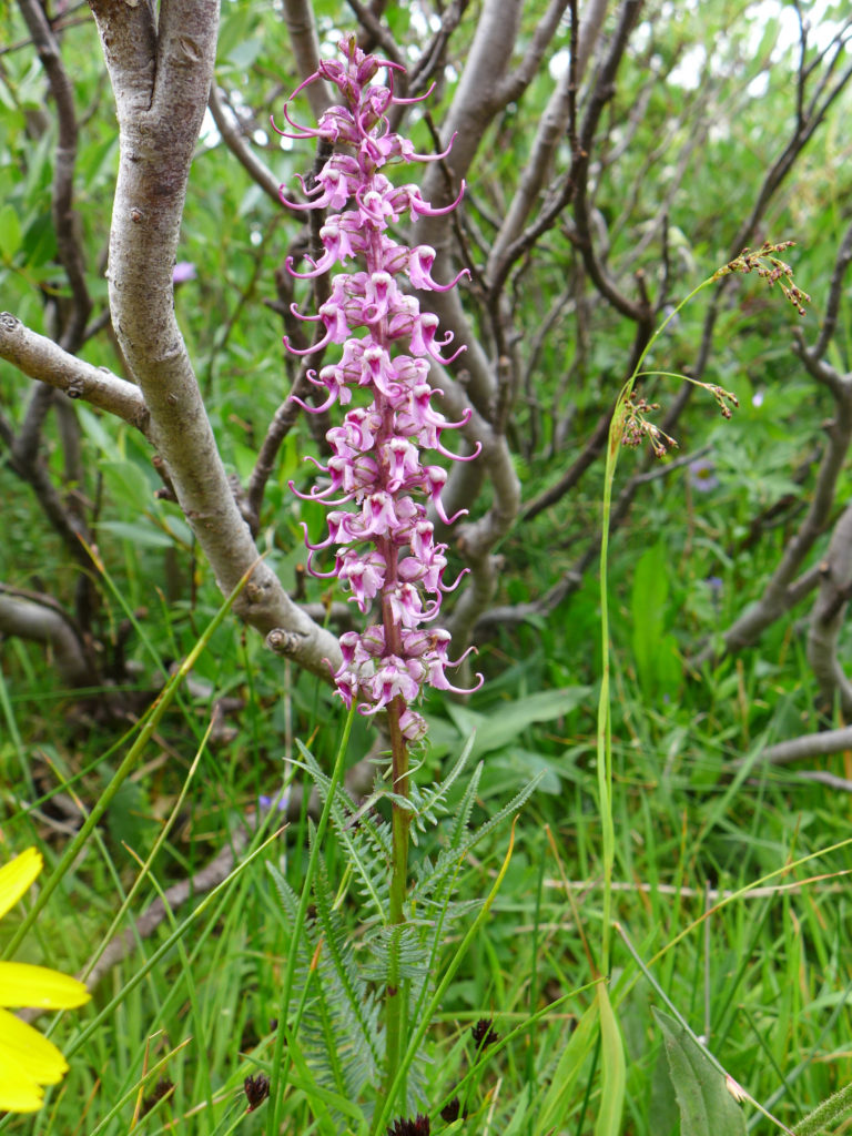
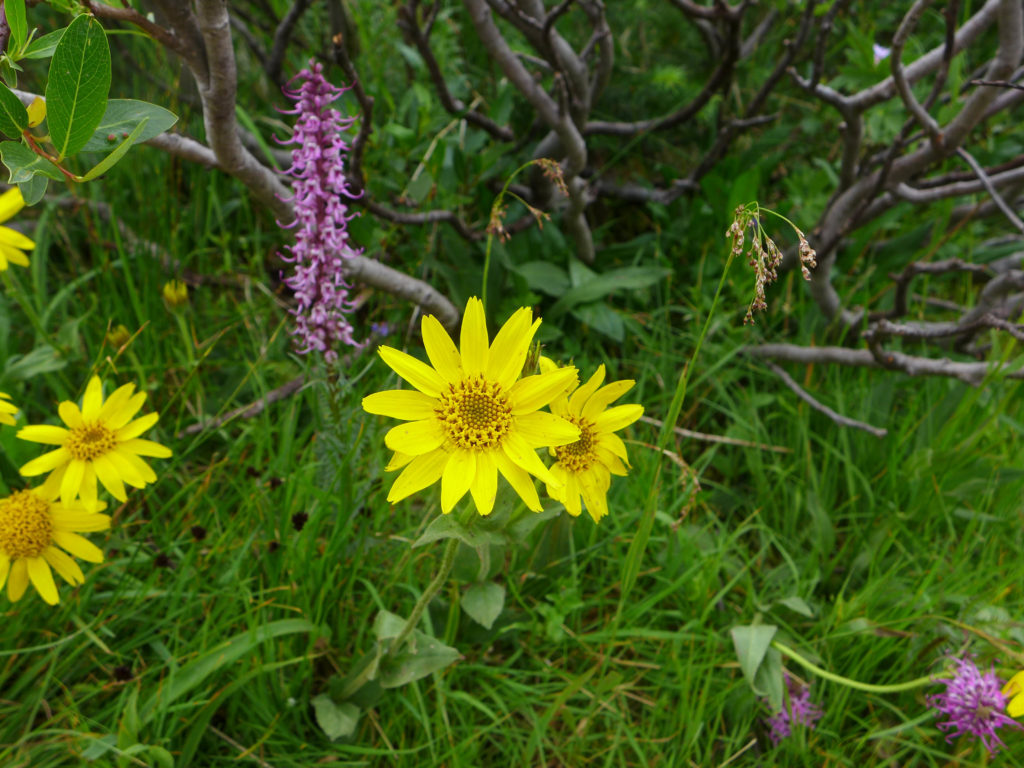
Last fall, there was some snow on the trail that had been tramped down and turned to ice, making some areas slick. This summer there was no risk of snow on the trail, but there were plenty of mucky spots and mud puddles.
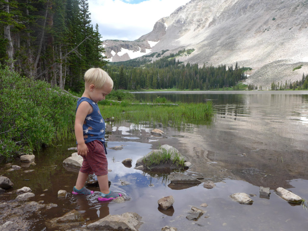
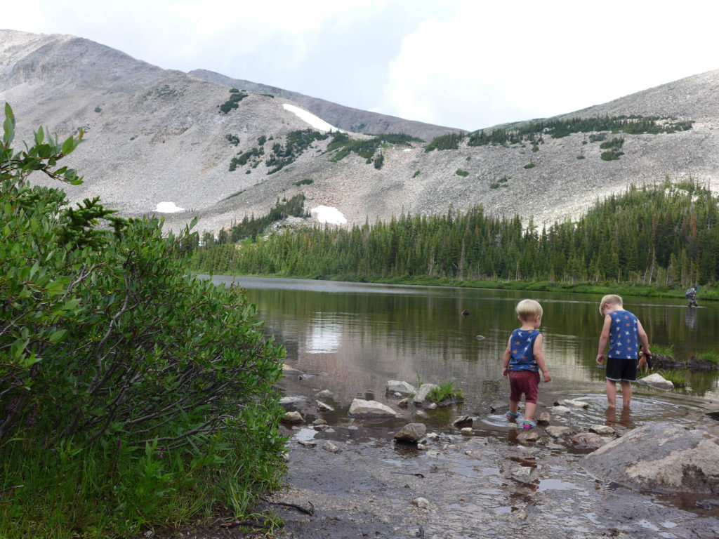
Last fall I said that young kids (4 to 8 year olds) should be able to hike to Mitchell Lake with minimal help but would likely need help making the full trek to Blue Lake. Older kids 8+ should have no trouble with the full hike. Those estimates were based upon the kids we saw on the trails as we hiked. Seeing 4 year-old Alex run along the trail to Mitchell Lake this summer, I think that we were right on target with the lower range.
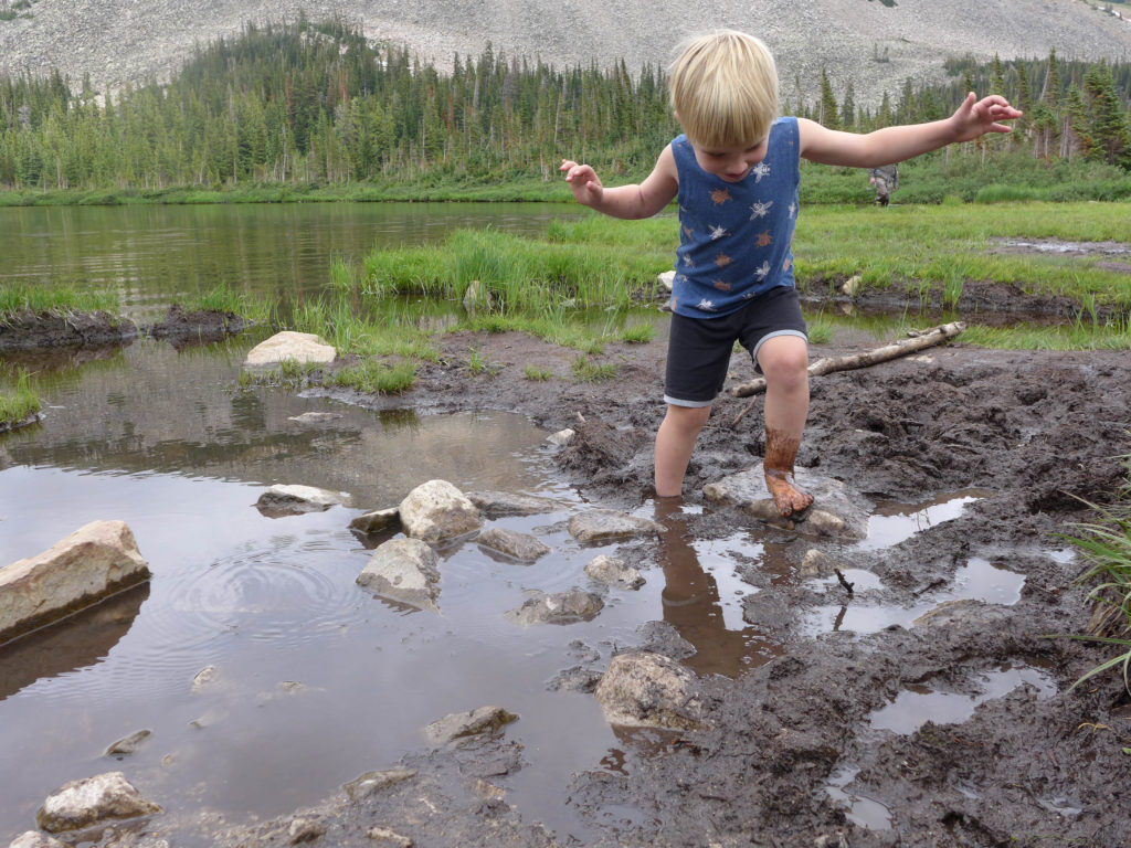
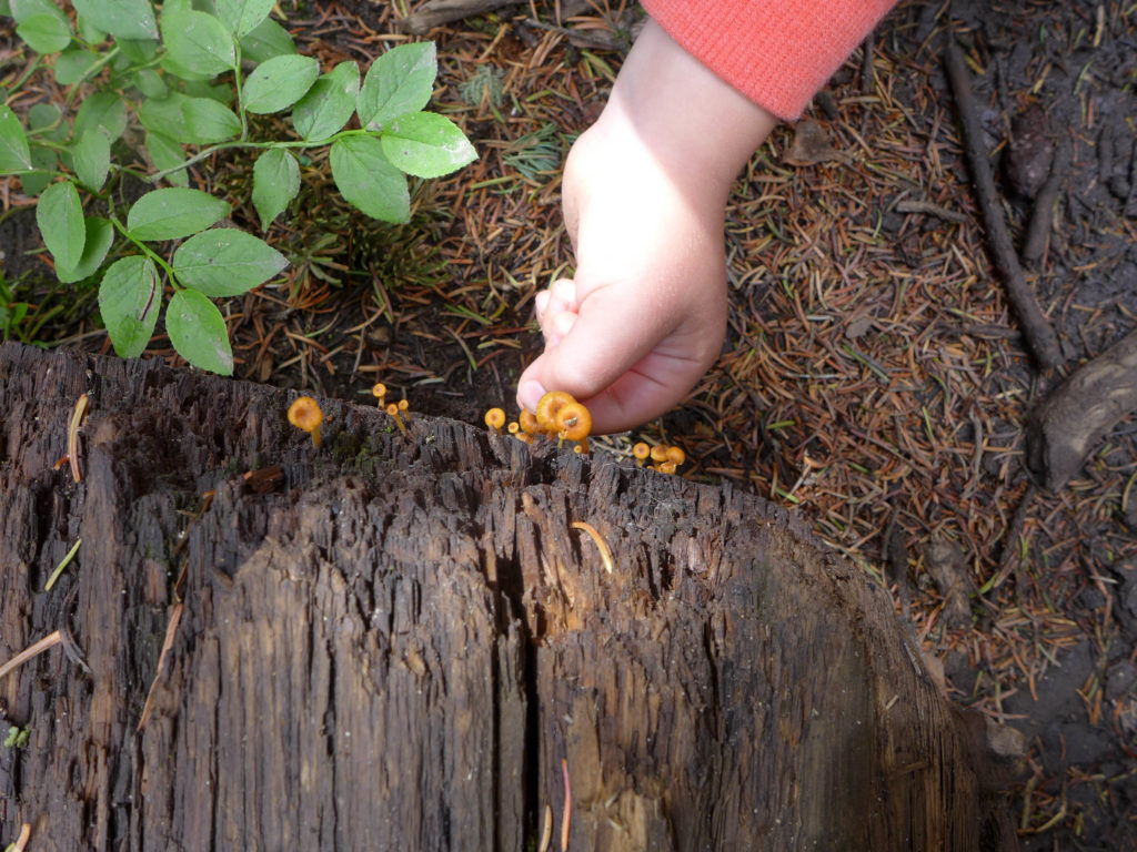
One big difference between our October and July hikes was the muck! As you can see, we had (almost) no reservations about letting them go wild.
At this time of year (and almost any time!), it was really helpful to dress in light layers. Since it was summer, our base layer consisted of tank tops and shorts for the boys, with a hoodie for more coverage.
I think the key to relaxing on this hike was recognizing that there was going to be muck and being prepared to let the boys play in it with wild abandon. Both boys wore their water shoes, which were perfect for this short hike. We let the boys get wet, jump in mud puddles, and generally disregarded the rules of hiking concerning good socks and dry shoes. If you’re going out for a longer hike and have kids with sensitive feet, water shoes may not be appropriate.
And don’t forget sunscreen! While there are some segments with plenty of shade, there is a lot of sun shining on much of the trail.
If you’re in the Boulder area, this hike and the whole Indian Peaks area is definitely worth your time. Just know that everyone else loves the area too, so try to get there early before the lots fill up. Good luck!
On this hike we realized that by 2pm on a summer afternoon the lots are starting to open up. If you’re going for a short hike like this one, that’s still a great time to head out, with the added benefit that you won’t have the strong mid-day sun shining on you.
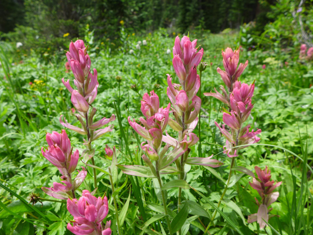
Even so, facing the crowds is totally worth it to hike (or re-hike) the trails around Brainard Lake. This is such a beautiful area, and it’s such a pleasure to see the trails change with the seasons.
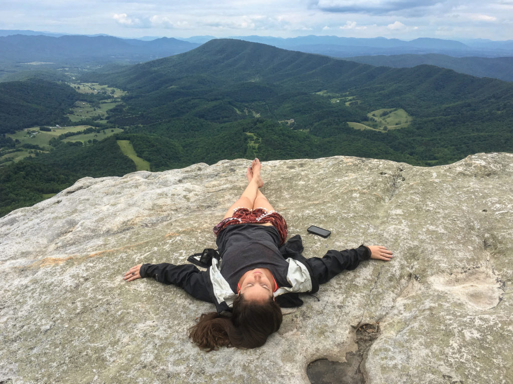
McAfee Knob is one of the most photographed views on the Appalachian Trail. From McAfee Knob, you’ll see a nearly 270-degree panorama of Catawba Valley, North Mountain, Tinker Cliffs and the Roanoke Valley. I hiked McAfee’s as a day hike, but there are numerous shelters and campsites along the trail. If you plan it right, you can catch sunrise or sunset on the knob, which would make for some incredible images.
In my opinion, McAfee Knob is the perfect day hike. You get a big payoff for only a slightly strenuous hike 8.8 round trip hike and there’s an option to make it a loop. You’ll climb about 1,700 feet in elevation over 4.4 miles. I wore these sneakers and my feet were more than happy. On a clear day, the views are said to be the best in the Southern Shenandoah Valley. Pack a hammock and a lunch or a single beer like we did, and hang out at the top for a long while.
This hike is about twenty minutes outside of Roanoke. Park in the McAfee’s Knob parking area. Though the trail is well worn and populated, snap a photo of the map on the information board before crossing the road and beginning the hike. Follow the white A.T. (Appalachian Trail) blazes as the trail winds its way upwards. You’ll pass a couple shelters and campsites along the way. Eventually, you’ll cross an old fire road and a power line clearing. The blazes pick up again on the other side of the clearing and after only a quarter mile more you’ll see the first good view of Catawba Valley. Another half mile up the trail and you’ll see the McAfee Knob Spur Trail. Turn left and almost immediately you’ll see amazing views.

McAfee Knob extends noticeably beyond the rest of the cliffs and there’s no way you can miss the line of people taking photos there. We walked past the crowds and explored the cliffs a little further until we found a comfortable rock bench from which to sit, chill and enjoy the view. If you have the time (and the snacks) stay until sunset. On the way back take the fire road for a much easier path down to the parking lot. You’ll also skim about a half mile off the adventure that way.
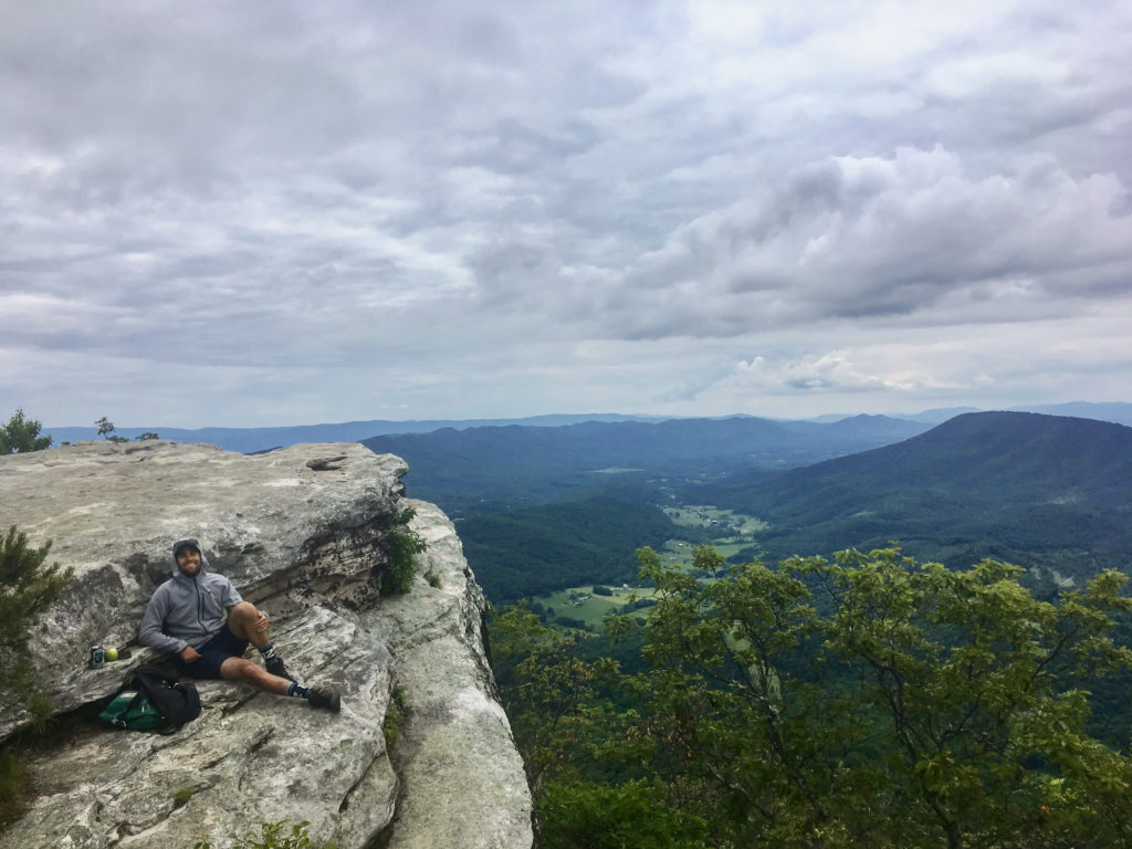
McAfee Knob is a very popular hike. I’m sure we bumped into nearly 50-75 other hikers along the trail and at the vista. That being said, the viewpoint and rock outcroppings are immense and there was room for everyone at the top. I noticed folks being really courteous about moving out of the way for photographs as well. I was also pleased to see that the trail and knob were mostly free of litter. Please remember to follow Leave No Trace hiking etiquette here and everywhere else.