Interested in more hiking posts? You can find more of our Colorado hikes here.
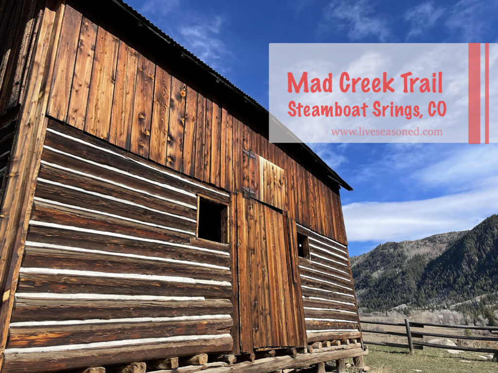
Come along on this short, fun, and extremely kid-friendly hike!
Continue reading
Come along on this short, fun, and extremely kid-friendly hike!
Continue reading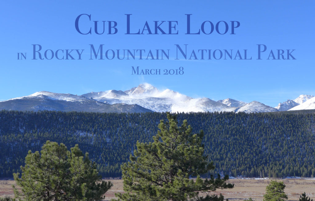
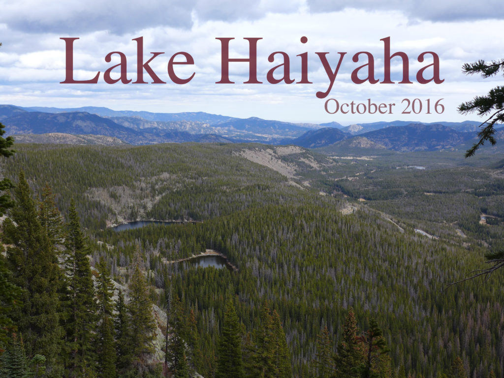
If you’ve been following along on Instagram, we spent a quick 36 hours in Rocky Mountain National Park last weekend. On Saturday we took an ambitious hike – click through to see more photos and details.
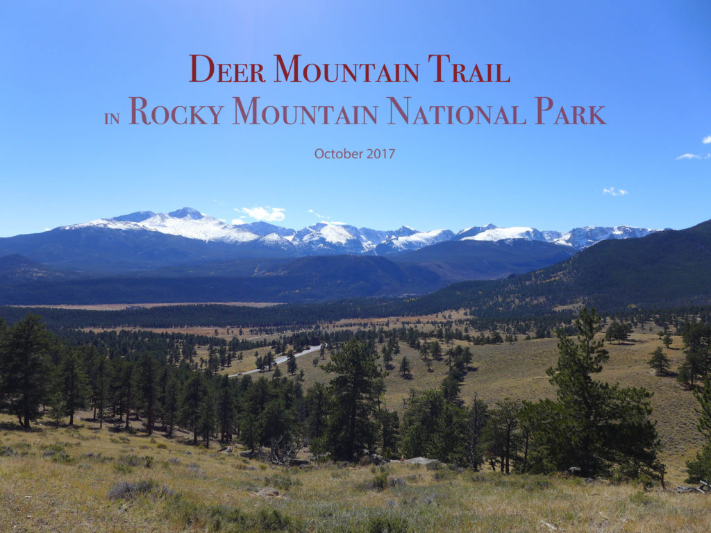
Today we’re sharing some photographs and info about our hike to the top of Deer Mountain in Rocky Mountain National Park. If you want even more info when planning a visit, leave us a comment, check out this post about winter camping in the park, or pick up this hiking guide (it’s super detailed and our favorite).
Earlier this month, we went on a five-day road trip to south west Colorado. It’s a part of the state we haven’t explored, but had heard great things about. We set out excited to experience the beautiful San Juan mountain range. Let me spill the beans right now: this trip was awesome (I’m writing this about a week after the trip, and we’re still talking about it). We loved the scenery, the hot springs, and the towns we visited.
This is going to be a two-post report. In this post I’m going to share photos and from the first bit of our trip that was spent in Great Sand Dunes National Park, and in the second post I’ll share photos from our visits to Pagosa Springs and Ouray.
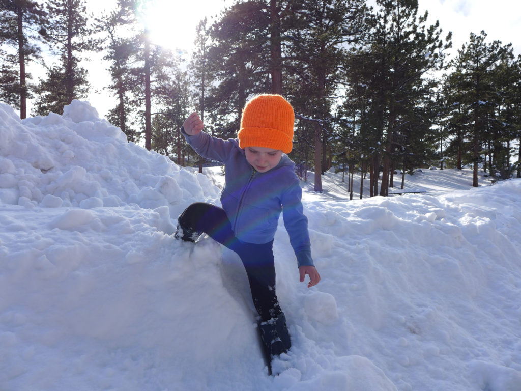
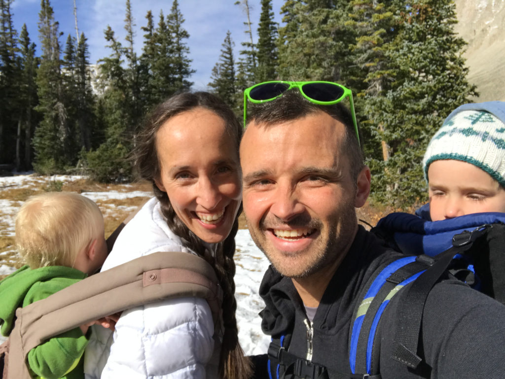
Last weekend we packed up the van and headed into Rocky Mountain National Park for an overnight adventure! Since winter camping is not a common past time, especially if you have little kids, I thought I’d share some details about our adventure, and hopefully encourage you to take off into the snowy mountains for a weekend of fun.
These are photos from a hike that we took a few months ago, and I just happened to find them here in an unpublished post. I was so sure that I wrote about this hike, but a few searches finally convinced me that I’m crazy.
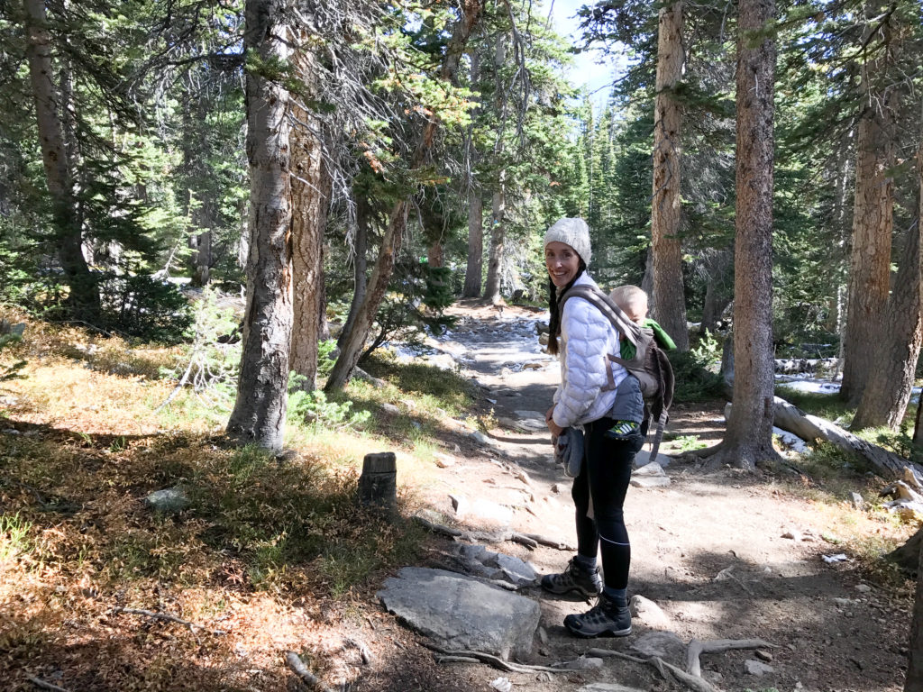
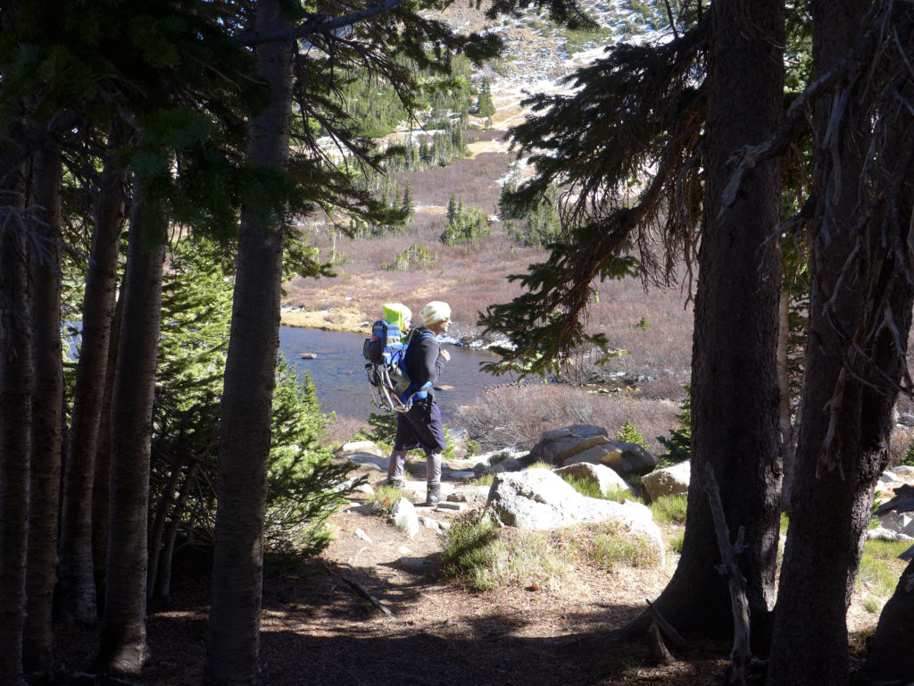
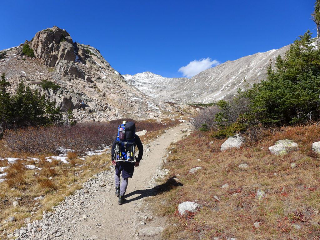
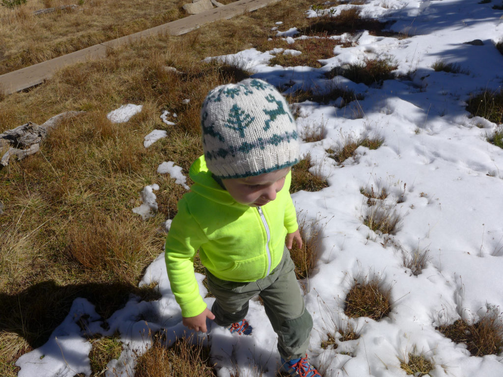
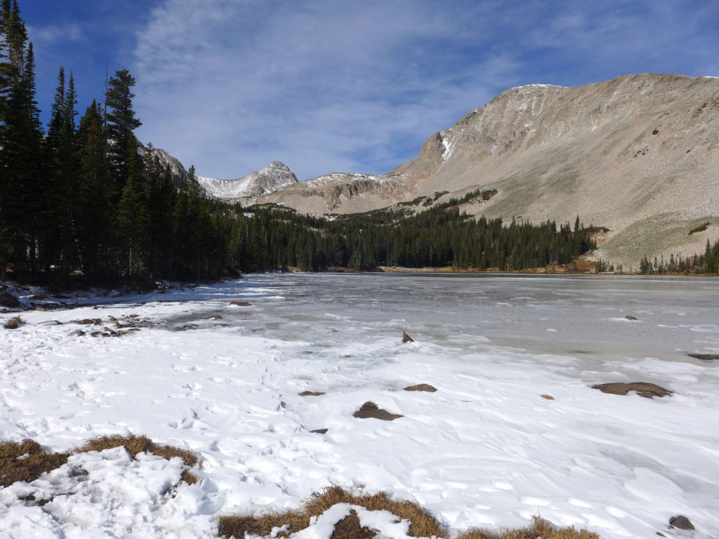
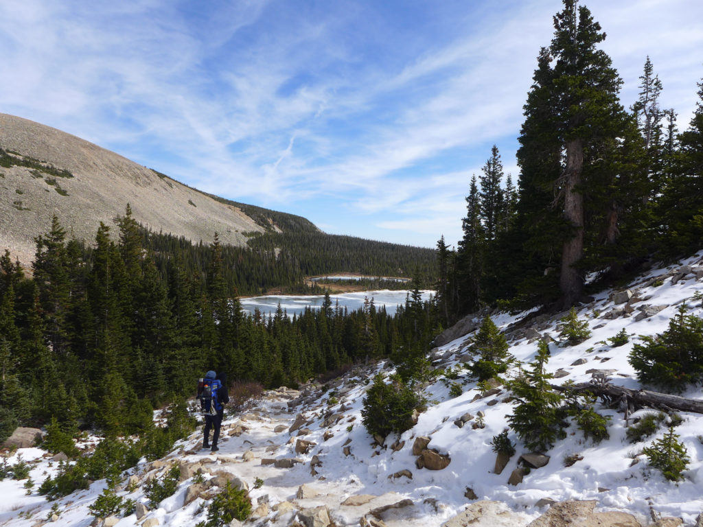
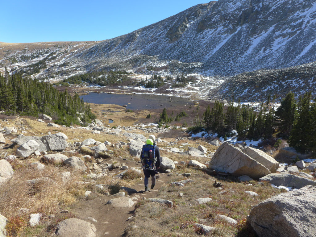
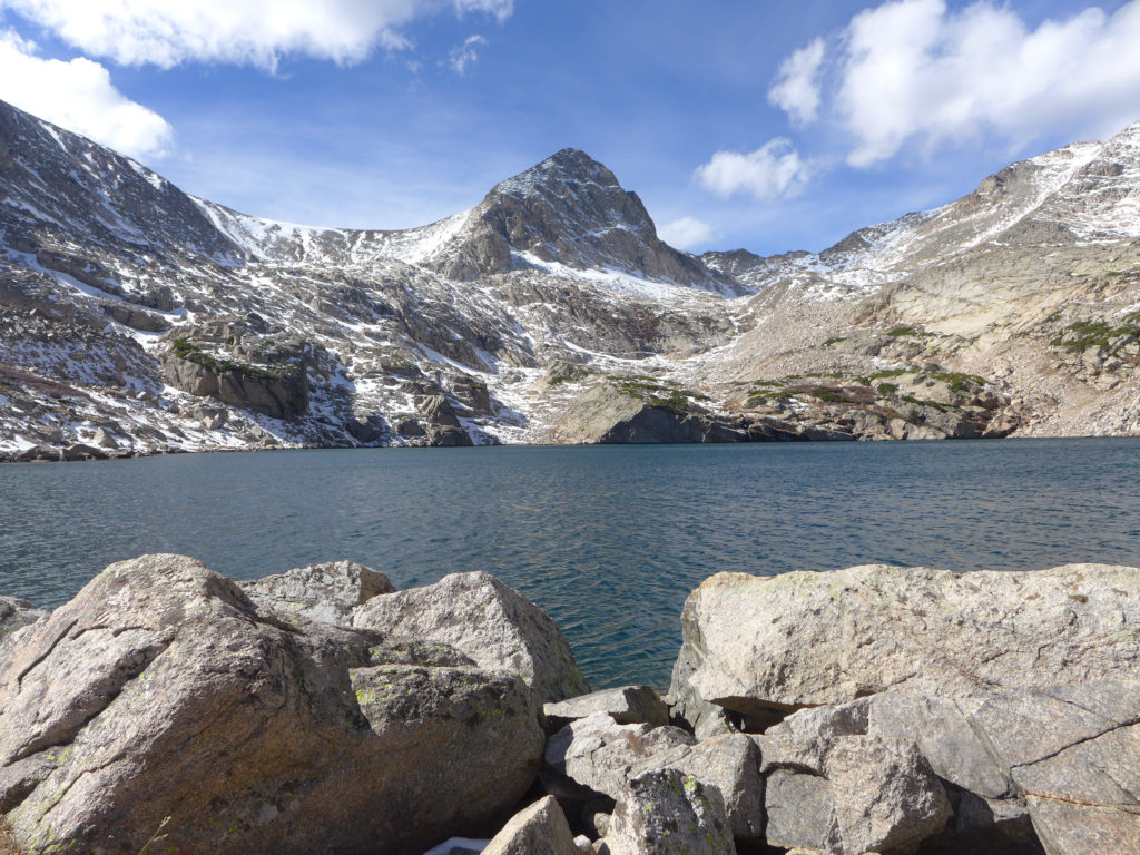
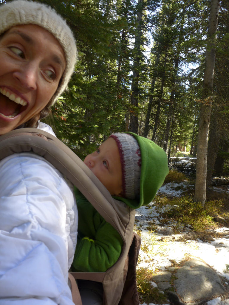
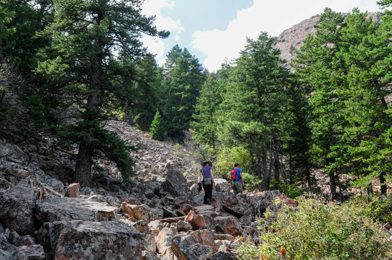
For the past two weekends, we’ve visited Brainard Lake Recreation Area and set out from the Mitchell Lake Trailhead. On our first trip, we did a short hike to Mitchell Lake, took a rest to have some hot chocolate, and then turned around. Yesterday we set out with the goal to make it all the way to Blue Lake, and we did!
As in the tradition of our previous hike posts, I wanted to share some photos and a brief overview of the trail. These photos are from both trips and in no particular order, but they give you a great sense of what the trail is like during mid October.
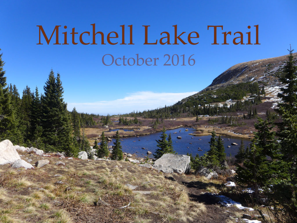
The trail starts within the Brainard Lake Recreation Area, but quickly leaves that area and continues on into the Indian Peaks Wilderness Area.
Brainard Lake Recreation Area is open to vehicles from June – October, but the exact opening and closing dates vary each year based on the weather. The entrance fee is on a sliding scale from $1 if you’re walking to $10/car, BUT you can access this area for free with a Nation Parks annual pass. When the area is closed during the winter, you can still park at a lot near the entrance and then enter the area by foot/ski/bike.
During the summer months, you can drive into the area and park at a number of lots. There’s a day-use lot near the main lake that often has spaces, and then there are two smaller lots near the Long Lake and Mitchell Lake trailheads, but in our experience, both of these fill up fairly early and remain packed throughout the day.
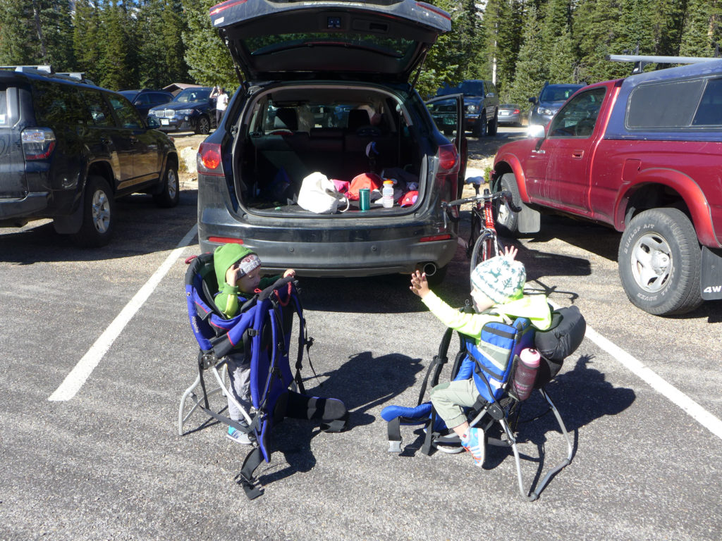
If possible, park at the Mitchell Lakes Trailhead and you’ll be able to quickly access the trail, if the lot is full, you’ll have to park in one of the other lots and walk over to the trailhead.
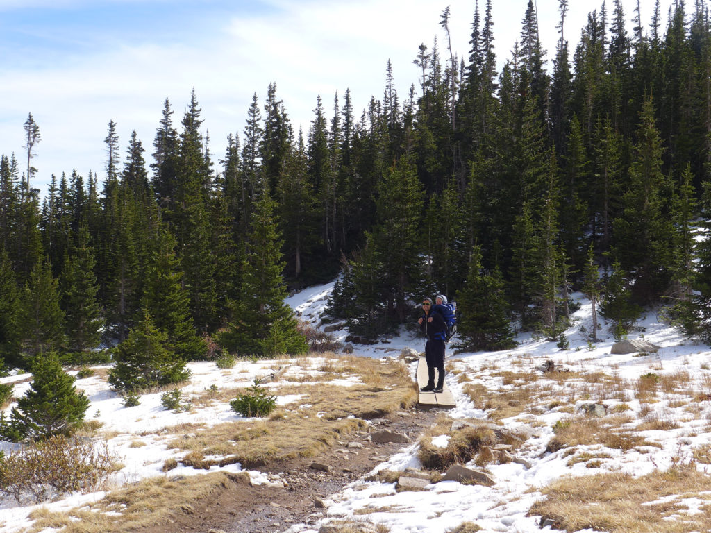
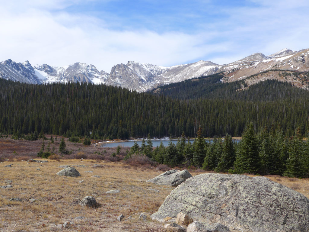
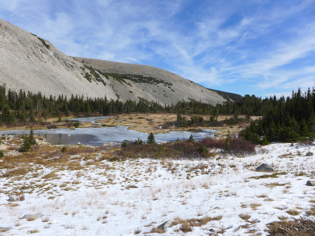
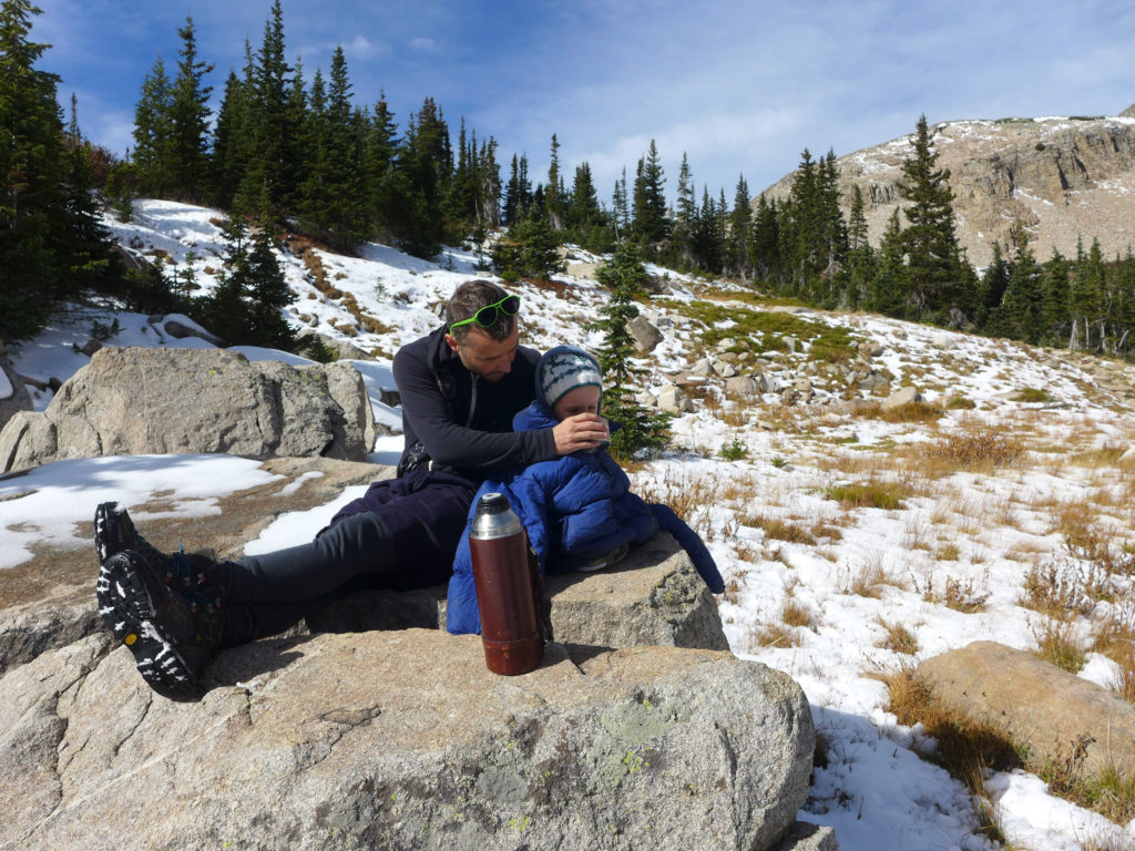
The hike to Mitchell Lake is just under a mile, and it’s another 1.6 miles to reach Blue Lake. These are both out-and-back destinations, making the round-trip hike to Mitchell approximately 1.8 miles and the hike to Blue Lake five miles. The altitude at the trailhead is approximately 10,500 ft, with a gradual climb of just 200 ft to Mitchell Lake and then reaching a final altitude of 11,300 ft at Blue Lake.
This is a popular, well-worn trail that is easily visible when there isn’t much snow on the ground. I’m not sure what it’s like when covered with snow, and while there were some markers in the trees, I didn’t pay close enough attention to notice how well-marked it was.
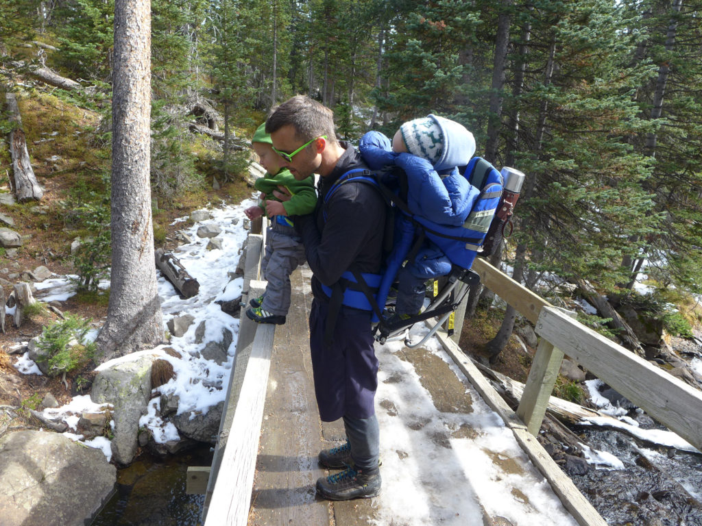
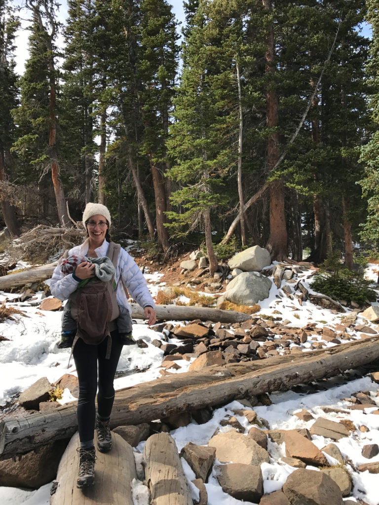
Near the base of the trail, hiking is relatively easy with that slow, gradual climb to Mitchell Lake. There is one large stream crossing over a short wooden bridge, and then another crossing over a wider stream with fall logs used as the bridge. In other segments, planks are used to keep hikers out of boggy areas. There are some steep areas where climbing the rocks is similar to climbing a steep set of stairs, with an increase in the portion of steep climbs as you approach Blue Lake.
During our first visit, there was some snow on the trail that had been tramped down and turned to ice, making some areas slick, but the following weekend this ice had melted, making hiking much easier. It was a nice reminder of how quickly weather and trail can change at that altitude.
Young kids (4 to 8 year olds) should be able to hike to Mitchell Lake with minimal help but would likely need help making the full trek to Blue Lake. Older kids 8+ should have no trouble with the full hike. *** Having only 3.5 and 1.5 year olds, I may have to go back and revise those numbers as we continue to test the trail, but this is based upon the kids we saw out on the trails as we hiked.
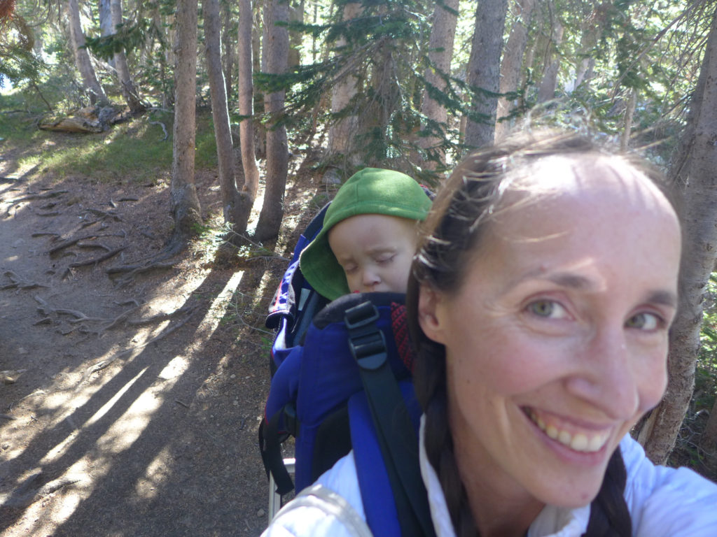
We ended up carrying both of our kids during both hikes. The first weekend it was because they were a bit under the weather, and the second weekend it was because we set out with the goal of the longer hike.
And I don’t know about your kiddos, but anytime we pull out a thermos of hot chocolate during a rest, they are happy hikers and totally oblivious to any chill in the air (pro-tip there)!
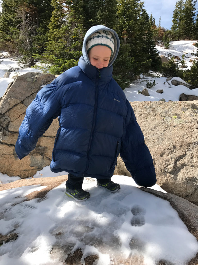
At this time of year (and almost any time!), it was really helpful to dress in light layers. I wore spandex on my bottom and then a tank, wool thermal, and a light down jacket on top. Calder did something similar. The boys wore lined pants, shirts, and hoodies. They could have been dressed a bit warmer, but we also used our down jackets to bundle around them when they were cold in the packs, which worked out well because it was often when we were hot from hiking and carrying them. We all wore wool hats that we put on and off all day.
It was particularly cold and windy at Blue Lake, but since we weren’t staying there long, it didn’t make sense to carry along extra layers just for that rest stop.
And don’t forget sunscreen! While there are some segments with plenty of shade, there is a lot of sun shining on much of the trail.
 By now, Calder and I both know that we live in a beautiful state, but even so, we couldn’t stop gushing about these two weekends spent hiking the same trail. We’re so glad we explored and now we’re anxious to hike it when the wildflowers are at their peak next summer. We’re also excited to have this hike at the ready the next time we have adventurous visitors in town.
If you’re in the Boulder area, this hike and the whole Indian Peaks area is definitely worth your time. Just know that everyone else loves the area too, so try to get there early before the lots fill up. Good luck!
Hey there, we’re still here! Somewhere.
As the weather has changed, we’re finally enjoying spring in the mountains and have turned our attention outside. Breakfast on the deck, planting a little bed of veggies, cleaning up the pond, afternoons at the park, which morph into evenings and dinner in the park. It’s all amazing, but it’s pulled me away from the computer, which is both good and bad. I love all of the time in the sun and fresh air, and there’s nothing that puts a bigger smile on my face than digging in the dirt (especially when the boys help), but I do miss documenting our days. So, I’m hoping to get back here, even if it’s at a more relaxed pace over the next weeks/months.
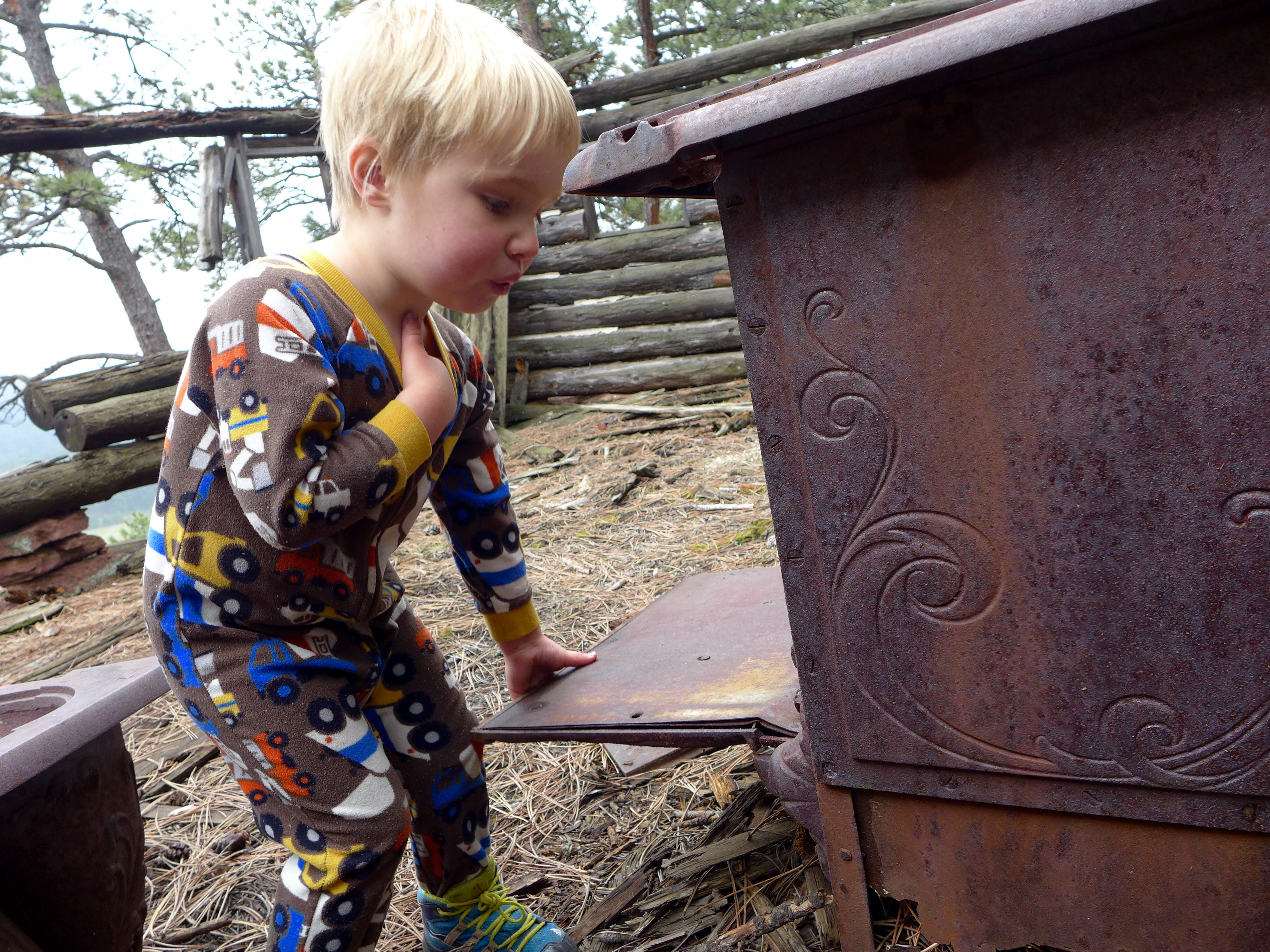
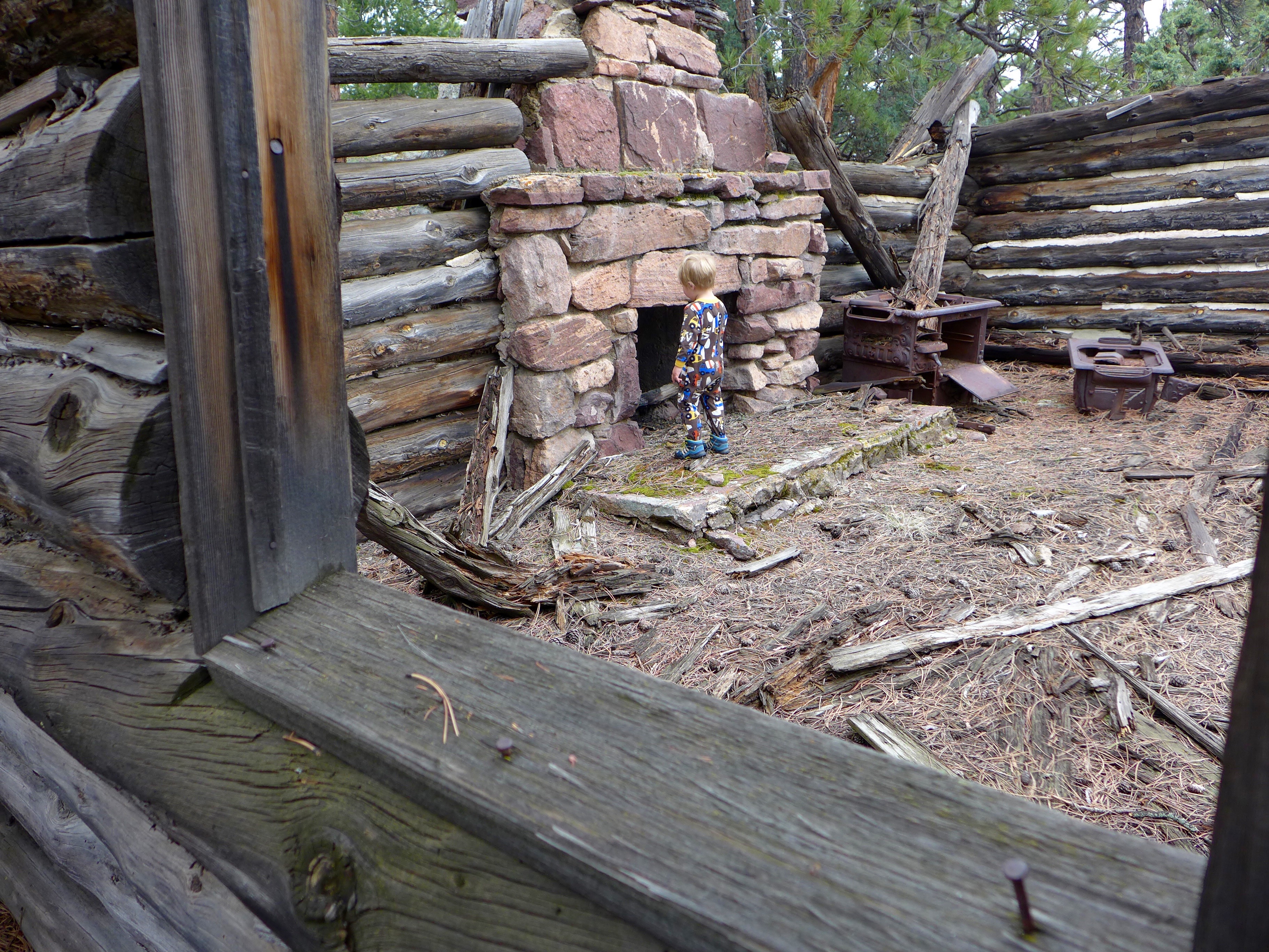
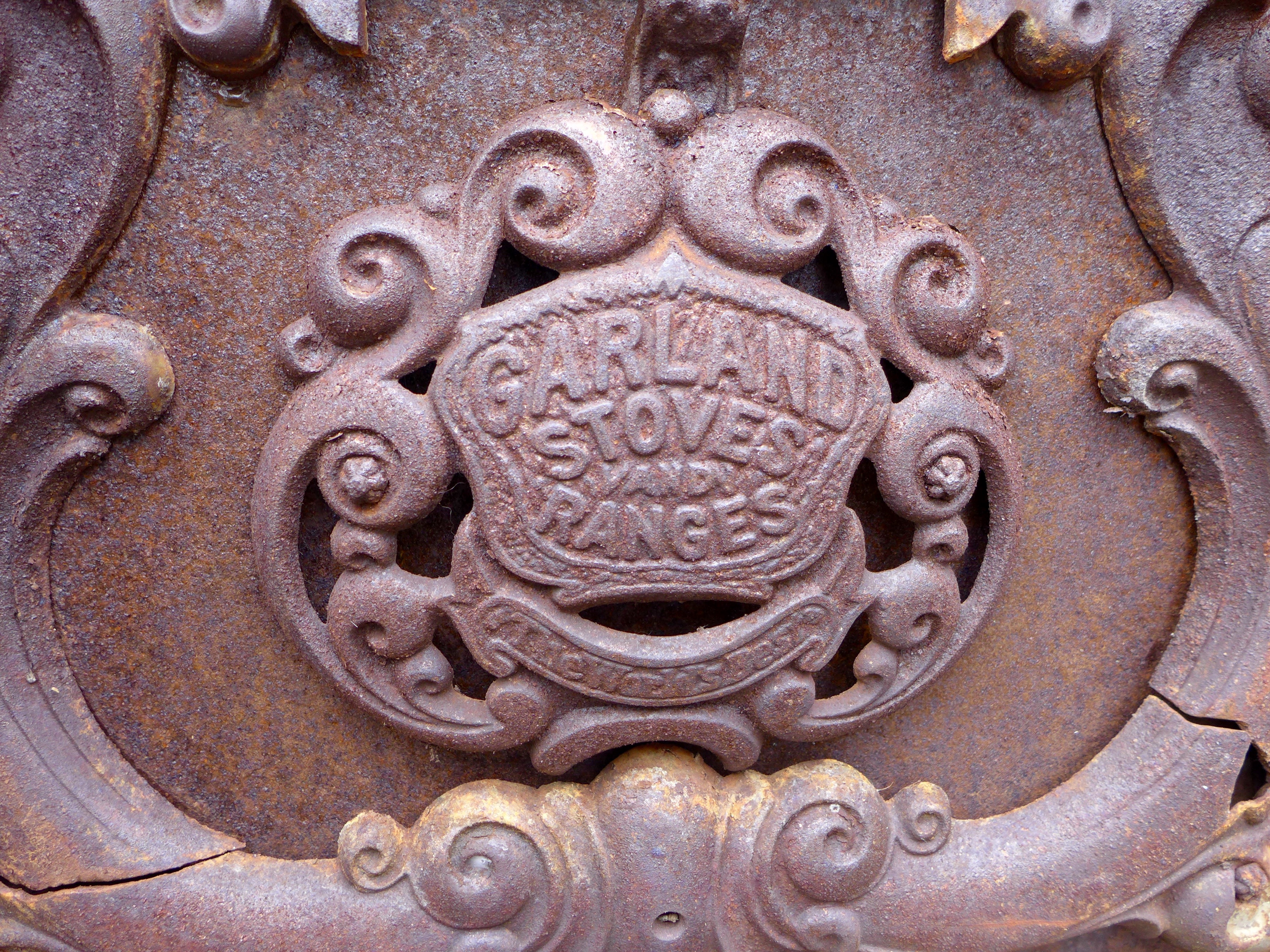
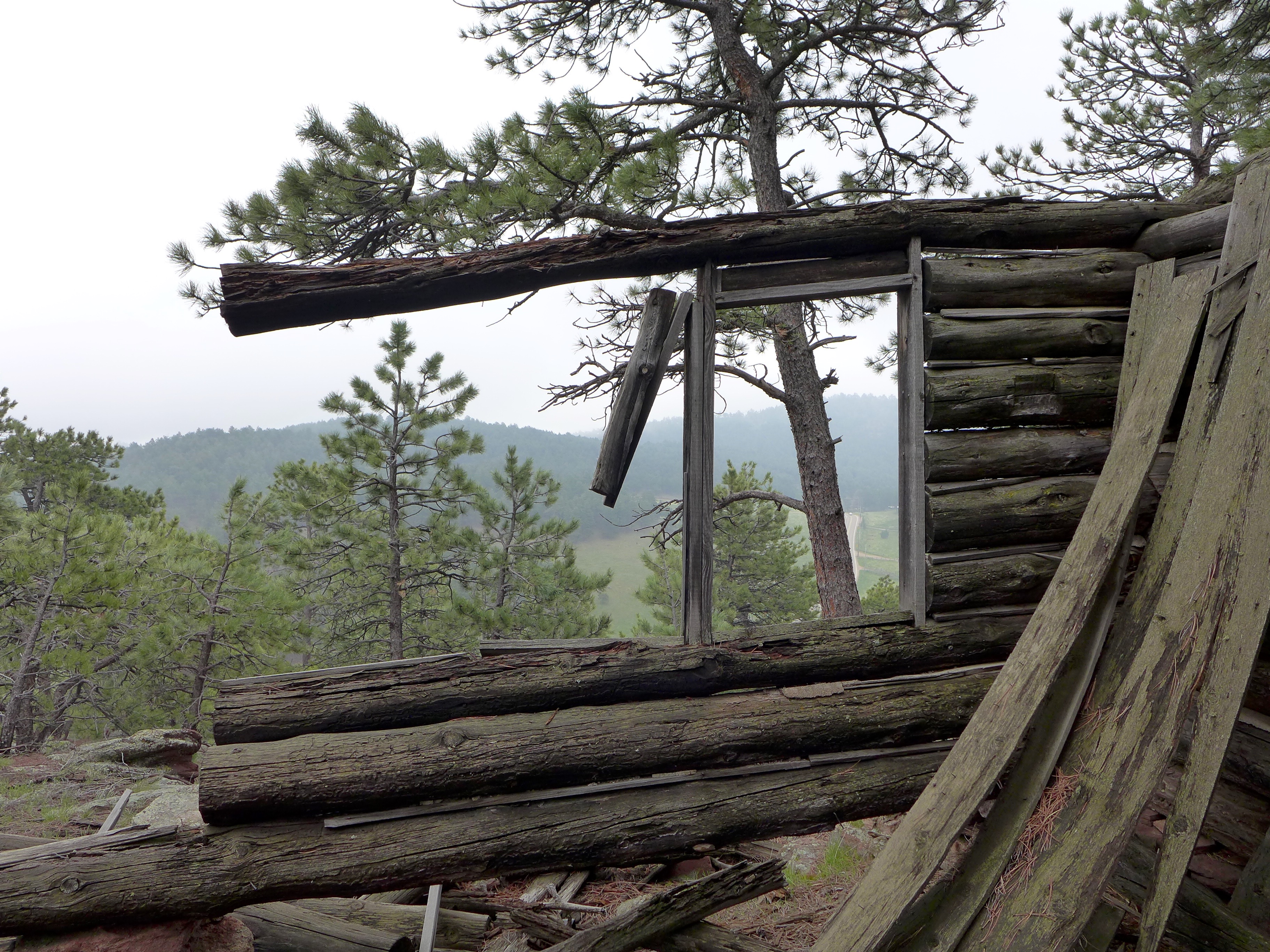
The photos in this post are from a Mother’s Day hike that Alex and I took up our mountain to the old cabin in the woods. I wanted to spend one-on-one time with each boy on Sunday, and when I asked Alex what he wanted to do, “hike to the cabin” was his idea. It was so perfect. There was only one moment when I threatened to leave him in the woods – three year olds are tantrum masters. But we recovered, and then had a great time exploring that cabin.
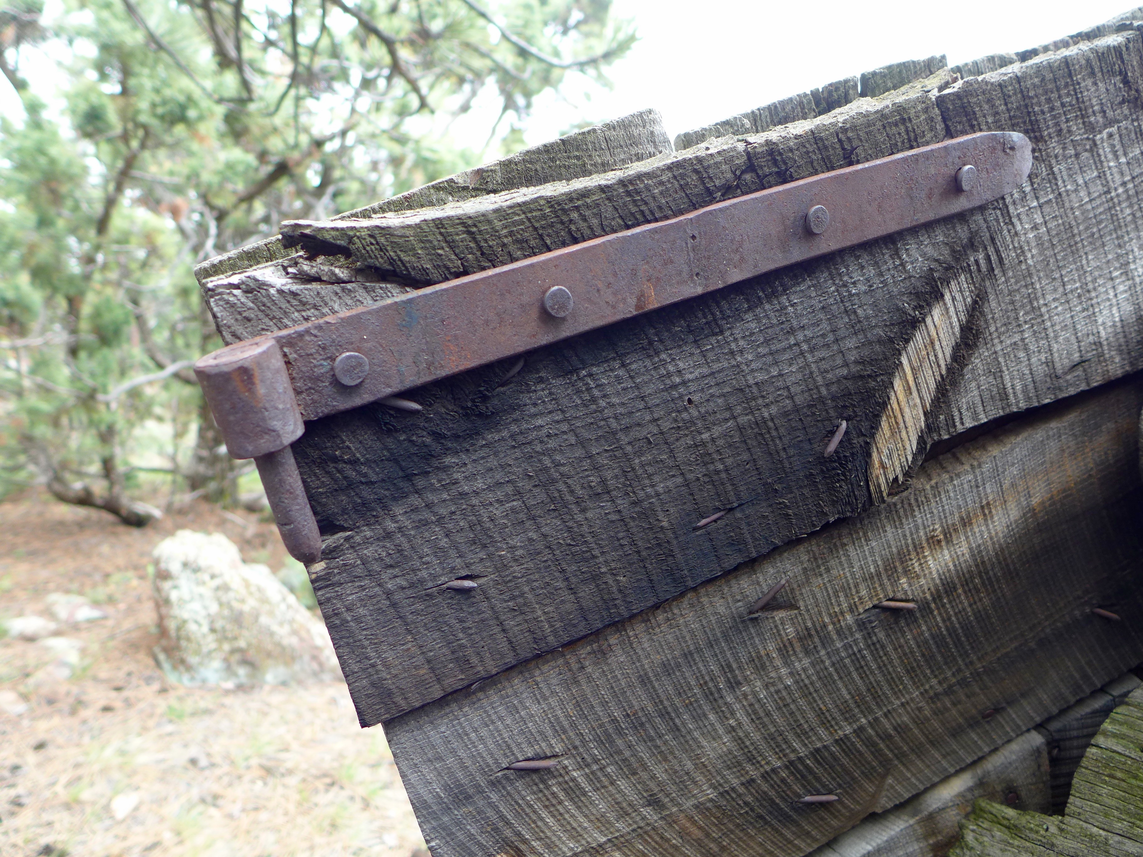
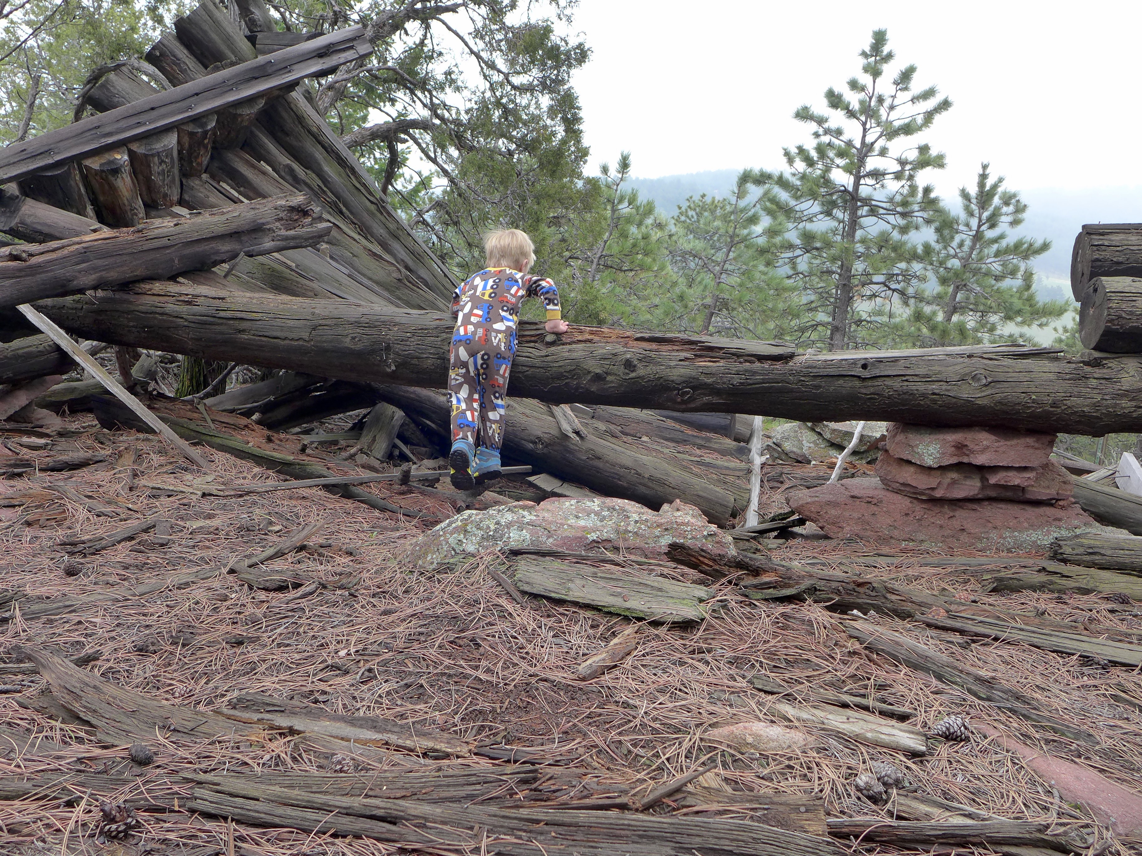
Every time I visit the cabin, I’m in awe of what it must have taken to trek all of the materials to that spot, and I’m also left with so many questions. Who was it? Why there? when did the cabin start to fall apart? It looks like such a quality piece of work, not a temporary shack. And it’s so cool that I wish I could freeze it in time, but I know that we just have to let nature take its course.
On this particular trip Alex came to the realization that “maybe this was a house!” and “maybe somebody lived here!”. It was amazing to watch his little brain grasp these big ideas, especially as he started to wonder what happened to the cabin, where did its floor go, etc. etc.
And in other news, little Luc started walking over the weekend! Soon the three of us will be taking that hike together.
And with that, I’m signing off to get back out in the garden. I’ve been working hard in that space and am so excited to share/document the work.
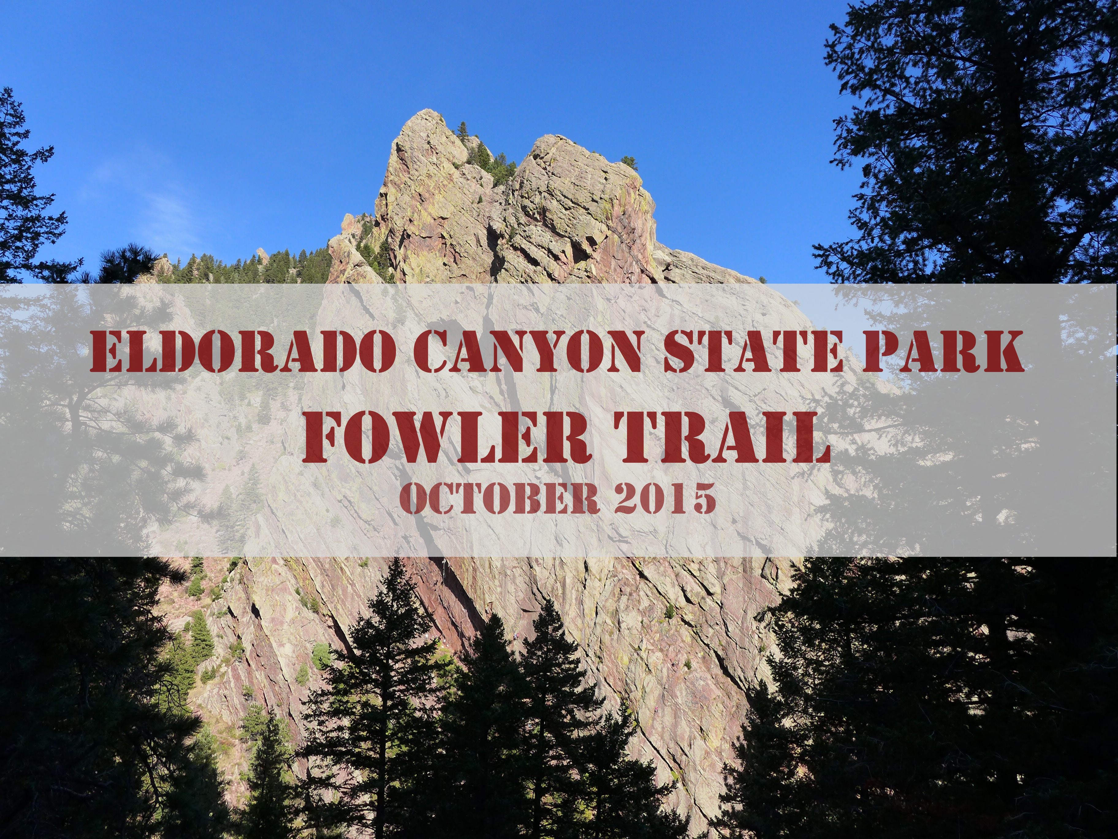
Last week a friend tipped us off to the awesomeness that is Eldorado Canyon State Park, in particular, Fowler Trail. As an active 2.5-year-old, Alex is really excited to get outside and do whatever we’re doing. Translating this to hiking, it means that he’s much happier walking along with us than riding in the backpack. Unfortunately, his little legs get tired fairly quickly, so I’m always on the hunt for trails that are not that steep or long. Fortunately, Fowler trail is both short* and relatively flat! As you’ll see in the photos, it also provides outstanding views of canyon walls filled with climbers, making it extra exciting for our little adventurer. One look at the climbers and he exclaimed, “wow, that’s wild!”.
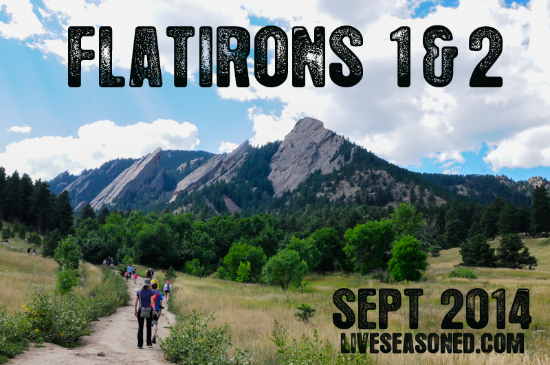
About a month ago, Katie, Jeff (our brother) and I hiked the Flatirons 1 & 2 trail. I’ve been meaning to write this post for some time since it was one of the most scenic hikes in Boulder, CO, so here goes:
The hike starts at the Chautauqua Park trailhead. Parking in the lot can be pretty tricky, especially on the weekends, but you can find additional parking on Baseline Road. That being said, the trail is extremely crowded. You won’t have the views to yourself, but hey, at least there is no chance of getting lost. After you find a parking spot, continue to the Chautauqua Park trailhead where the trail takes you through a lovely green meadow. (Note that if you’re hiking right after a rainstorm, it will be pretty muddy since the trail is basically a path for runoff water. ) The Chautauqua trail connects with the Flatirons 1&2 trail and the signage is very clear as is the flow of people flocking to the Flatirons 😉


Over the course of this relatively short hike (about 2.5 miles), you will climb 1,400 feet in elevation. Flatiron 1 is approximately 7,100 ft high, which makes for stunning views. As you hike up the trail, there are plenty of outcroppings that are perfect for taking a break and enjoying the vistas. The Flatiron trail is mainly switchbacks through thick forests of ponderosa pine that cut around enormous boulders. Along the way, there are also several rock climbing access points. Speaking of climbing, there is a very short section of the trail (about 15 feet) where you have to climb up a boulder. There are footholds and handholds worn into the rock making it easy for adults, but I wouldn’t recommend taking children on this hike. I would also turn back immediately if it starts to rain because the rocks will become slippery making a large portion of this trail fairly dangerous.


Once you finally wind up, up and up, the views are spectacular. There are clear views of the city of Boulder as well as amazing views of Flatiron 3, which is sure to have rock climbers scrambling up it. The top of the trail is a perfect spot to stop and have a snack or a picnic, but remember to hike all your waste out with you, even banana peels! The top of the trail is like an adult jungle gym. You’ll see folks in all different nooks and crannies. It goes without saying that you should be careful when you’re climbing from boulder to boulder, don’t knock into any rocks that may fall and injure someone at a lower elevation. After you’ve climbed your heart out and took a bajillion pictures, it’s time to make your way down the ridge. Be mindful of other hikers who are still making their way up and if they look like they need encouraging remind them that they’re almost there!


Geology Rocks! I say that far too often, but I just can’t resist. Here’s a quick rundown of some geological properties of the flatirons. I’m going to give some definitions in case you slept through your geology lab class.


Before of after your hike, be sure to stop by the historic ranger cottage near the parking lot – you can’t miss it. It has a wealth of information, free maps and dozens of stuffed birds and mammals. I really enjoyed the station because I gained a better sense of what animals were sharing the forest with me. It’s especially cool to see the animals you have very little chance of seeing in the wild like mountain lions, coyotes, and bobcats. If you want a little snack, continue past the ranger station for about a block and you’ll see a little refreshment cottage with homemade hard ice cream and just about everything else.
After the hike and the ice cream, you should probably treat yourself to an afternoon snooze! Happy hiking!