
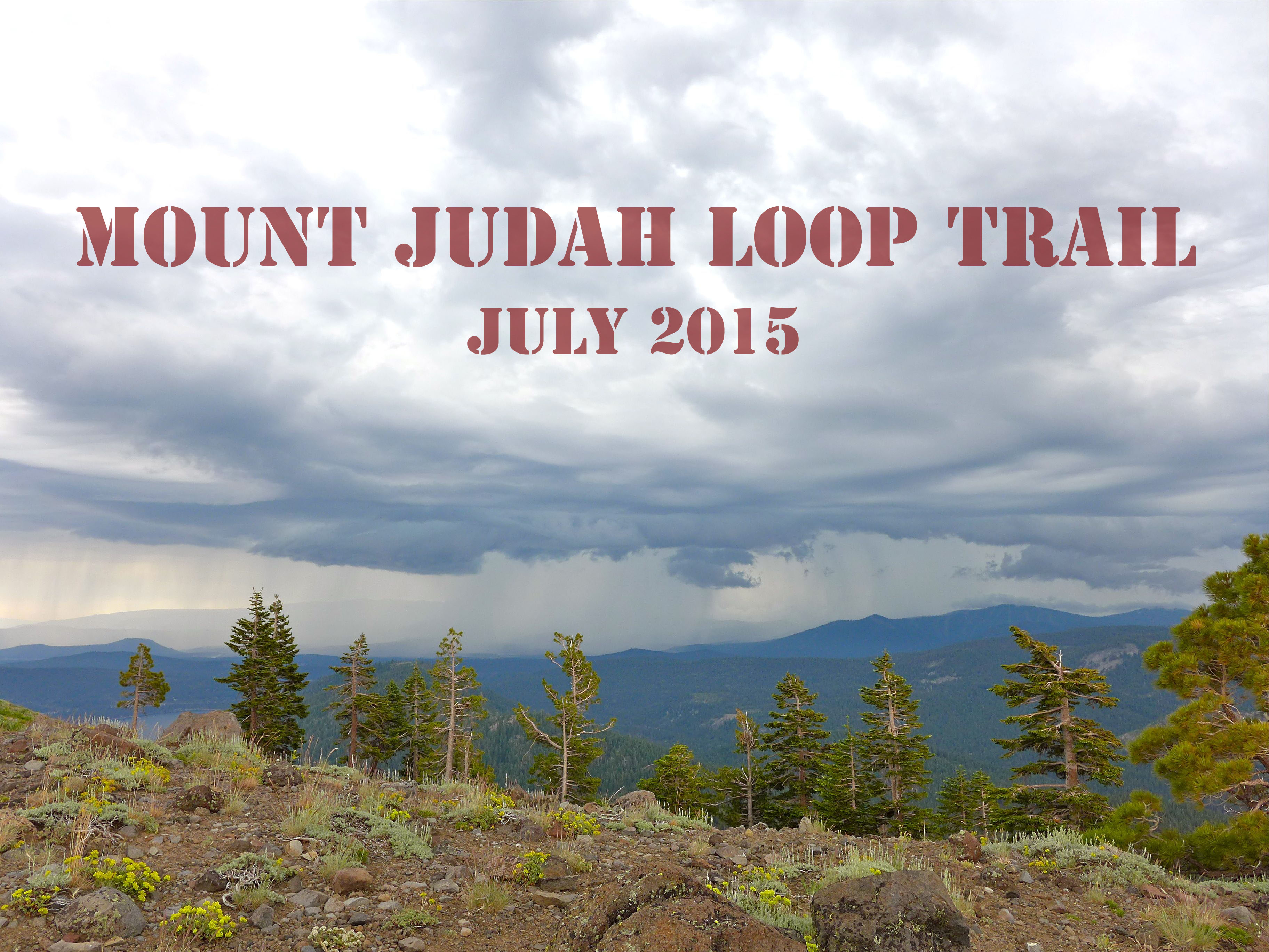
We like a good hike, and every once in a while we have the chance to hike slow, take pictures, and share the adventure with you. This is our first hike in California, but you can check out some of our previous Colorado hikes here.
Trail Location:
We found this particular hike in a book of trails that was in the house, but you can easily find information about it here and here. The trail is in the Northern Sierras, near Truckee, CA, and it’s just 4 miles from the Soda Springs exit on Route 80. It’s proximity to the highway makes it an easy and worthwhile stop if you’re on a road trip. There is ample parking in the lot next to the Sugar Bowl Academy (we visited in summer, I’m not sure if the parking situation changes when school is in session). From there, you have to take a short walk down the side road to get to the trailhead. You could also drive down that road and park at the trailhead, but I’m not sure how crowded that area gets on the weekend.
Trail Overview :
The total distance for this hike is about 4.5 miles. You begin on the Pacific Coast Trail, hiking towards the Sugar Bowl Ski Resort, and on one of the runs is where you’ll bump into the Mount Judah Trail. You could take a left there and head up the trail, but we continued on the PCT and took the second intersection with the Mount Judah trail (there are only two points of intersection). Whichever way you connect to Mount Judah, you’ll end up hiking the one initial PCT section both in and out to the parking area.
This hike is marked as moderate in the trail guides, and I would agree. The most difficult portion is the initial (and final) ascent (decent) on the PCT. The terrain is rocky, the trail relatively narrow, and the incline steep, but after those switchbacks, the rest of the trail is much less rocky with a more gradual climb. The trail covers a total elevation gain of about 1000 ft.
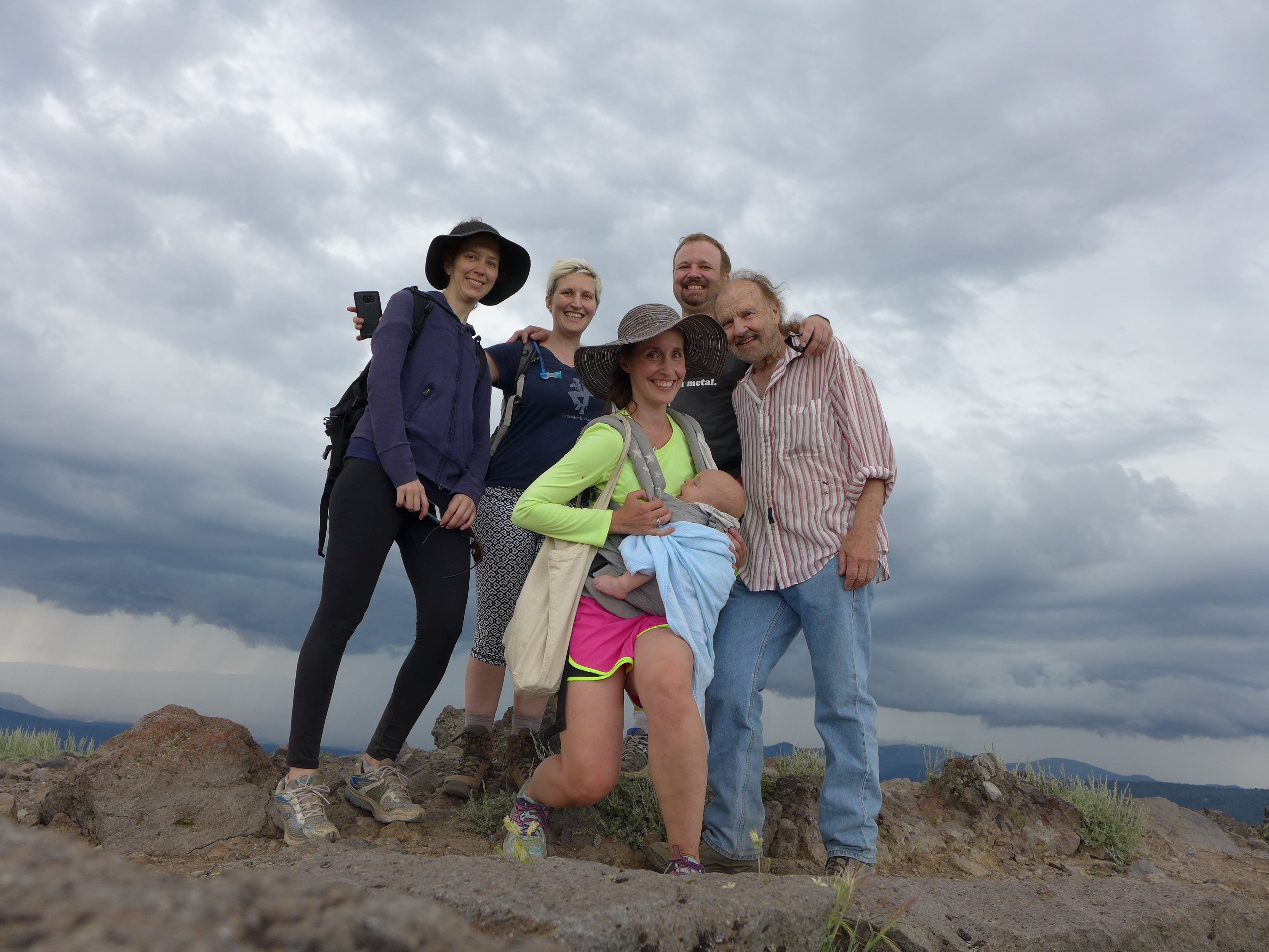
Side note : someone in our group was concerned about going on this hike with a bum knee, then Calder’s sister reminded them that they would be hiking with a septuagenarian, a pregnant lady, and a lady with a baby… if our rag-tag bunch could handle this hike, then most readers probably can too!
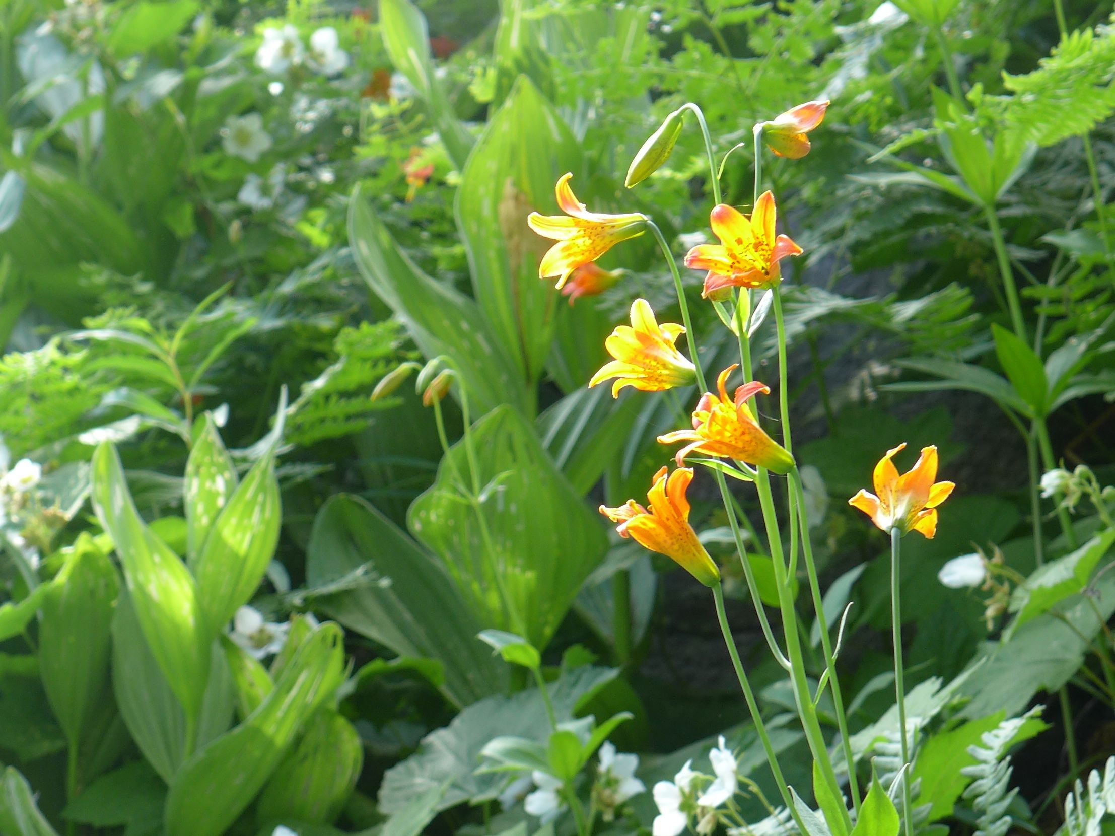
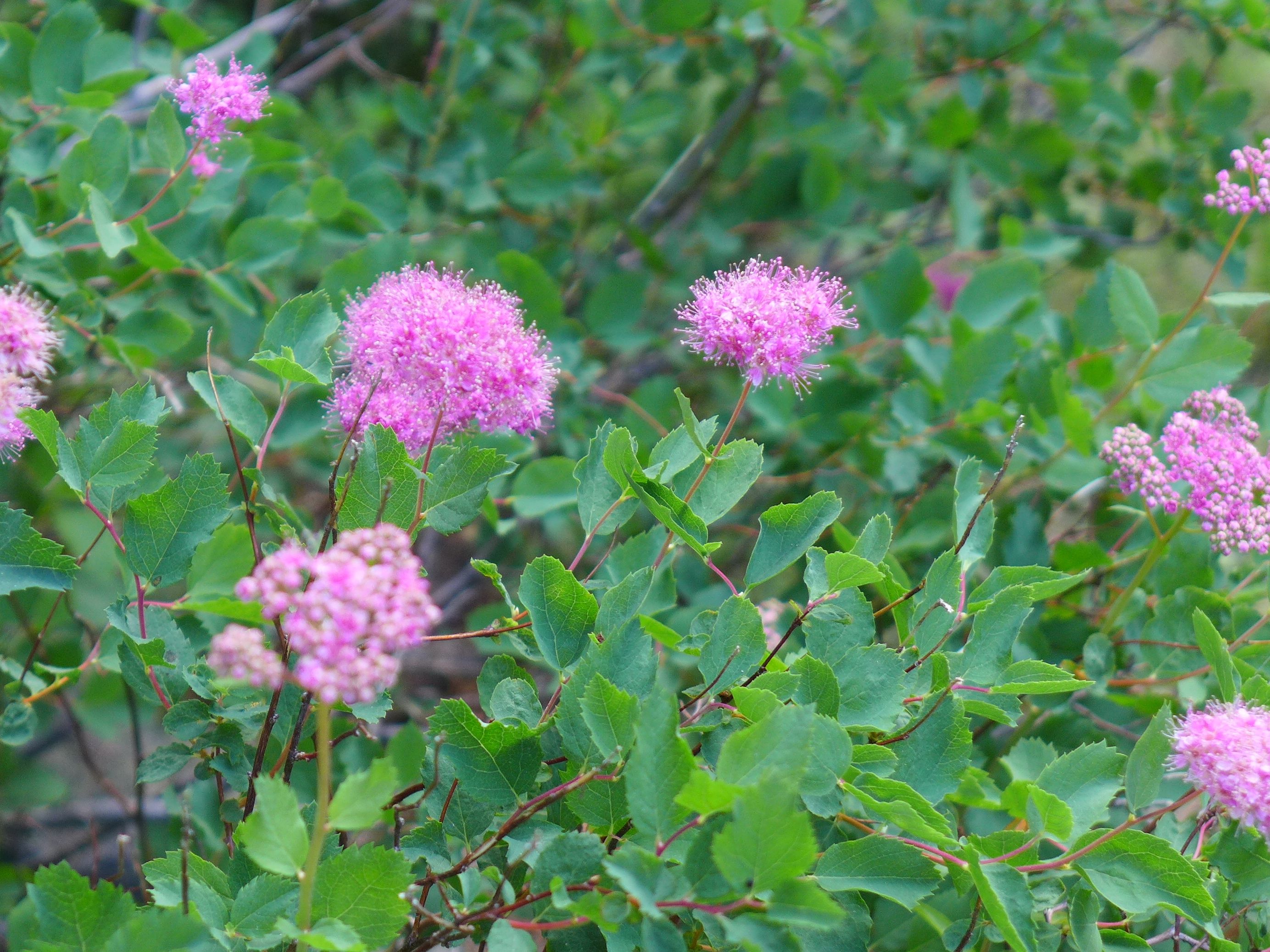
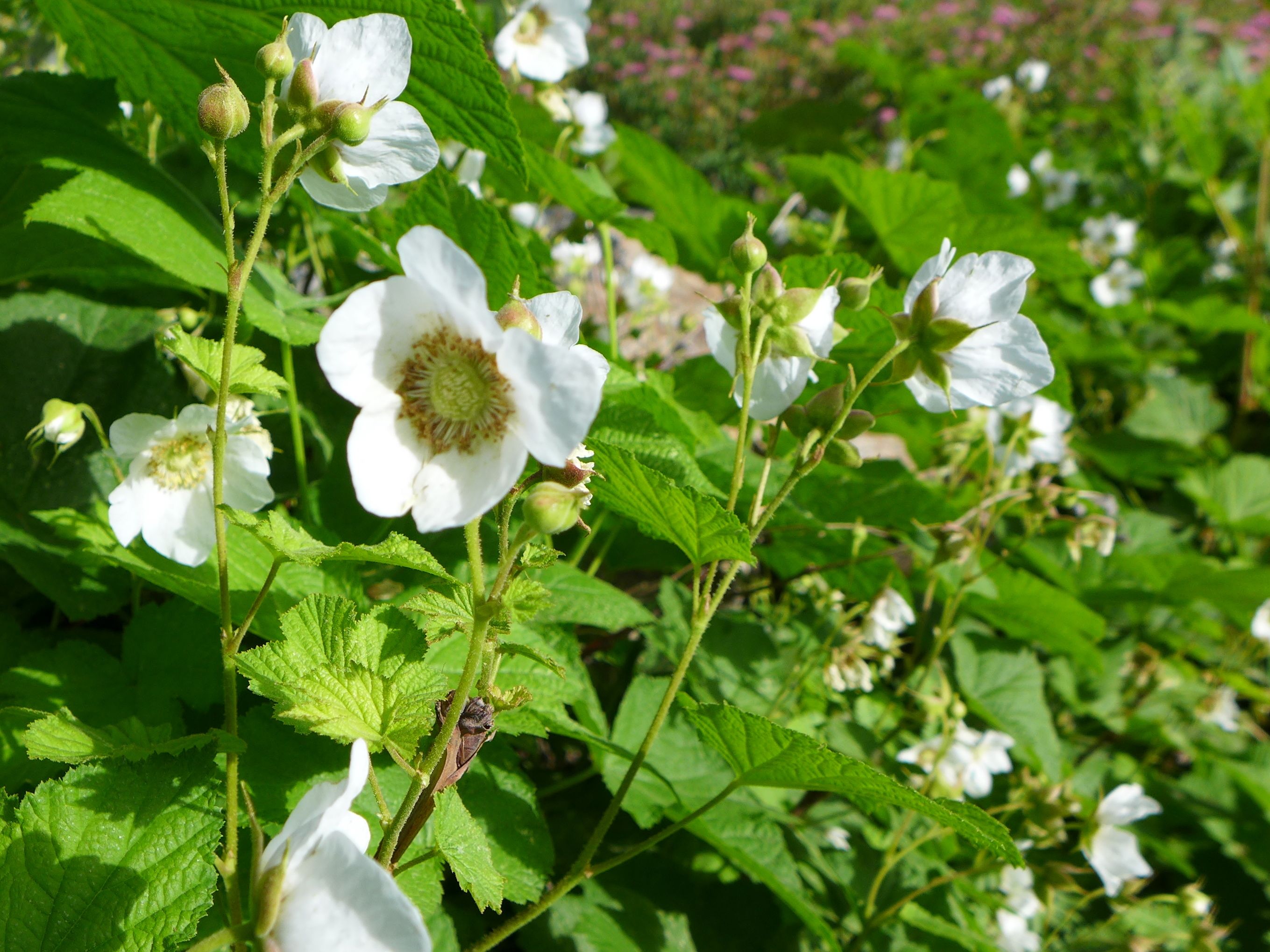
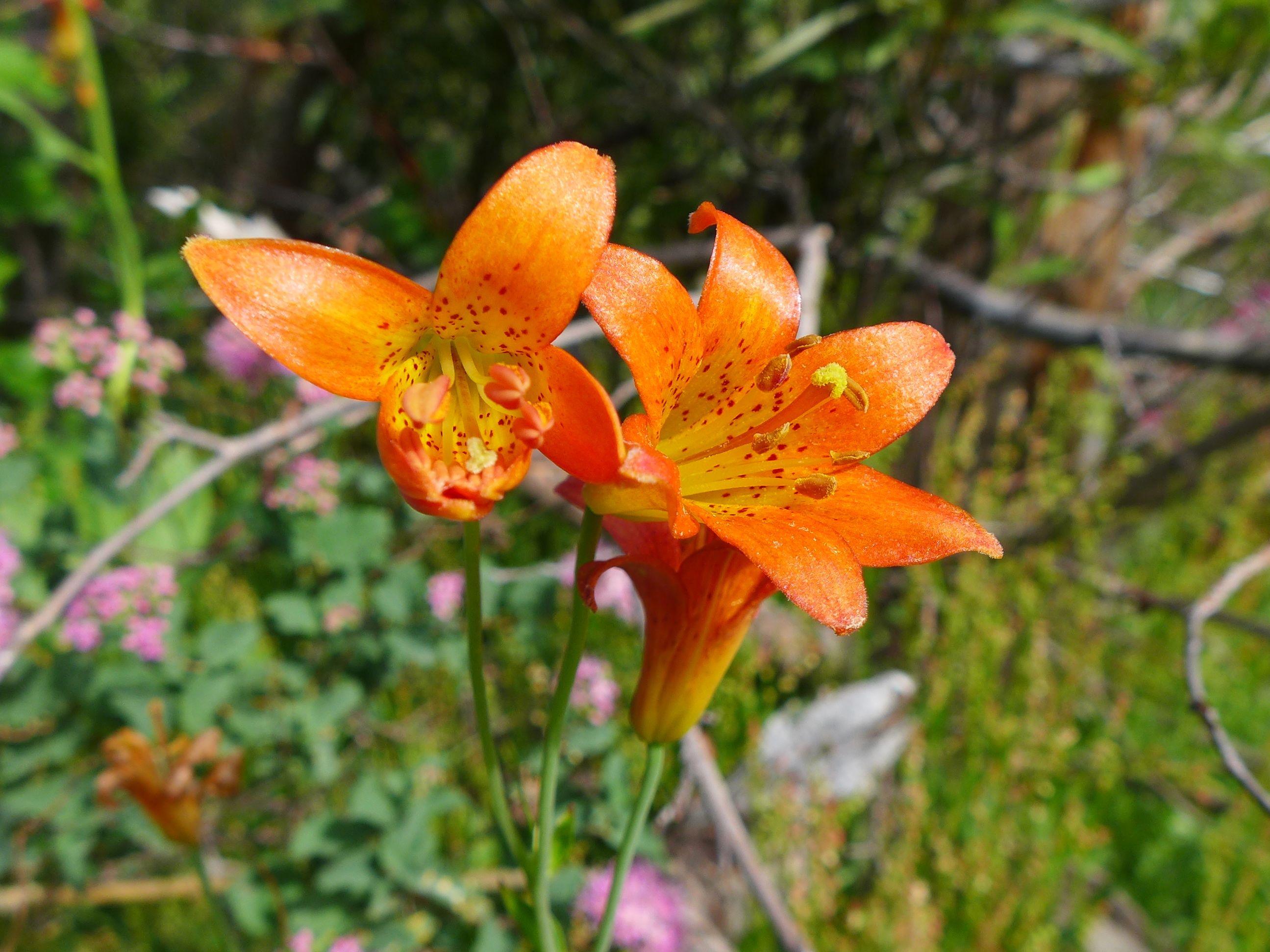
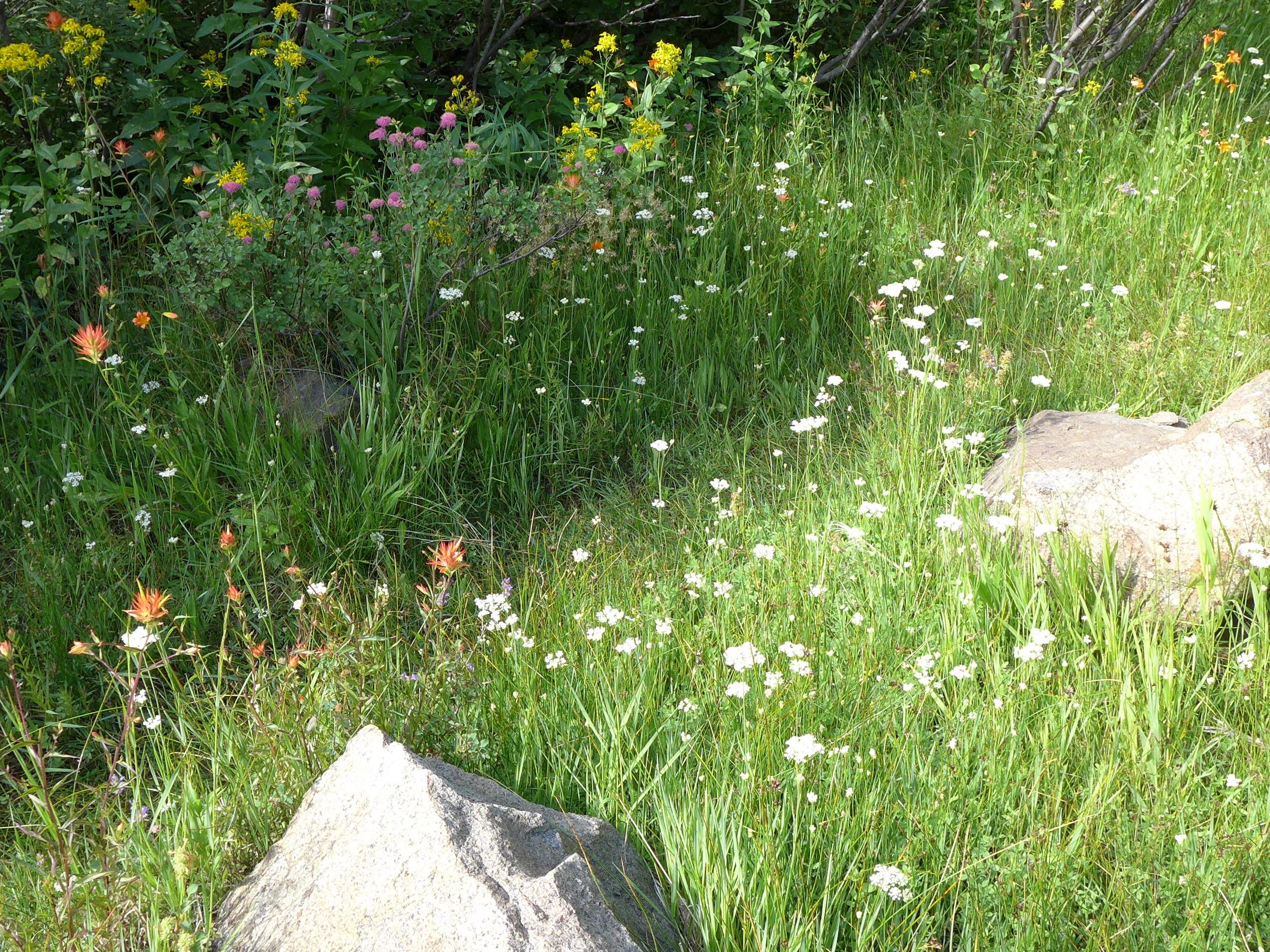
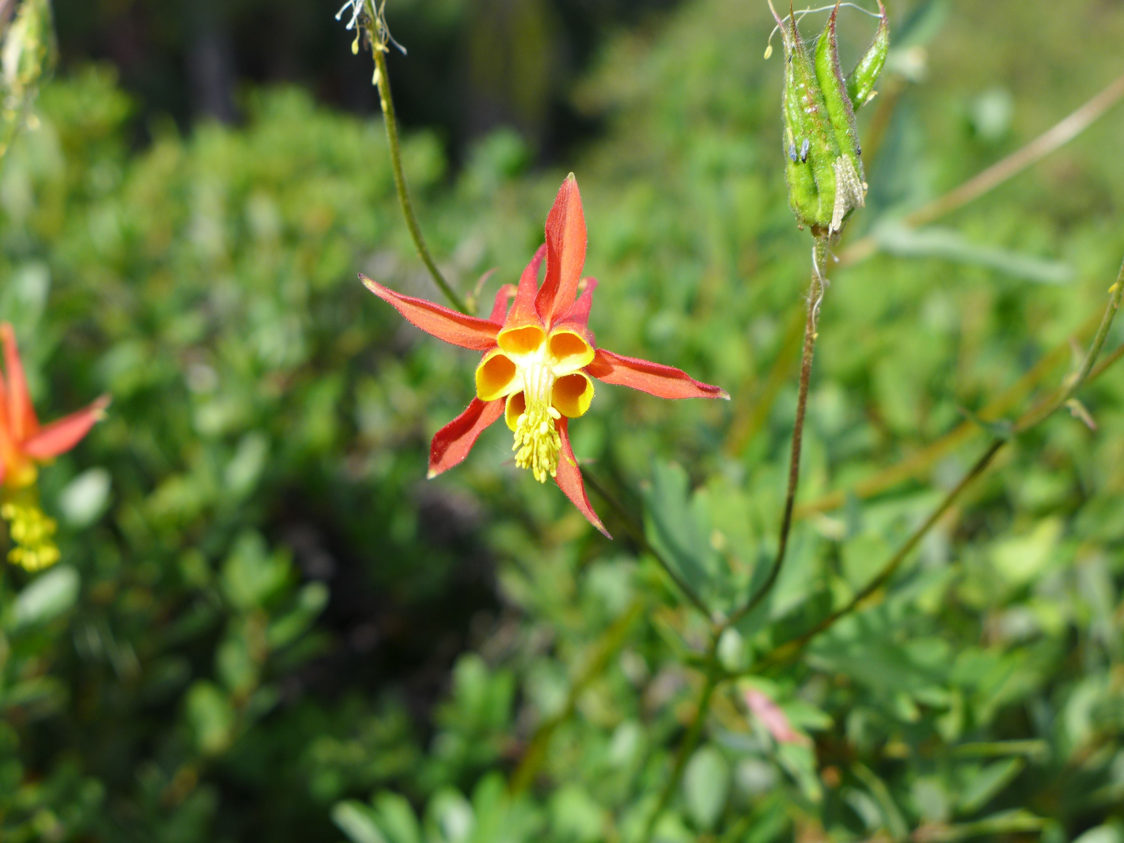
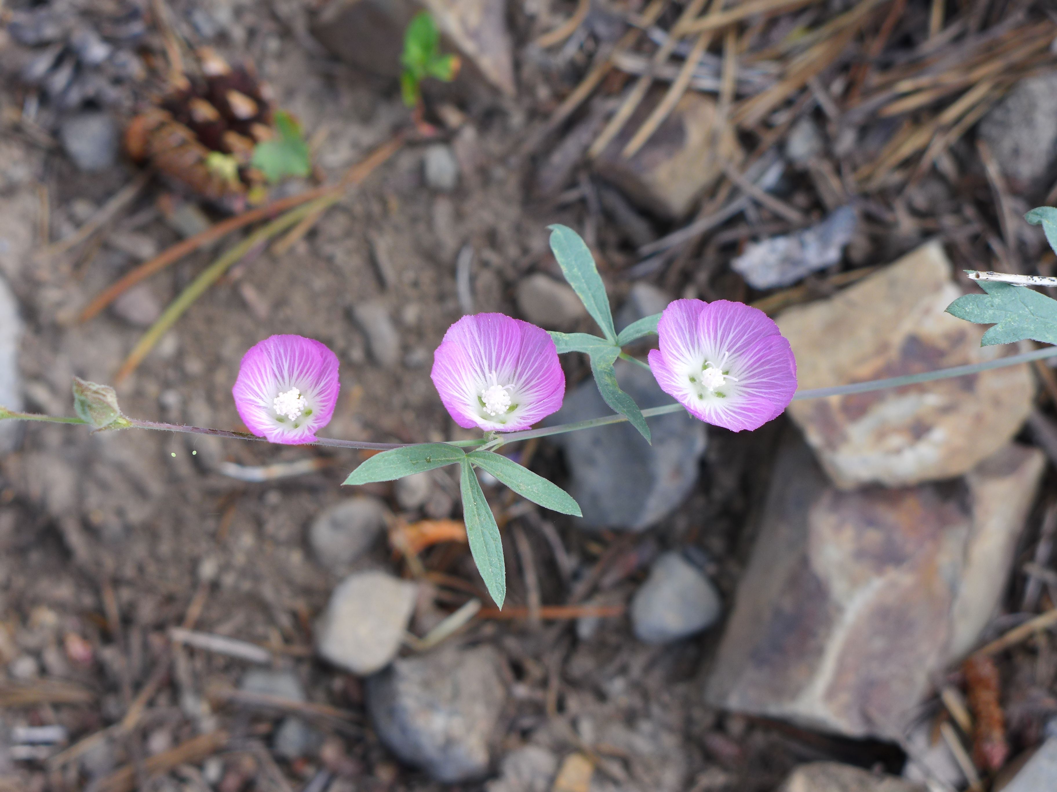
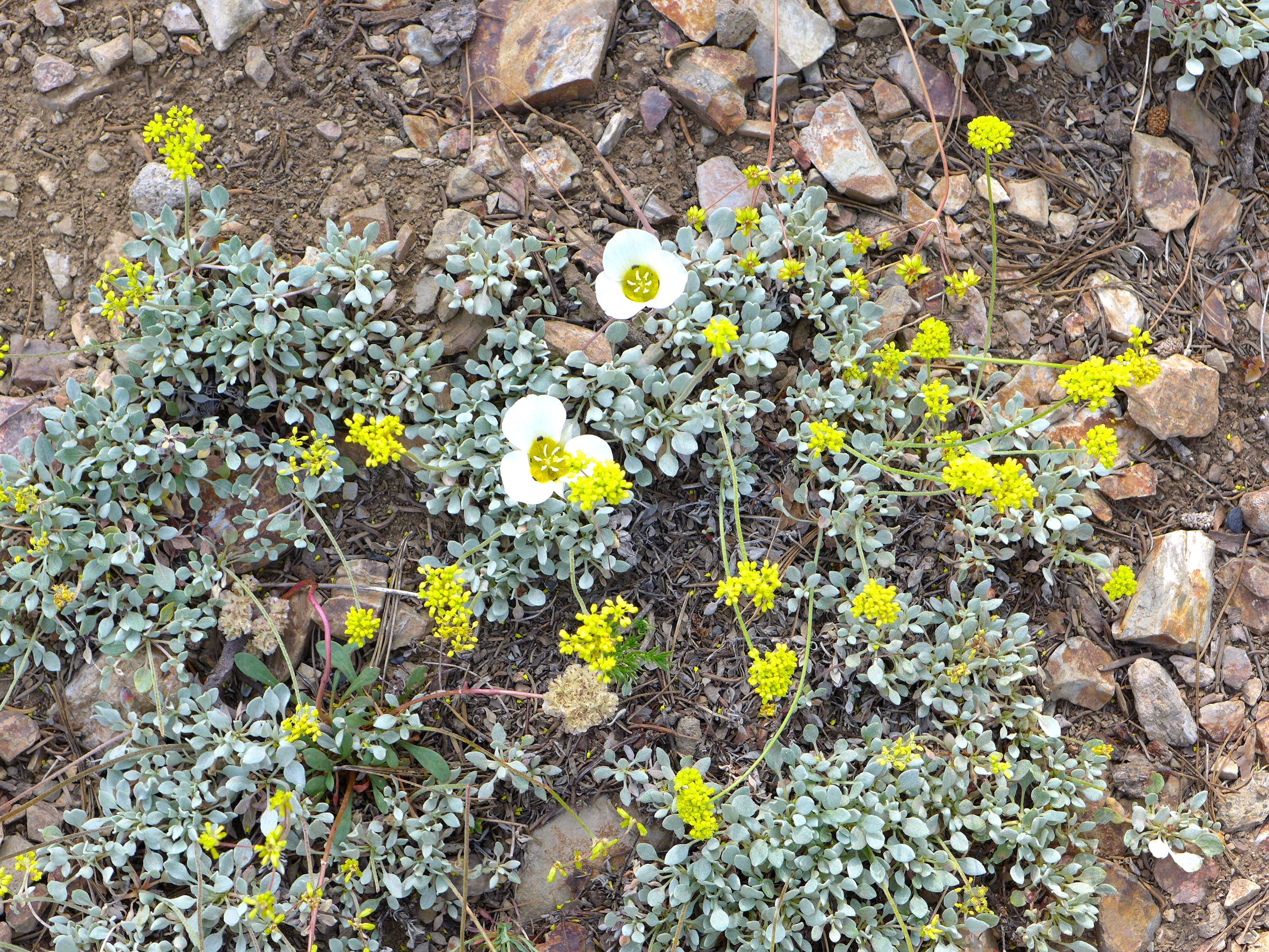
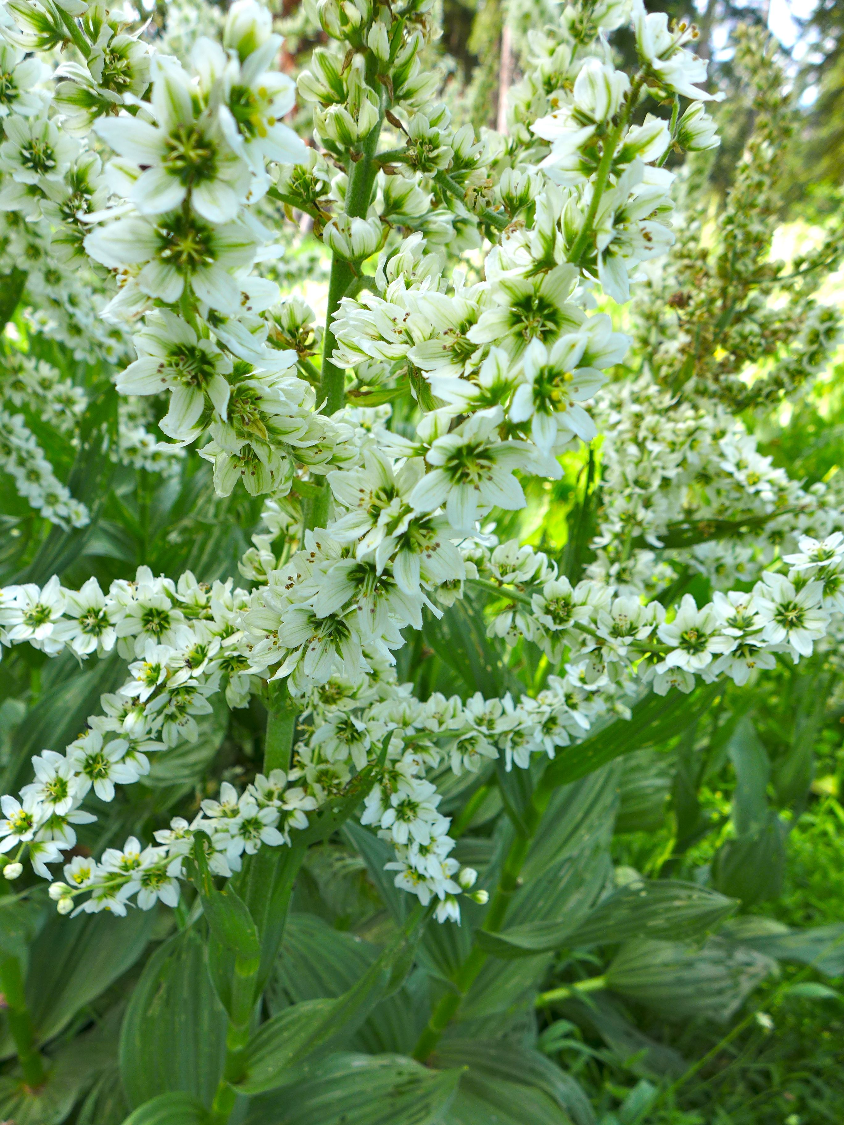
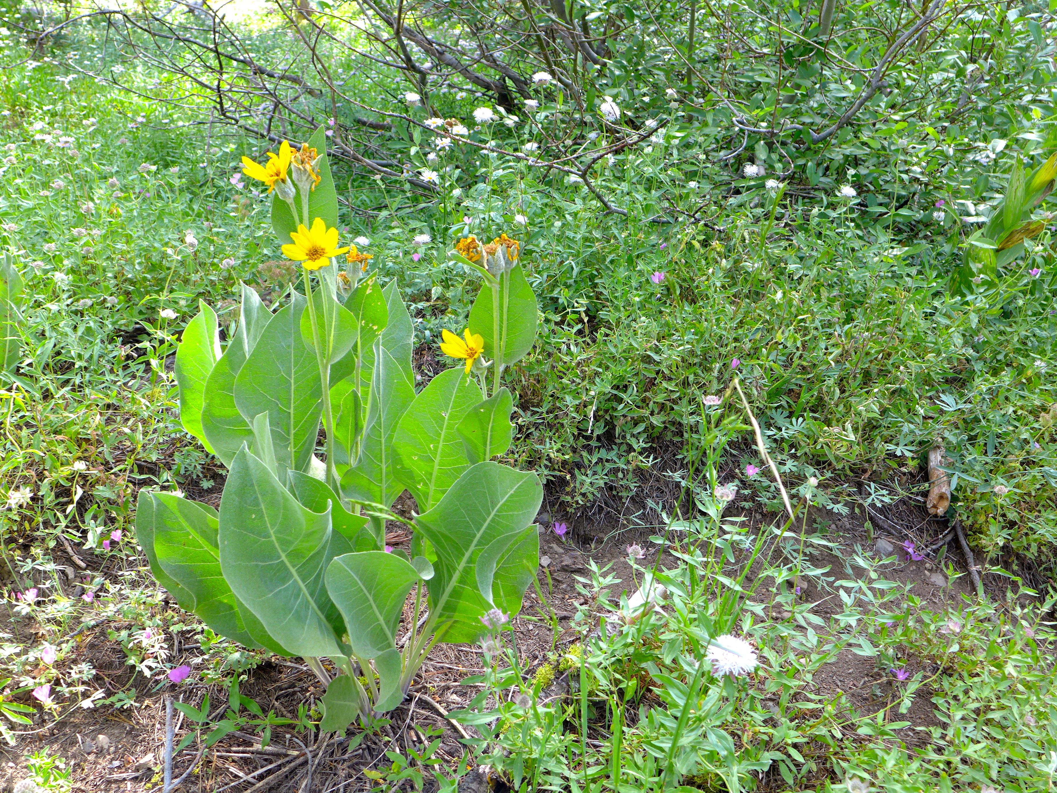
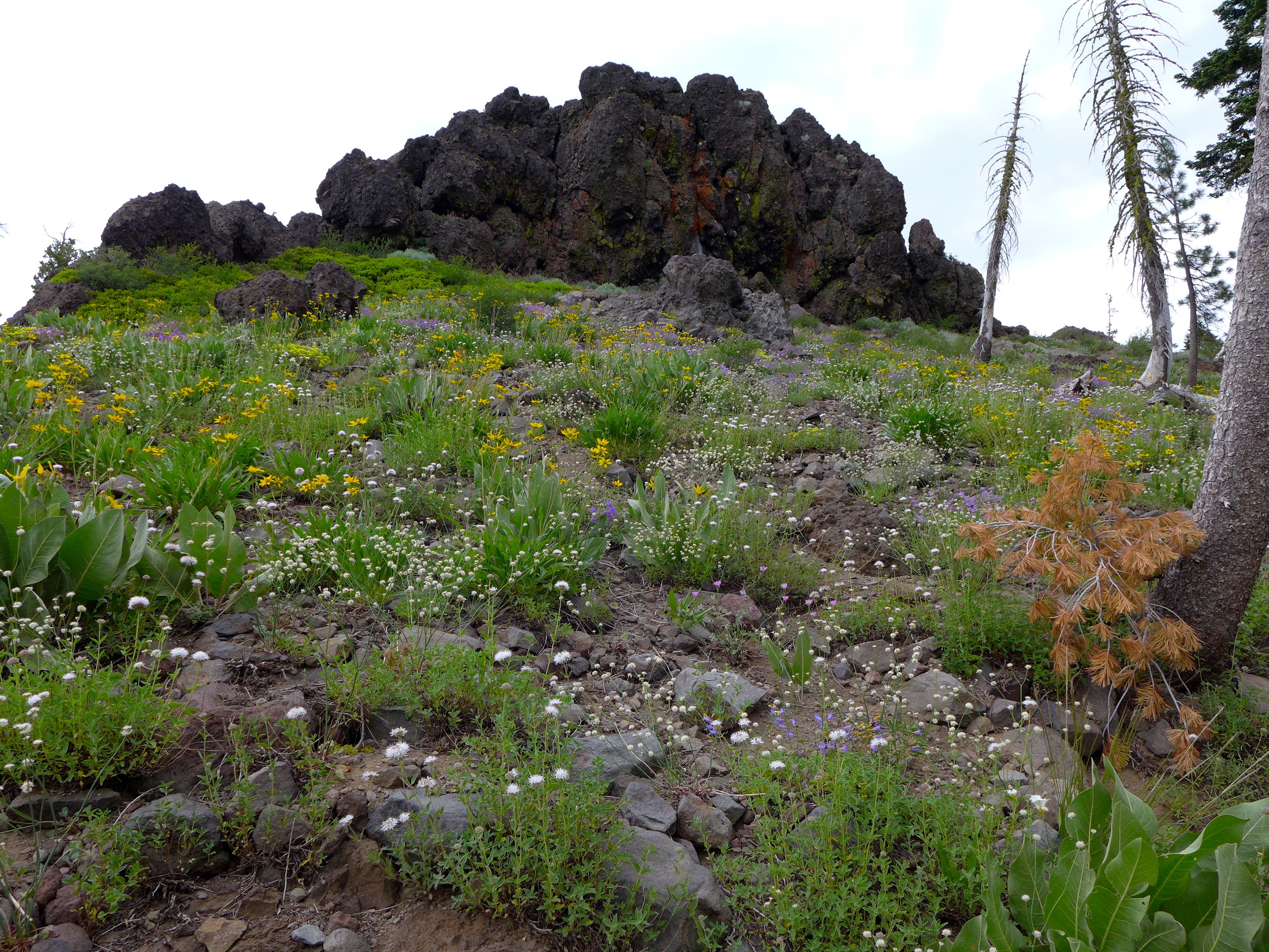
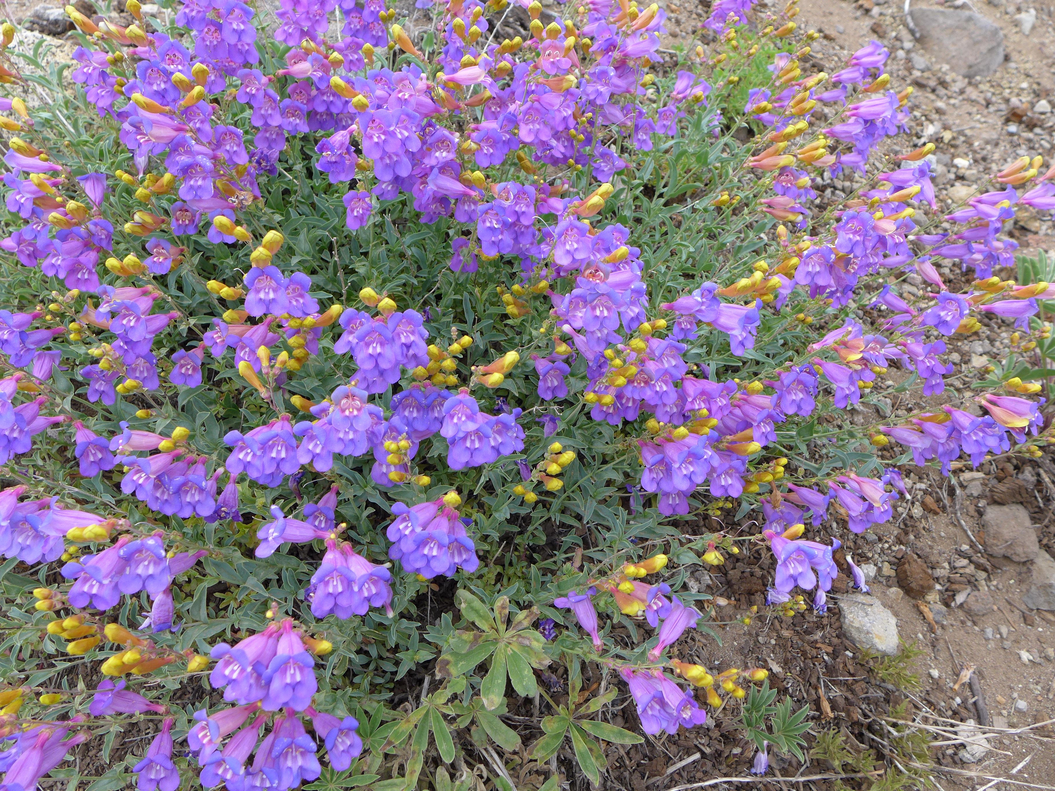
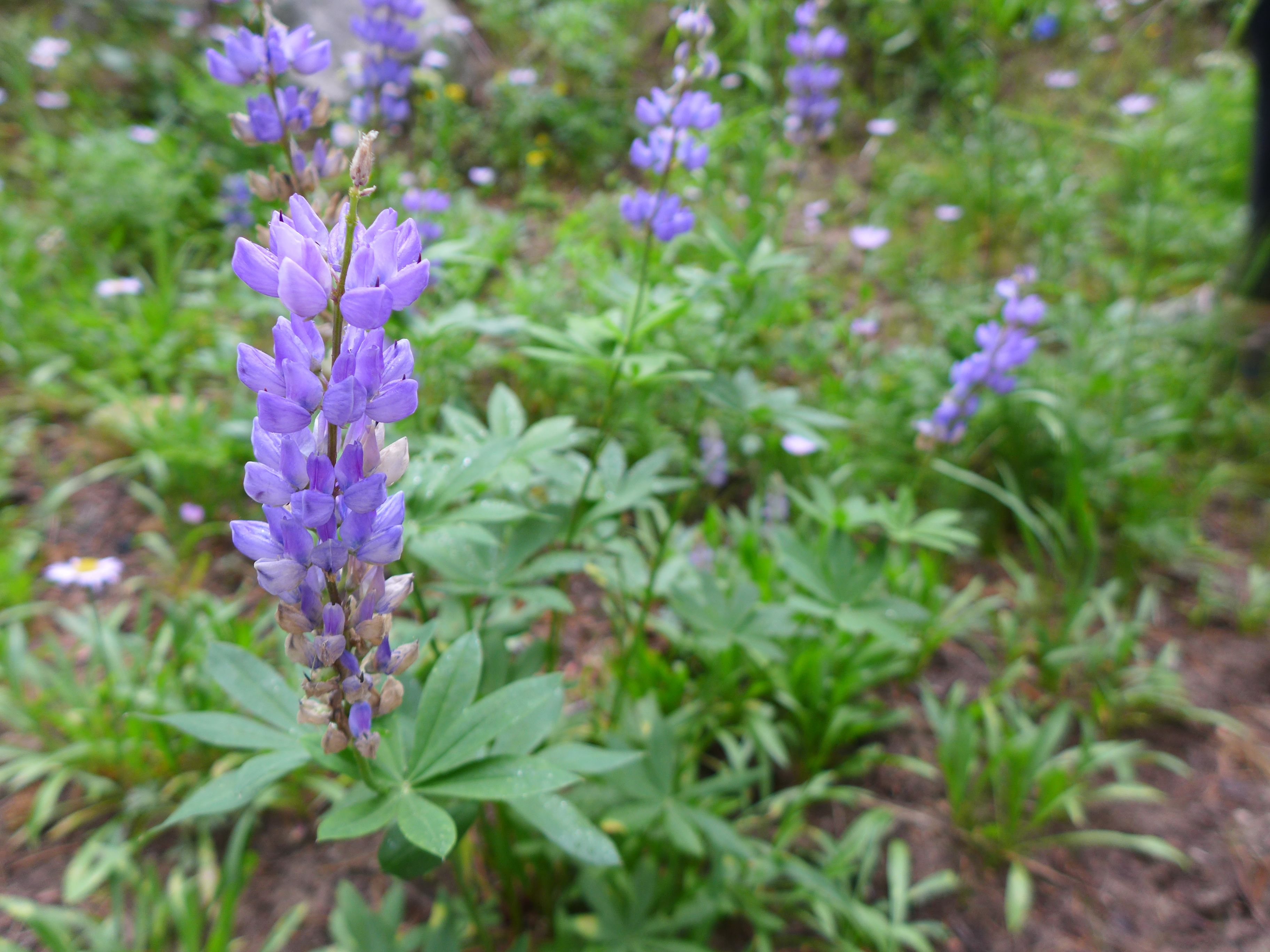
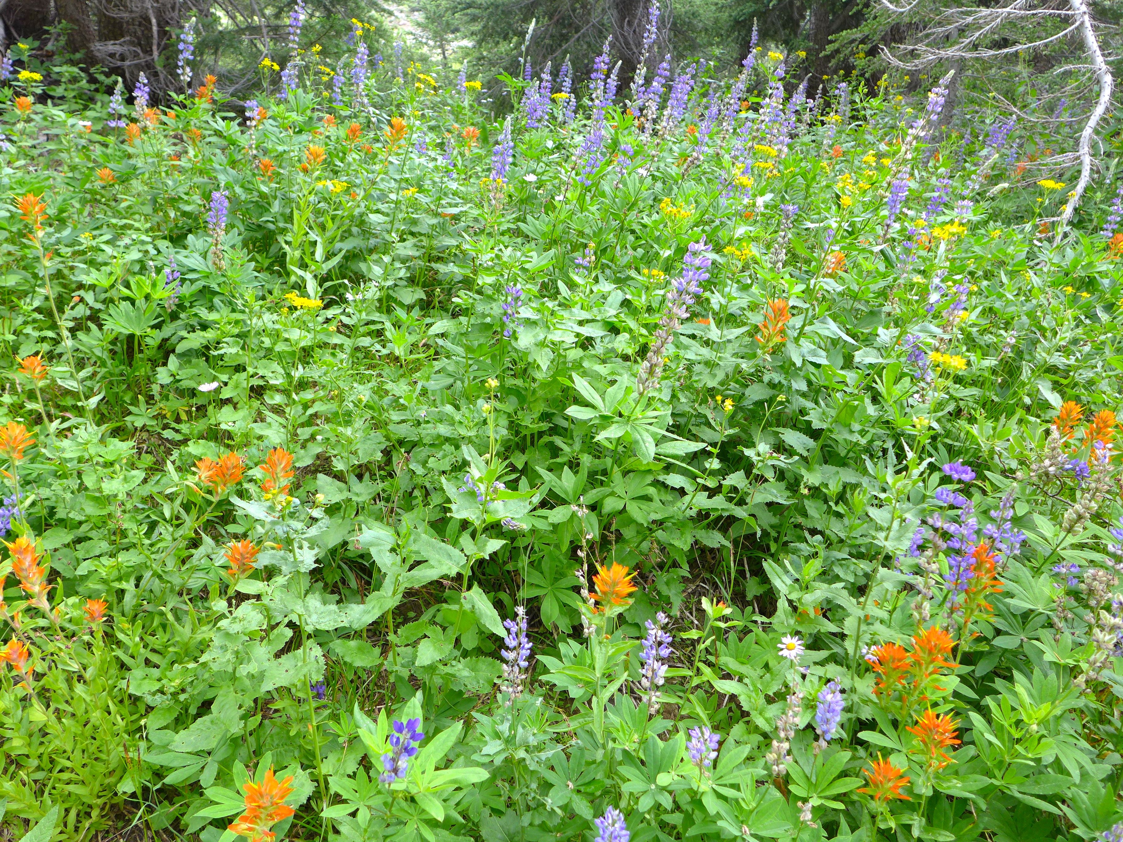
The Wildflowers :
Everyone agreed that the wildflowers were particularly striking this summer. It seemed like everything was blooming at once. There were wildflowers in every direction. I photographed many as we hiked, but still haven’t had the time to ID them (any and all help is appreciated!).
The Views :
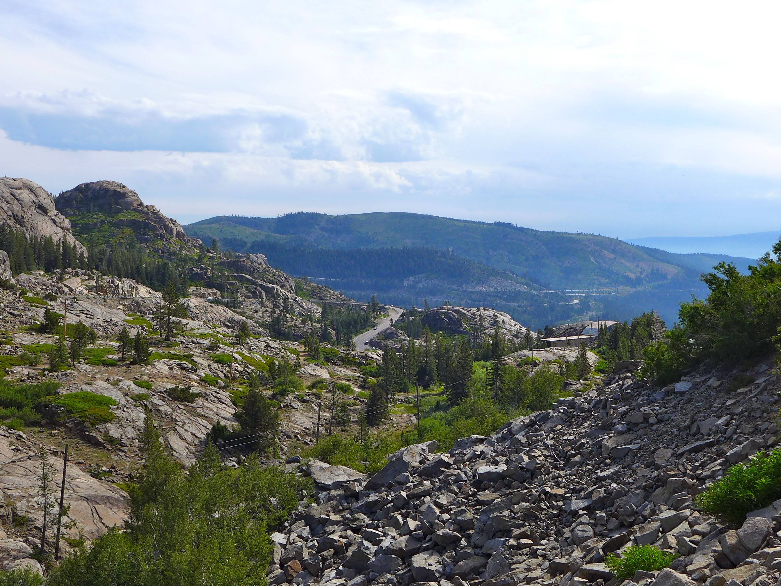
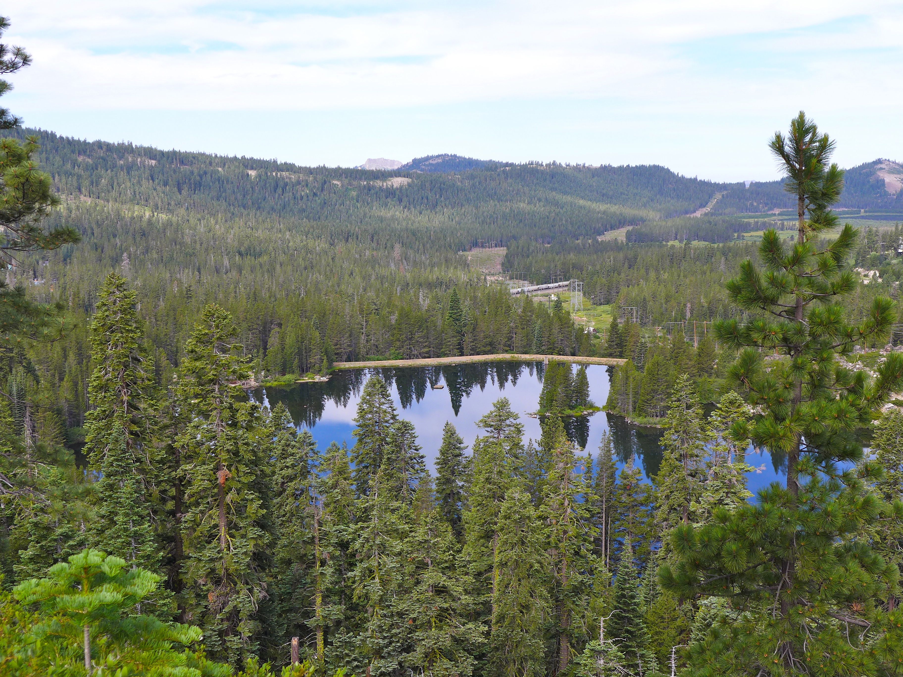
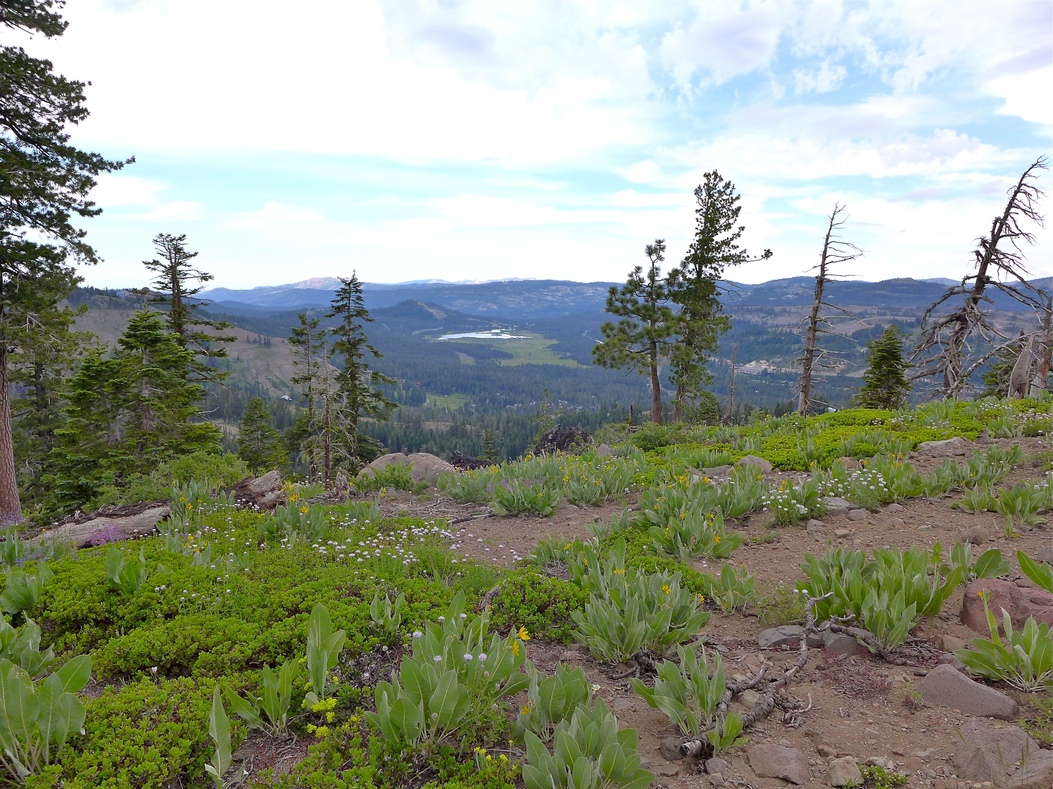
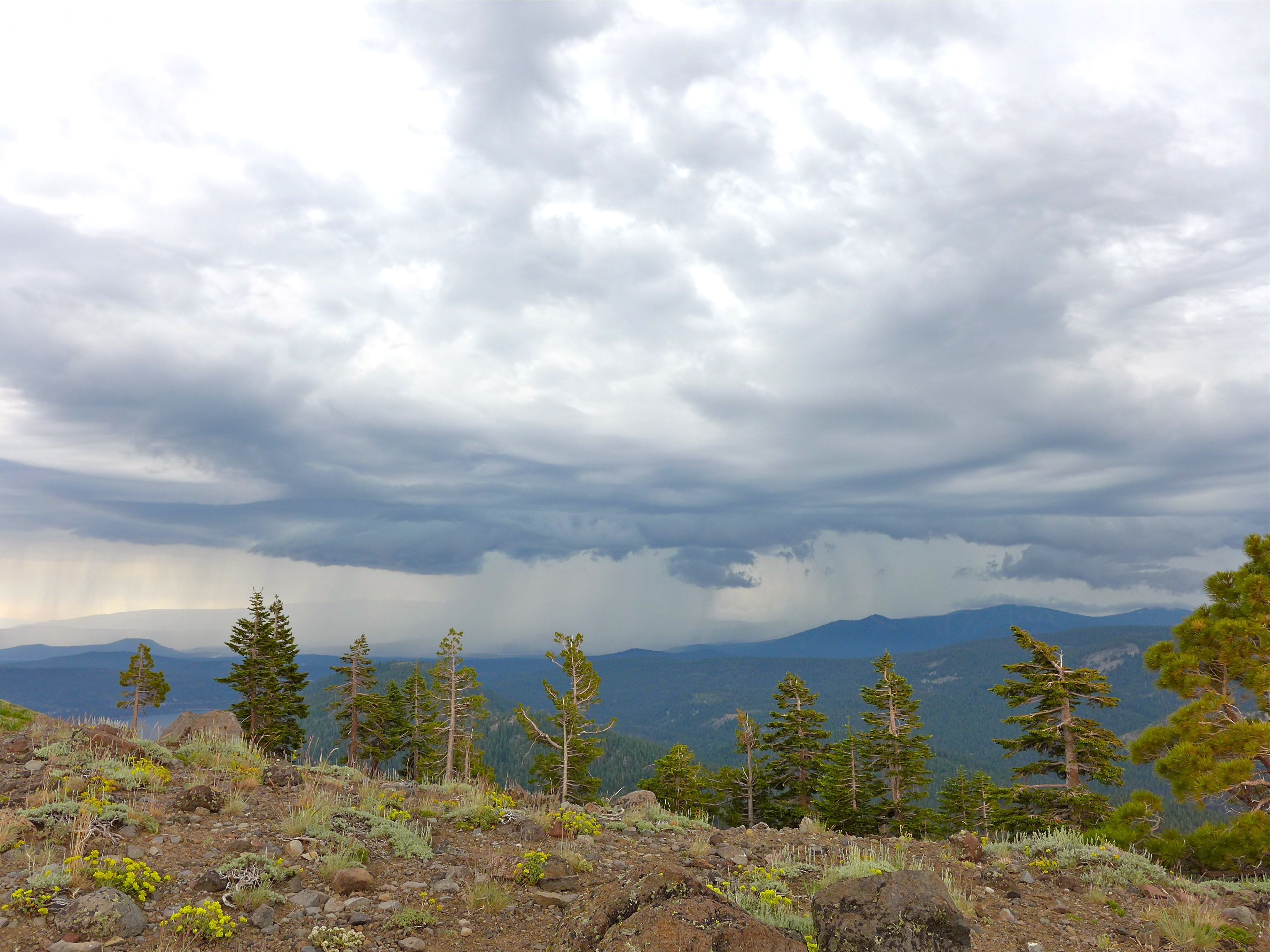
I mentioned above that this hike is perfect if you’re on a road trip and have the time, particularly because of the amazing views. Rather than just driving by Donner Summit on Rt 80, you’ll give a more spectacular view from above (as seen in the first photo above). You’ll also see a few alpine lakes, and if you’re lucky, you may even see and hear a train pass by (look closely at second photo above). When at the first intersection of the PCT and Mount Judah Trails on the Sugar Bowl, you’re actually standing on top of the train tunnel, but you would never know it!
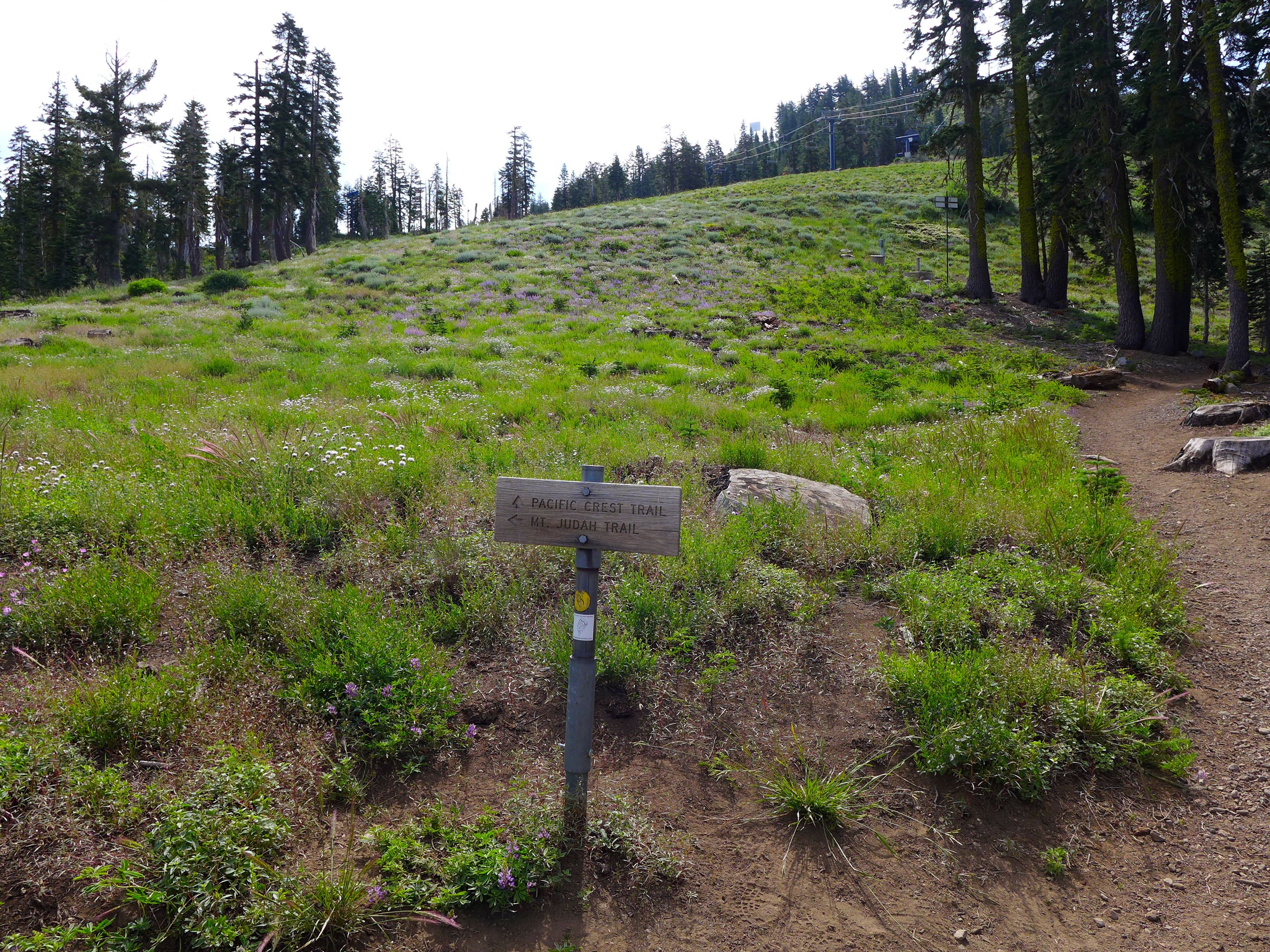
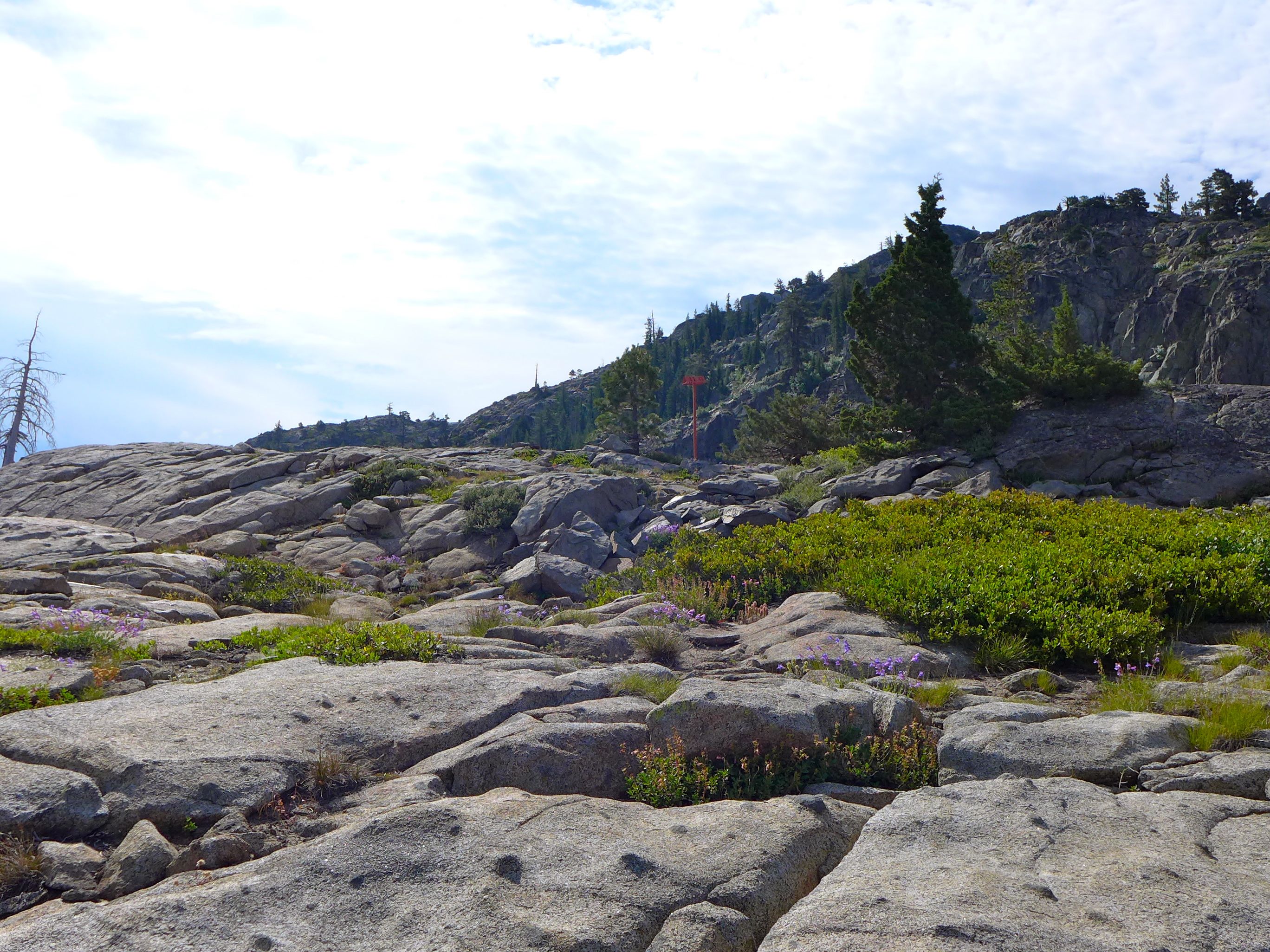
Signage :
The sign above is position at the first intersection between the two trails. We continued on the PCT to the right, and came back to this point via the Mount Judah Trail from the left. The second intersection between the two trails is not as clearly marked, but, as far as we could tell, it was the very next intersection on the PCT, so there shouldn’t be much confusion.
Trail Traffic :
We hiked the trail on the 4th of July, and it was packed! There were many casual hikers like us, as well as a number of people out for a trail run. Whenever possible, we would try to get off the trail for the runners, but at points that could be difficult, fortunately everyone was happy to be out sharing the trail. We also bumped into a few hikers that were a thousand or so miles in to hiking the full PCT. I was jealous!… but I was also so happy to get back to the hot tub after our measly four mile hike.
The Geography :
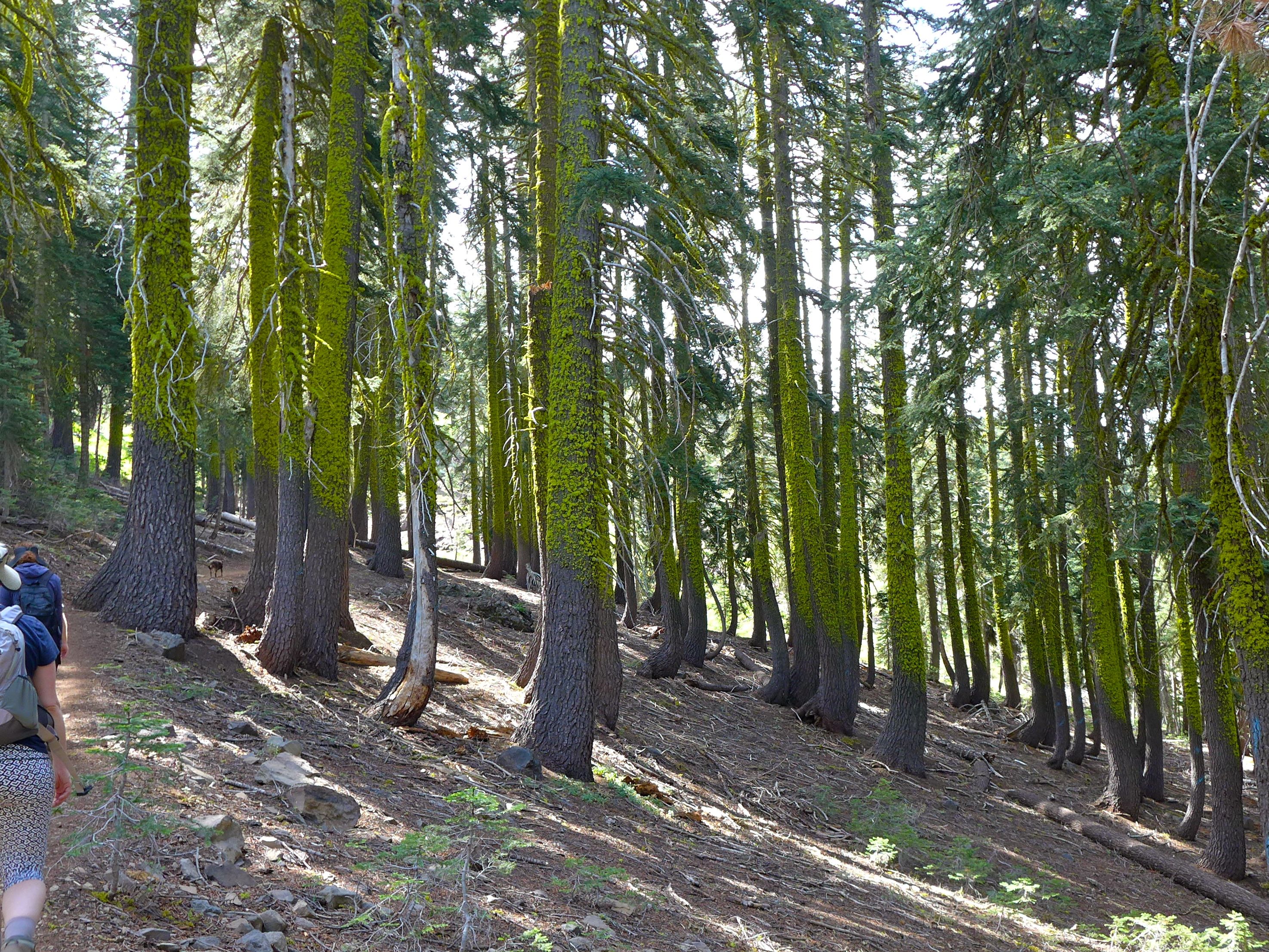
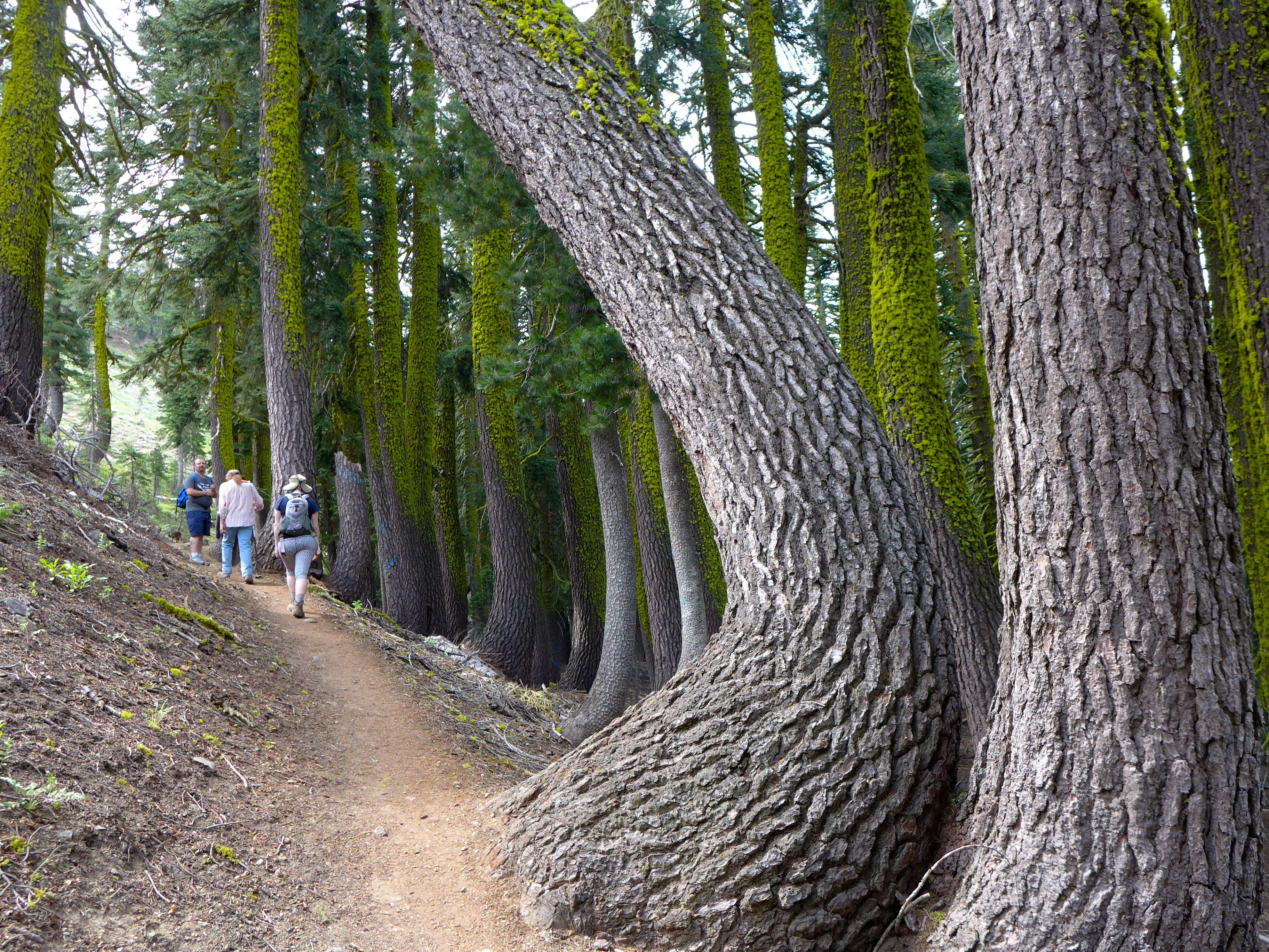
At the start of this hike, you’re climbing over exposed rocks and drier terrain. As you climb up into the mount, you enter the pine forests, where the ground is softer and the air cooler. You also see an obvious change in vegetation, there are fewer wildflowers under the trees, but plenty of beautiful moss growing on the rough bark. Did you notice how the lower edge of the moss is consistent across the forest? We think it’s related to the average level of the snowpack. What do you think?
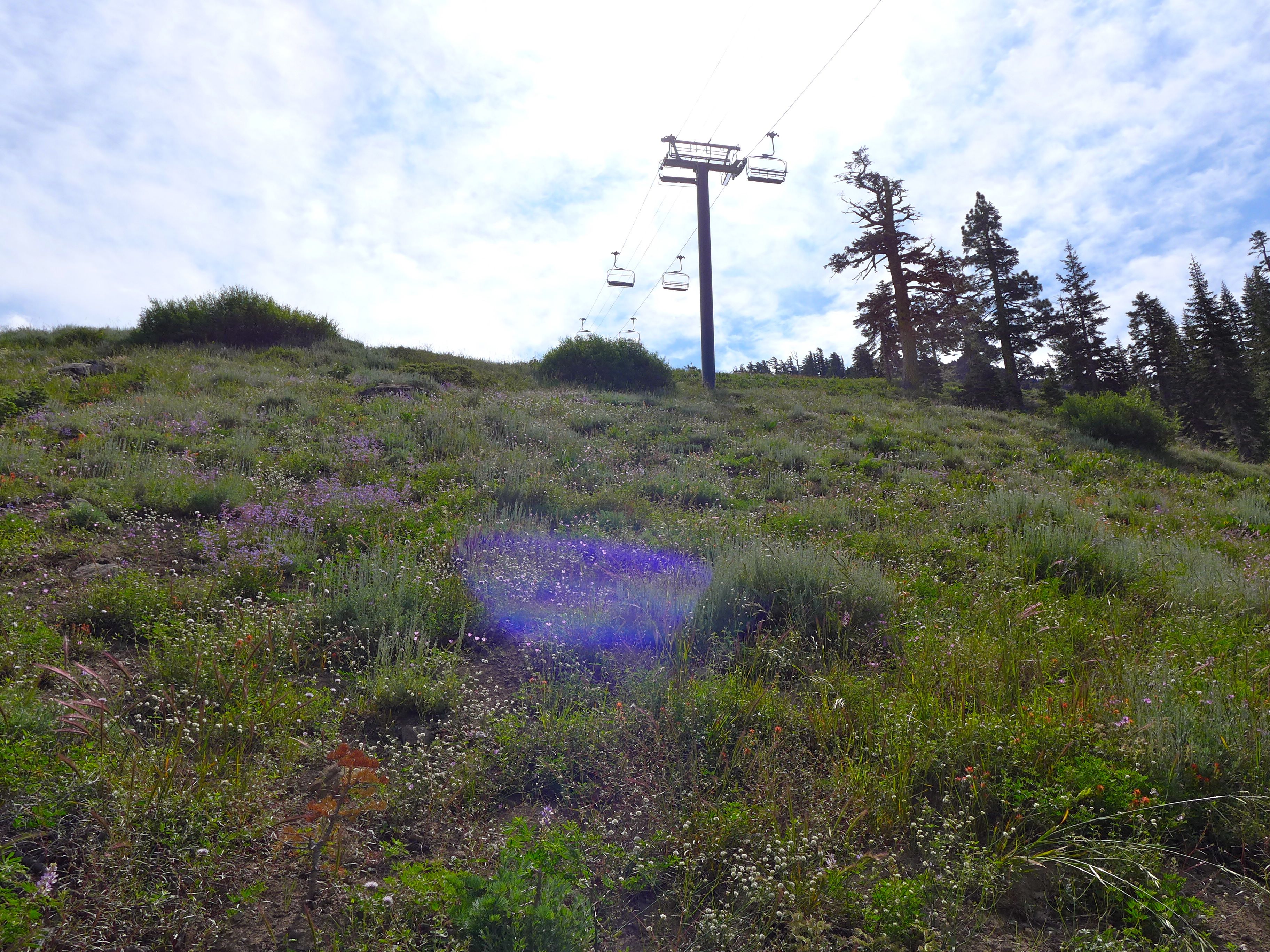
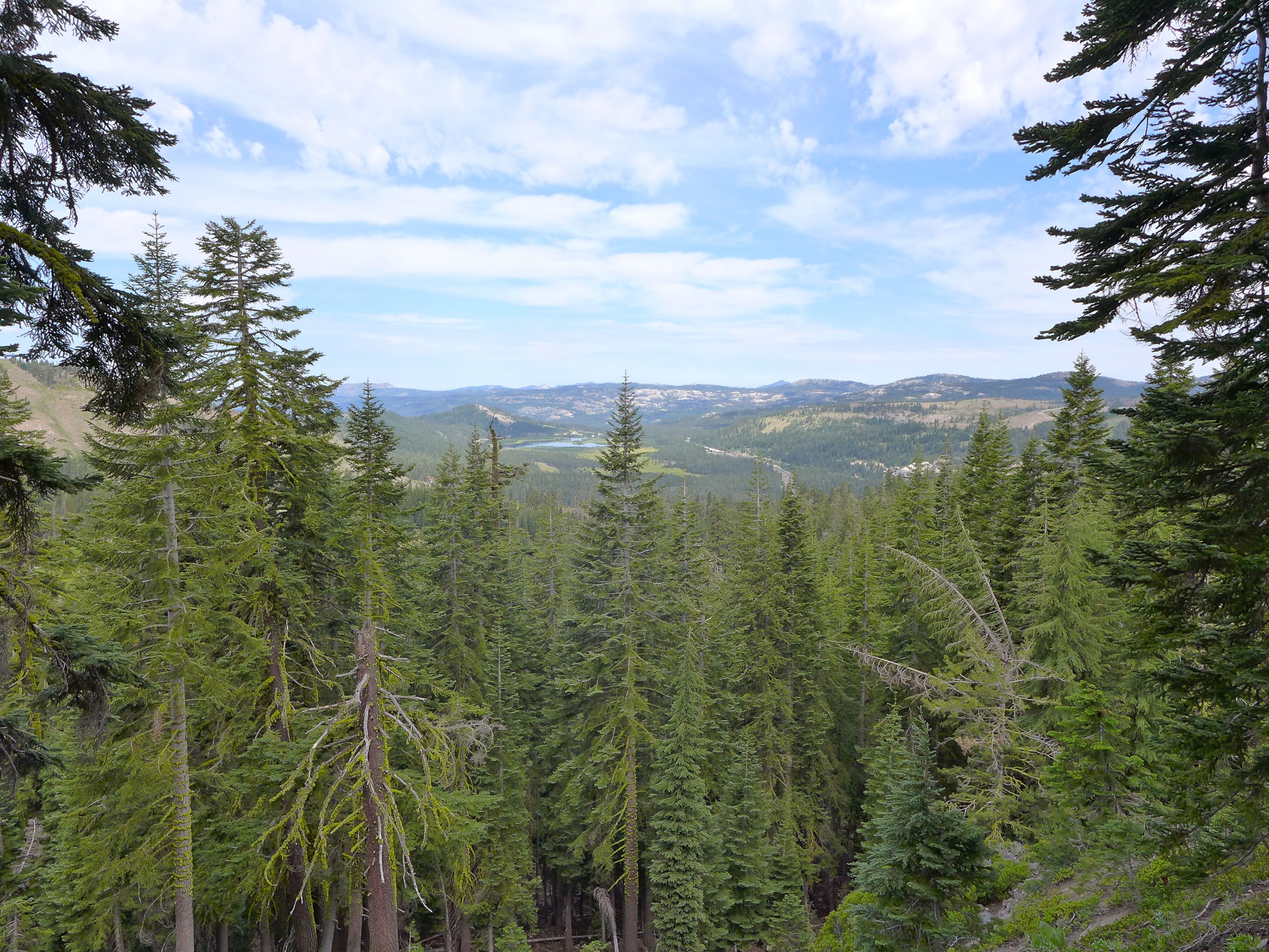
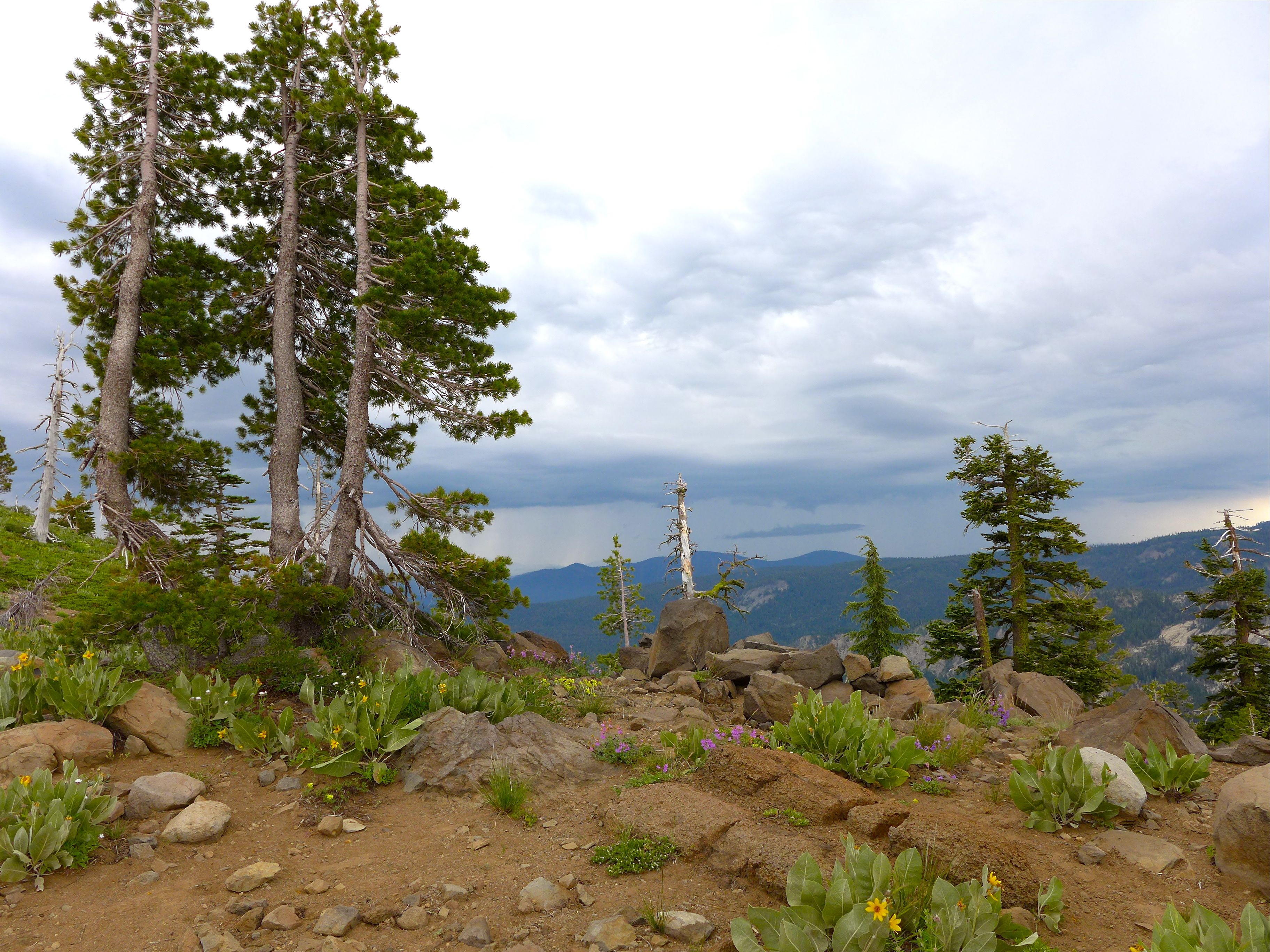
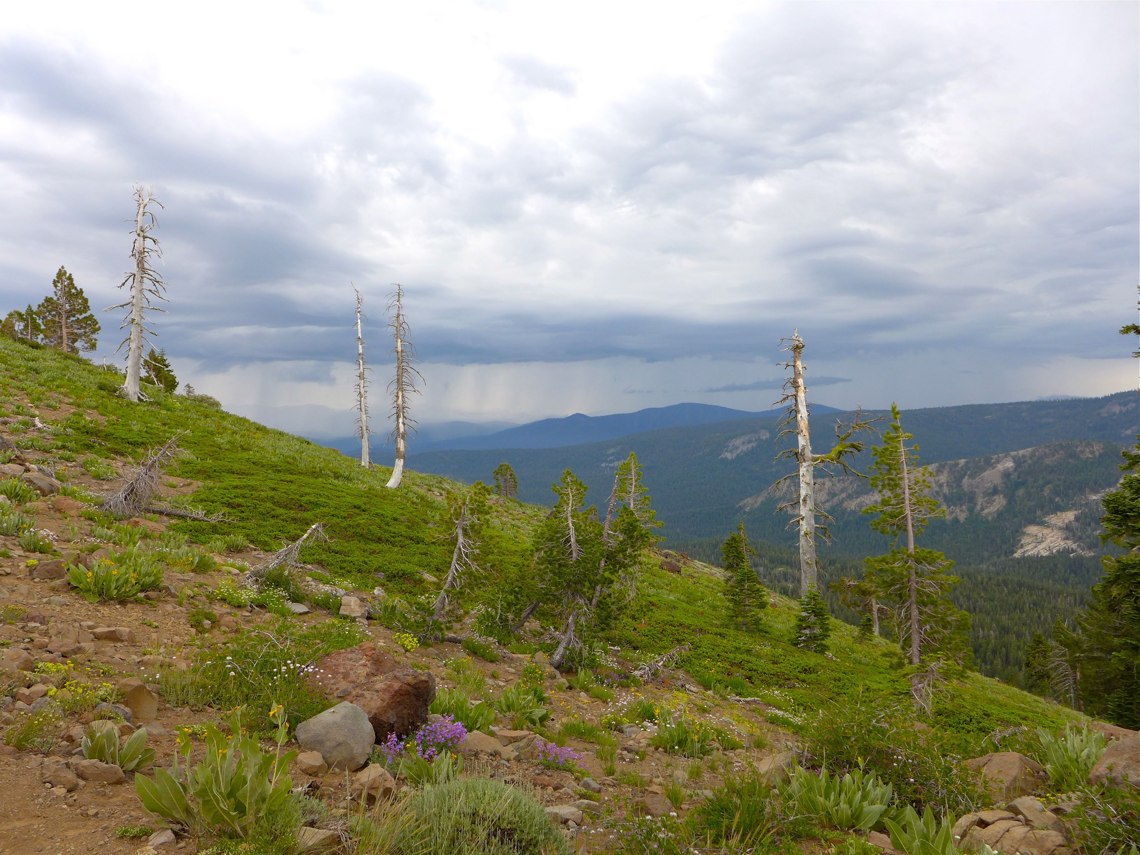
Eventually, as you keep climbing up, you emerge from the forest and are on the rocky, exposed peak of the mountain. The trees are again replaced by wildflowers, but a different mix from the start of the trail. Here, the wildflowers are low-lying, whereas in the open meadows at the start of the trail, the flowers were stalky.
The View from the Top :
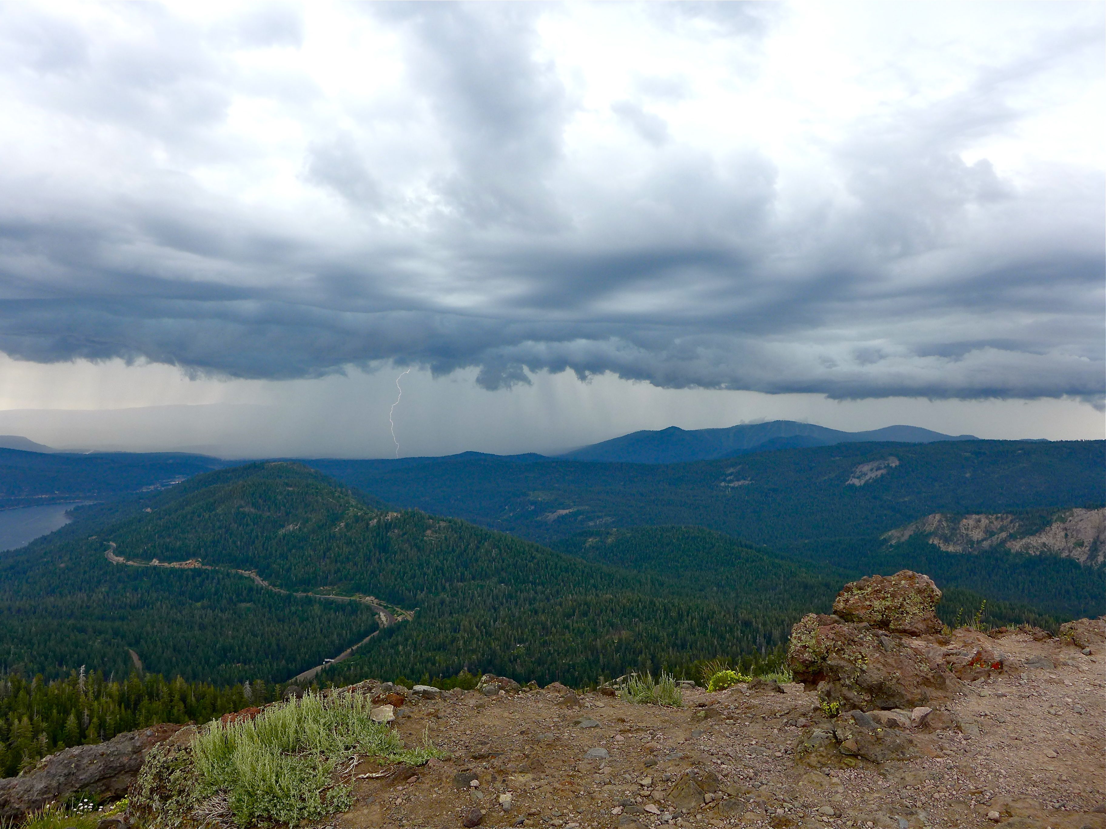
You’re rewarded with amazing 360 degree views from the top of the mountain. You’ll see Donner Lake to the east, and the much smaller Lake Van Norden to the West.
Depending upon the weather, you may also have the opportunity to see some crazy lightning storms. Before I go any further, I have to say that I don’t necessarily recommend seeking out the lightning. I hear about the lightning danger in Colorado all the time and have a healthy fear of getting caught in a storm. And I think my fear provided a bit of entertainment for our group. They wanted to sit at the top and eat lunch. I wanted to run down the mountain with my tail between my legs!
So, all warnings aside, seeing the storms and the lightning strikes from the top of the mountain was amazing. If I weren’t so afraid, I would have loved to spend more time at the top photographing the strikes, as luck would have it, I got one photograph that day with a lightening bolt.
Other Details :
- SNOW : The trail is generally clear of snow from June-October, if you plan on hiking it before or after that period, you may want to pack some snowshoes just in case you hit fresh powder.
- SUN : No matter what time of year you hike, be sure to pack some sunscreen and a hat. I’m even fond of a light long-sleeve layer in the summer as additional sun protection.
- LAYERS : Since this hike varies between mellow and vigorous sections, it’s useful to dress in layers, allowing you to dress/undress depending upon how hot you are.
- KIDS : I had no trouble hiking while carrying Luc on my front in the Ergo. At the time of this hike he weighed about 12 pounds. I think the hike would be a lot more challenging if hiking with 30 pound Alex on my back. I still don’t have much experience hiking with kids, so I’m not sure at what age a kid would be able to hike this on their own, and I’m sure it would vary from one kid to the next. Hopefully as Alex and Luc grow, we’ll get them out there on the trail and report back!

And that, my friends, is the end of the trail. Since Sarah’s going to be in town this weekend, we’re hoping to fit in at least one hike in the Boulder area. We hope you’ll have the chance to get out on the trails too! xo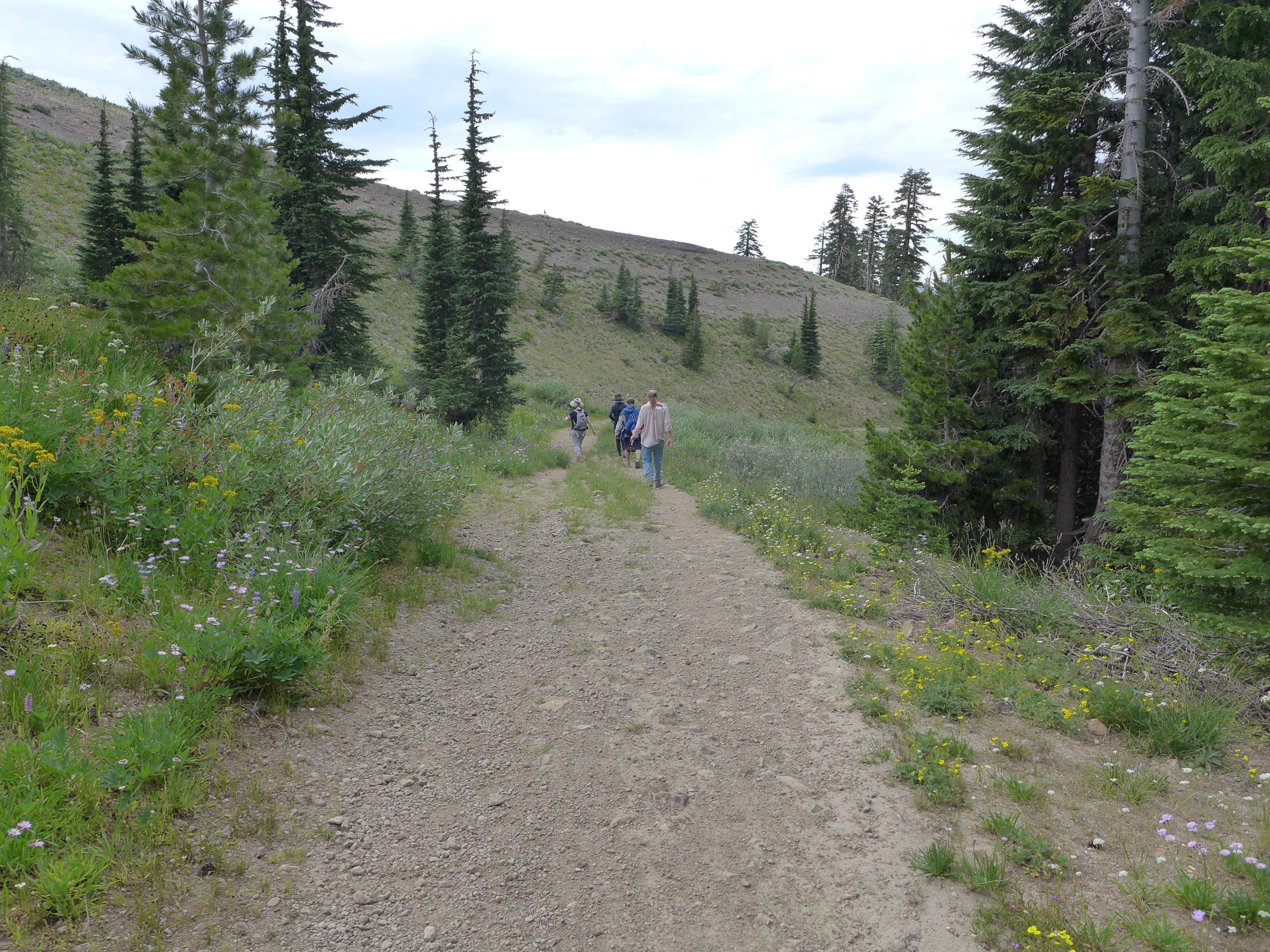
wow, all those wildflowers are so stunning. each is so beautiful and unique, i am in awe!
I know, it was amazing!